May 21, 2024
Day 6: Belden Resort to Paradise
I got away from Belden Resort at 9:15. Not sure what took so long because there wasn't much to do. First I heated a small can of bean and ham soup in the microwave, in a ramen noodle bowl from last night. Then I ate two Kind Mini dark chocolate and sea salt bars. Then a handful of mixed nuts. I still had a full box of chocolate coated peanut butter wafers that I didn't open and wasn't in the mood to eat. I also made tea to drink now and a 24 ounce insulated bottle of hot tea. So I didn't exactly start hungry. I started dissatisfied with the choices.
On the way out of Belden Town I found the old school house. That and an auto garage building are the only "ghost town" buildings that I could find.

The weather was splendid. Blue sky, light wind. The first half of today's ride is all downstream in the canyon of the North Fork Feather river. Easy miles and quite scenic.

| Heart | 2 | Comment | 0 | Link |
I passed 3 or 4 small dams and reservoirs that are used by PG&E as a reliable intake for a diversion pipe that leads to a power station far below. And I inevitably passed the power houses somewhere below the dams.

| Heart | 0 | Comment | 0 | Link |
A few miles down the road I passed through the tiny community of Tobin which has a sometimes resort and also a pair of interesting truss bridges. The railroad bridges are all built 1905-1909. The highway bridges are all built in the 1930's.


CA 70 stays very close to the river in a steep canyon. The railroad is usually across the river. Burns continue to be hit or miss, but the proportion of burned areas is decreasing as I get closer to the origin of the Dixie fire.


I saw many roadside waterfalls in the steep canyon. The climate is getting steadily drier, though. The trees are getting smaller and less dense.

Today's route has 3 tunnels built in the 1930's when the Feather river highway was first constructed. The first and longest tunnel is the 1937 Elephant Butte tunnel with the notable feature of 4 windows. The windows don't have a place to park a car, so only cyclists, motorcyclists, and pedestrians have the chance to stop and enjoy them.

| Heart | 1 | Comment | 0 | Link |
The canyon is extremely steep and narrow near the tunnels. No shoulder, but also no traffic. With construction closures ahead and behind, a small burst of cars goes by about once every 5 minutes.

| Heart | 0 | Comment | 0 | Link |
The Grizzly Dome tunnel is shorter but still long enough to merit having lights. The tunnels have sturdy metal shields at the entrances to deflect rocks that would fall onto the road.

| Heart | 0 | Comment | 0 | Link |

Today I had to wait for 3 construction zones. The first construction zone was for the underground power cable, where I followed the pilot car 2 miles. The second construction zone was a 1 mile area where the road is being raised 6 feet to reduce flooding. One lane has been raised so far, so there is one way traffic 5.5 minutes each direction. With a concrete barrier between the new high lane and the construction below, it's controlled by a traffic signal instead of human flaggers. I waited much longer than 5.5 minutes, so there must have been a shift change or trucks entering or exiting. The third construction zone was the shortest, a landslide area only half a mile long, also controlled by a traffic signal.

Through traffic avoids the CA 70 route. Right now there are 5 separate areas with construction delays on CA 70. A through motorist might spend as much as an hour waiting, and drive very slowly through 9 miles of construction zones. As a result, construction vehicles are about the only traffic on the road. There is almost no local traffic because there is no population. About every 5 minutes a group of 4 or 5 vehicles would pass by. Most of the time it was my private highway.

| Heart | 2 | Comment | 2 | Link |
https://www.inaturalist.org/taxa/777236-Diplacus/browse_photos?place_id=14
1 year ago
A big climb begins after crossing the Pulga bridge. Before the climb I stopped in the shade to eat some chocolate peanut butter wafers. Now is a good time for a quick sugar rush.
Dixie fire burns end at about Pulga which seems to be just south of where the first started. Wind blew the fire east and north from the origin point, not much in this direction. This direction is also resistant to burning because the trees are smaller and less dense on the lower slopes of the Sierra Nevada range.


The climb after the Pulga bridge is long and continuous, climbing 950 feet. But the grade is an astonishingly easy and steady 3 percent. I like the gentle 1930's and 1920's highway grades!

The road climbs away from the river, with frequent views into the deep canyon, but few views of the river at the very bottom.

The top of Yankee Hill has a distant view of the North Fork Feather river which has been my companion for two days. My final view of the river.

Near the summit of Yankee Hill I stopped for a late 3 PM lunch at Toni's restaurant. I was long overdue for real food. First and only services on today's route.
Yankee Hill is in the burn zone of the 2018 Camp fire which burned the city of Paradise. The Camp fire and the Dixie fire both started near here. The Dixie fire spread northeast with the usual westerly winds. The Camp fire spread west because of a rare Diablo (Devil's) wind blowing from the east, caused by extreme high temperature and high air pressure to the east.
Near the summit of Yankee Hill I stopped to explore the ruins of a place I probably would have visited if it hadn't burned first.

The Rock House property is now an outdoor event rental space, with a large patio and a catering truck outside the ruins.

The descent from Yankee Summit is gently graded, giving my first views looking west into the Sacramento river valley. The foothills are relatively forested.

| Heart | 0 | Comment | 0 | Link |
The descent from Yankee Summit isn't very long because the highway crosses a finger of giant Oroville reservoir which is impounded by the nation's tallest dam. The 770 foot tall dam is just below the confluence of all the forks of the Feather river, so the watershed is huge. The reservoir is an important part of the Central Valley Project, a vast network of reservoirs and canals. Oroville reservoir is California's second largest water tank, filling from winter rain and spring snow melt, then steadily drained during the long summer dry season to irrigate farms and provide water to faraway cities. The reservoir is full now, but was nearly empty when the big fires burned.
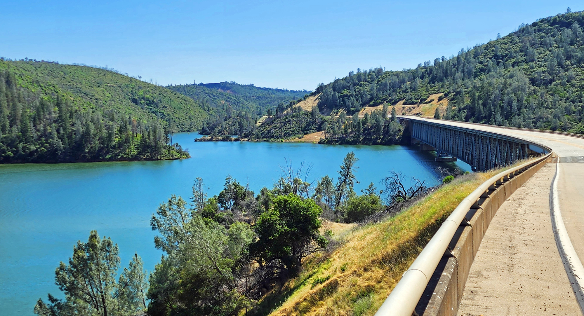
| Heart | 0 | Comment | 0 | Link |
In 2021 the reservoir was nearly empty, but in February 2017 it was overflowing and a portion of the concrete spillway washed away. 100,000 people were evacuated downstream in the Oroville area in case the dam failed. Afterwards the spillway required an emergency $800 million repair.

| Heart | 0 | Comment | 0 | Link |
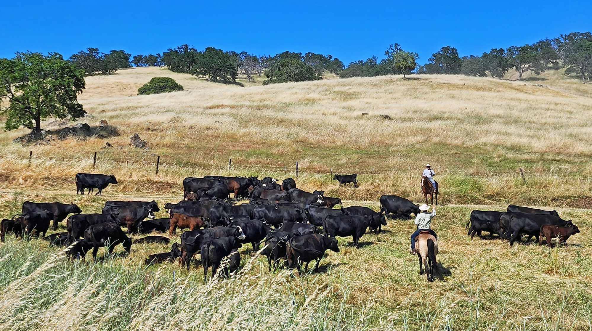
I continued descending after passing just a tiny piece of Oroville reservoir. Down to the semi arid Sacramento valley. At 650 feet elevation I turned off the highway onto a busy county road that climbs steeply to Paradise, with moderate traffic but also a usable shoulder. The beginning of the climb is mostly grassland. Then oak trees. Then eventually scattered pines.
| Heart | 0 | Comment | 0 | Link |
The county road has nice scenery but it climbs 1200 feet, all quite steep. Many 6-7 percent grades. One long 10% grade. One long 9% grade. The first and only steep grades of this tour. At the end of the day and the peak heat of the day, about 85F. Good thing I had the 3 PM lunch!

Coming into Paradise I went down a side road to get a view into the West Fork Feather river canyon. Now I'm far upstream from the reservoir. The stream is small and seldom visible.

| Heart | 0 | Comment | 0 | Link |
The final 4 miles of today's ride were in the burn zone of the 2018 Camp fire. I saw many intact houses, but also many mailboxes and driveways with nothing left. I will save the Paradise pictures for tomorrow since I already have so many pictures today.
Tonight's home is Best Western which is the only major motel in Paradise. It appears to be fairly old, so it survived the fire. It's in an industrial area that had relatively few trees. The surrounding parking lot and roads gave the motel excellent defensible space when the Camp fire rushed through.
I arrived at 6:15 and spent a few minutes in the room resting, cooling down, and deciding what to do for dinner. There are no restaurants near the motel, so I left at about 7 PM and pedaled 2 hilly miles each way to the Cozy Cafe in the downtown area. That building also survived the fire even though most downtown buildings burned. Service was slow. I got back to the motel just before sunset. No worries because tomorrow is short and easy. I can sleep late tomorrow morning.
Today was the most challenging day of the tour. I did it, despite less than ideal food options. The remainder of the tour will be easy.
Today I pedaled out of the Sierra Nevada mountains and said goodbye to the Feather river. The landscape changed from dense pine forest to grassy hills. Transportation infrastructure is one of the star attractions of today's route. Many trestles, truss bridges, and tunnels. Strangely, road construction made the route ideal for cycling.
Distance: 55.1 miles
Average speed: 8.9 mph
Ascent/Descent: +2867/-3319 feet
Today's ride: 55 miles (89 km)
Total: 199 miles (320 km)
| Rate this entry's writing | Heart | 3 |
| Comment on this entry | Comment | 0 |