August 28, 2023
Almost to the High Alps
Rainy but not a washout!
It may have been raining with a high of 45 degrees, but we had an awesome day. We were off to Trümmelbach waterfalls by public transport and then on to Gimmelwald of Rick Steves’ fame. Trümmelbach falls and Gimmelwald are both in the area called the Lauterbrunen valley. This area is known for its steep walled mountains surrounding a deep green valley. In addition, periodically all along the valley there are waterfalls cascading down from the steep walled sides. While you are in the valleys you can see up to the snow covered peaks of the high alps. Since it was a wet rainy day the waterfalls were gushing and the snow covered tops were hiding in the clouds but we got periodic glimpses of them and a few pictures.

| Heart | 2 | Comment | 0 | Link |

| Heart | 2 | Comment | 0 | Link |

| Heart | 2 | Comment | 0 | Link |
Trümmelbach Falls are a series of 10 water falls that are INSIDE a mountain! The water was roaring through at enormous speeds, it was really amazing the amount of water rushing and boiling through. It is hard to tell from still photos the magnitude and power of the water as it rushed by.
The first depictions of Trümmelbach date from 1810. The lowest falls were made accessible by stairs and bridges in 1877-1886. The tunnel lift that takes you up 100 vertical meters to access the upper falls was built in 1913. Currently the Trümmelbach gorge is accessible for 600 meters, and 10 falls can be viewed. The height difference from the lowest falls to the highest falls is 140 meters.
A few historic pictures of the Trümmelbach falls:

| Heart | 2 | Comment | 0 | Link |
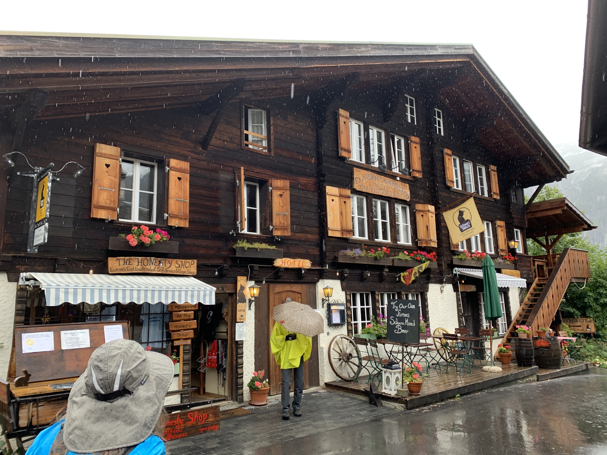
Next we headed by bus and cable car up to Gimmelwald a tiny town perched on the edge of a mountain with fields that practically go straight up. The streets in Gimmelwald are closed to car traffic and the town is very quiet and peaceful and there are lots of iconic Swiss chalet houses. There are many options to buy local cheese and other treats from the residents using the honor system.

| Heart | 2 | Comment | 0 | Link |

| Heart | 2 | Comment | 1 | Link |

| Heart | 1 | Comment | 0 | Link |

| Heart | 0 | Comment | 2 | Link |
1 year ago
1 year ago

| Heart | 1 | Comment | 0 | Link |

| Heart | 2 | Comment | 1 | Link |
After exploring Gimmelwald it was back down the cable car to the bus and then the train back to Interlaken. Google maps and the SBB app have been life savers when navigating around Switzerland. We’ve been asking google maps for directions to wherever we want to go then clicking the public transport tab and it lays everything out clearly, gives you the changes you will make from one mode of transport to another and our wait times when switching buses or trains has been minimal. Everything has worked together so smoothly and efficiently. After figuring out the route on google maps then we’d switch to the SBB app where we bought tickets for both buses and trains. Very easy and fast. These apps together made getting around very easy!
| Rate this entry's writing | Heart | 5 |
| Comment on this entry | Comment | 1 |


