June 17, 2024
In Rhayader: Elan Valley loop
Rhayader is a distinctive town, admirably situated on the River Wye only about twenty miles from its source in the Cambrian Mountains. With cycling and walking routes radiating into the hills and along the waterways in all directions it makes a fine base for a variety of outdoor activities - an in fact the town’s website bills the place as the Outdoor Capitol of Wales. While we’re here we frequently see walkers and cyclists passing through its streets or hanging out on the sidewalk at one of its pubs.
And about those pubs - that’s another distinction about the town. Rhayader allegedly has the greatest per capita concentration of pubs and drinking establishments in the UK, at one per 173 residents according to Wikipedia.
My kind of town, obviously. We’re glad we’re here for three nights and would have been fine with an even longer stay.
We’re in luck and have fair conditions today with minimal chance of rain. The day starts with us enjoying breakfast in our apartment - a place we would like even more if it had any way of controlling the heat and it wasn’t so damn cold a lot of the time. It’s a nice change from the Full Welsh breakfasts that have started our days recently, instead enjoying scrambled eggs, store-bought pastries, and muesli.
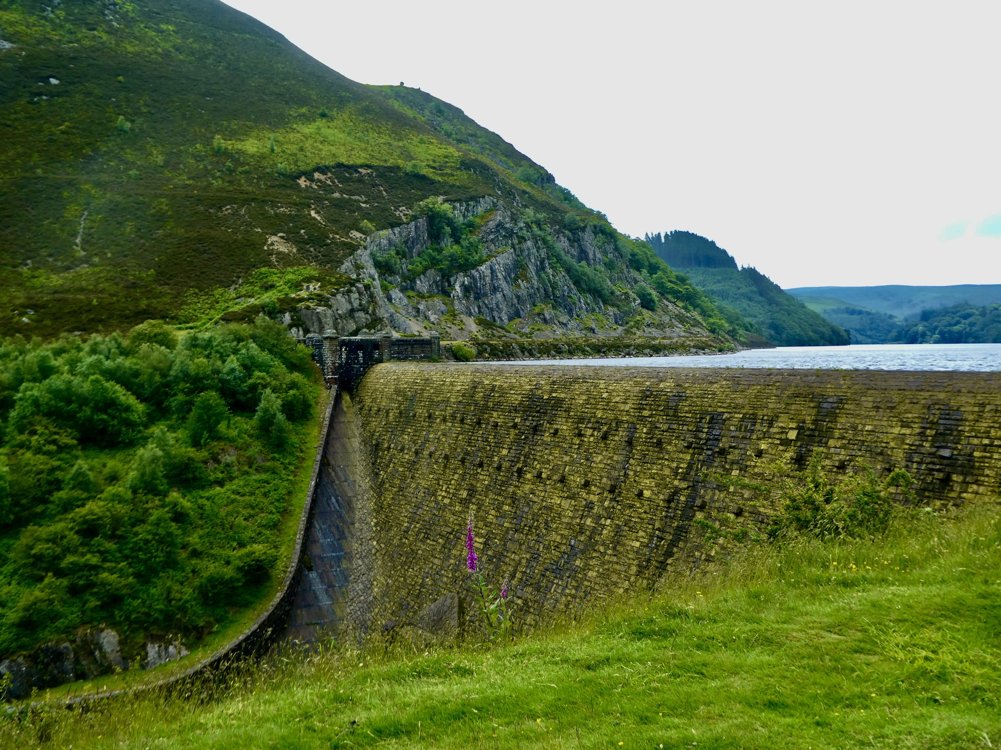
We both start out close to eleven, after waiting for the day to warm up about as much as it’s going to do. Rachael’s plan is to take the 12 mile loop hike I drew out for her up to the summit of the plateau west of town, an island-like rise bounded by the Wye on the east and on the west by the Elan River and the reservoirs formed by its four dams built a century ago to build a water source for Birmingham. In my reading of this route, it should be a great hiking experience for her. She’ll get a lot of wide open views, should encounter a few sheep, and should be able to look down to the west over the Elan Valley and the reservoirs.
It doesn’t turn out quite as planned though. RideWithGPS didn’t indicate that when it’s been wet conditions can be really boggy up on top. When Rachael found herself getting mired down she dropped the plan for completing the loop, backtracked, and then walked a few miles west along the Elan Valley Trail to get her miles in. Not the hike she started out with, but a good one nonetheless.
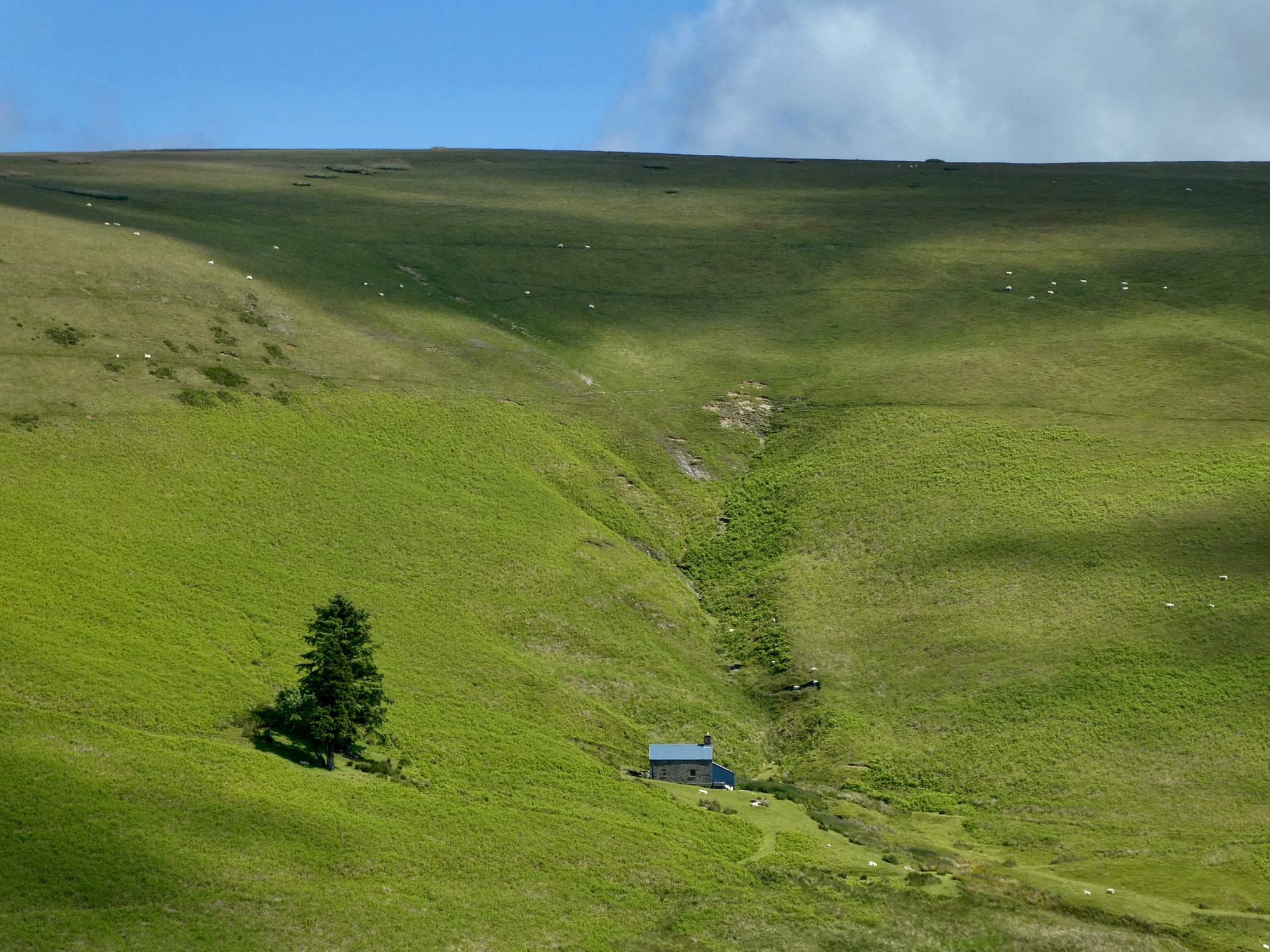
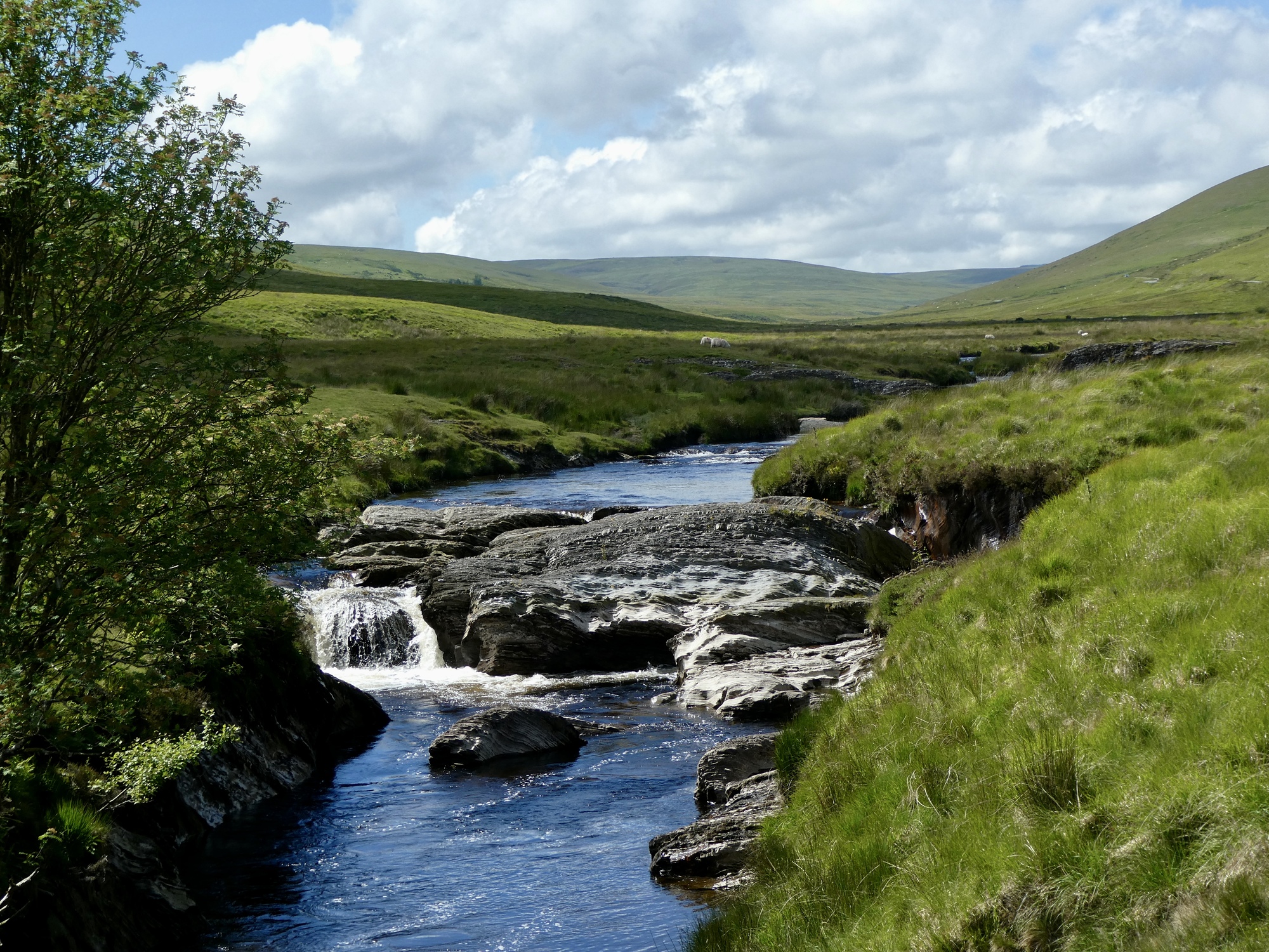
My plan was a repeat of the ride I took the last time we were here. Its a circuit of that formation Rachael’s hiking on top of, following the Elan Valley Trail along the river and its dams and reservoirs for twelve miles and then returning to town by climbing out of the valley and dropping down along Nant y Dernol Creek. Before crossing that divide though I plan to continue west along the Elan for five or six miles before turning back. I remember this part of the ride as being especially dramatic as it crosses the so called Desert of Wales, a land stripped of its trees long ago. Not a single view blocker for miles, a place Mr. Garceau would love.
I’m especially looking forward to repeating this ride in today’s conditions. Last time it was late in the summer in a drought year, in the middle of a heat wave. Water levels were alarmingly low, it was a sweaty 90F, and worst of all I managed to leave home without any water at all.
As last time, the ride begins on the beautiful, very popular Elan Valley Trail. This southern half of the loop is entirely different from the barren north. The hills are generally still wooded, and the blue reservoirs and sky make for a dramatic contrast with the ubiquitous green of the land.


| Heart | 5 | Comment | 0 | Link |
| Heart | 5 | Comment | 0 | Link |

| Heart | 3 | Comment | 0 | Link |

| Heart | 3 | Comment | 1 | Link |
1 year ago

| Heart | 4 | Comment | 0 | Link |

| Heart | 5 | Comment | 0 | Link |


| Heart | 6 | Comment | 0 | Link |

| Heart | 3 | Comment | 0 | Link |

| Heart | 2 | Comment | 2 | Link |
1 year ago
I read up on the project and dam and consulted the map to see where the dam was located. It looks like it must have been around the corner on the right of the first dam, not near this one. It looks like it is strait across the water from the bike path though so the remains were probably visible if I’d known to look for them.
So I went back to look through the other photos I took but didn’t include in the post. I only took one photo between the first and second dams but by pure luck I shot it at exactly the right spot and the remains are there, easy to see. I’ll include it in the next post. Thanks for bringing this up!
1 year ago

| Heart | 5 | Comment | 0 | Link |

| Heart | 1 | Comment | 0 | Link |

| Heart | 2 | Comment | 0 | Link |

| Heart | 2 | Comment | 0 | Link |
It’s been an excellent ride up until now, but for me the real highlights come when I leave the trees behind. For the next several miles I stop constantly to admire yet another striking view. Also though I frequently check in on Rachael’s position on the Garmin and become increasingly concerned about her because she’s not moving. At first I thought she must have stopped to have her snack somewhere, but it’s been at least a half hour now since I first noticed this.
I try phoning her, but there’s no service; and a canned text I try sending from the Garmin goes nowhere either. So that might be the problem - her location might just be frozen at the last spot there was reception, and she’s perfectly fine. It doesn’t seem like that though, because the Garmin looks like it knows her position. Normally when it loses touch her icon goes grey on the display, but not this time.
So I cut my plans short, as I start imagining her stuck up on that plateau somewhere and somehow - maybe she’s had a fall and injured herself or something - so I decide I need to get back to town. I drop the out and back west of the Elan Bridge I’d been planning, and other than continuing to stop for photographs and bird sightings along the way I head for home.
| Heart | 6 | Comment | 1 | Link |
https://www.mountainbothies.org.uk/bothies/wales/lluest-cwmbach/
1 year ago

| Heart | 4 | Comment | 0 | Link |

| Heart | 3 | Comment | 0 | Link |


| Heart | 6 | Comment | 0 | Link |

| Heart | 3 | Comment | 0 | Link |


| Heart | 2 | Comment | 0 | Link |


And Rachael’s fine, of course. I knew it as soon as I reached the crest, when a text from her pops up on the Garmin that she’d sent a couple hours ago letting me know she’d run into muck and changed her plan. I’m back on the grid again.
I ride with a much lighter heart the rest of the way as I coast the remaining four miles to town, exhilarated by the views and the descent. I’d love to take this ride again; and in fact I resolve to, tomorrow. I’ll bike up this road and continue west on those miles I dropped out today.

| Heart | 4 | Comment | 0 | Link |
Today's ride: 19 miles (31 km)
Total: 2,196 miles (3,534 km)
| Rate this entry's writing | Heart | 9 |
| Comment on this entry | Comment | 0 |