August 8, 2024
In Grassington: Littondale OAB
As problematic as we thought it would be getting here, I’m really grateful that we made it to Grassington - a small, pretty market town that somehow I failed to take a single photo of. Now that we’re here, I’m sorry we hadn’t planned for a longer layover. Rachael’s hike up on the moors and my short ride today both rank high among our favorite days of the tour.
It’s another questionable weather situation today and it would have been no surprise had we both spent most of the day holed up keeping dry in our lodge. We’re in luck though when we wake up this morning and see that rains aren’t due to begin until around one or two in the afternoon. We woke up early hoping for this break and after having breakfast in our room we both get an early start with Rachael leaving around nine for her walk and me with the bike soon after.
My ride plan is to pedal north and upriver along the Wharfe and then branch off to follow its tributary the River Skirfare into Littondale, turning back when the pavement ends at the nothing hamlet of Foxup. It looks like a perfect ride for the conditions - 28 easy miles along the river, through terrain that from the profile map promises to be attractive if not as dramatic as we saw around Malham two days ago.
It might help to take a closer look at the terrain here, which is quite complex and interesting. The arrows illustrate the direction I plan to ride, but several other enticing choices are around. One would be to continue north along the Wharfe as is arches west up the next trough north of the one the Skirfare flows through. The road is a little busier, but it continues on further; and from the number of bikers I’ll see today it looks like it must be a popular choice.
Another option would be to follow my route but make a loop of it by branching south to Malham Tarn and the cove before turning east back to Grassington. You can see Malham Cove in the lower center on the map. It’s really not far at all from Grassington, and it looks like it must be easier approach from this side than from Settle, which is also in the map in the lower left.

| Heart | 0 | Comment | 0 | Link |
The first three miles follow the east bank of the river on quiet Grass Wood Lane, the road that passes in front of our lodge. Grassington’s a small place, and within the distance of a few blocks I’m out of town and biking past stone walled meadows with sheep and cattle grazing in them. There’s even a donkey off to the right, though I didn’t slow down for a better look.
It’s a narrow, empty road, but soon I’m puzzled to come upon a car parked in the road with a mother and daughter walking toward it. Behind them I see a few sheep leaping over a wall into the meadow. The woman says something about having a few strays to round up before taking her daughter to school.
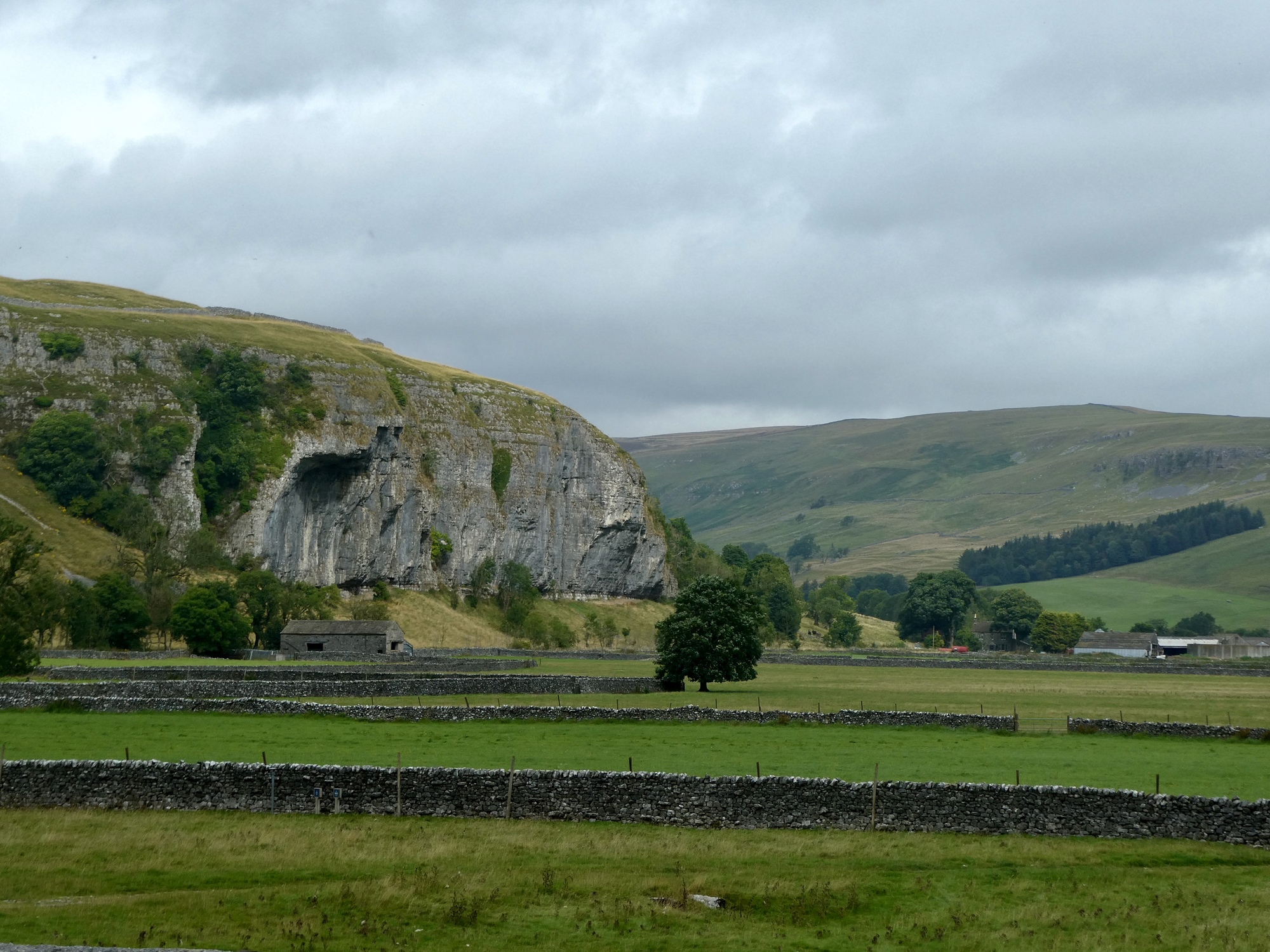
As I bike these few miles I stop often to admire the views west across the river and to the hills and ridges beyond. As I look I try to determine if the highest one visible is the one I dropped down from to Malham Cove which is just three or four miles west of here as the jackdaw flies.

| Heart | 2 | Comment | 0 | Link |

| Heart | 2 | Comment | 0 | Link |
My quiet lane ends after three miles at Coniston, a riverside village that looks worth exploring if I had more time. I cross the river here and join the B6160 that runs up the other bank - a slightly busier through road that continues north through Kettlewell to eventually end at the east-west highway to Hawes. It looks like it should be fine for cycling, as I’ve been seeing a number of bikers speeding up along it from across the river.
I’ve really been pretty pokey so far but I really slow down at the bridge. First there’s the river itself of course, and the views up and down it - especially up, toward a sheer cliff lining the river not far ahead. More endearingly though, there’s a dressage basic training session underway in the field below the bridge, with a row of mothers looking on from over the edge of the bridge. The youngest of the riders, maybe seven or eight years old, looks like she’s having her first horseback experience. The instructor reminds her several times to kick her pony to get it underway, and after maybe a dozen feeble taps the pony finally gets takes a few slow steps.

| Heart | 2 | Comment | 0 | Link |

| Heart | 3 | Comment | 0 | Link |

| Heart | 3 | Comment | 0 | Link |
The B road is just fine for cycling, as I suspected. I’m on it for about two miles before coming to the turnoff into Littondale, and when I get there I’m a little conflicted to be having to leave it. It looks like the riding would just keep getting better if I continued north.
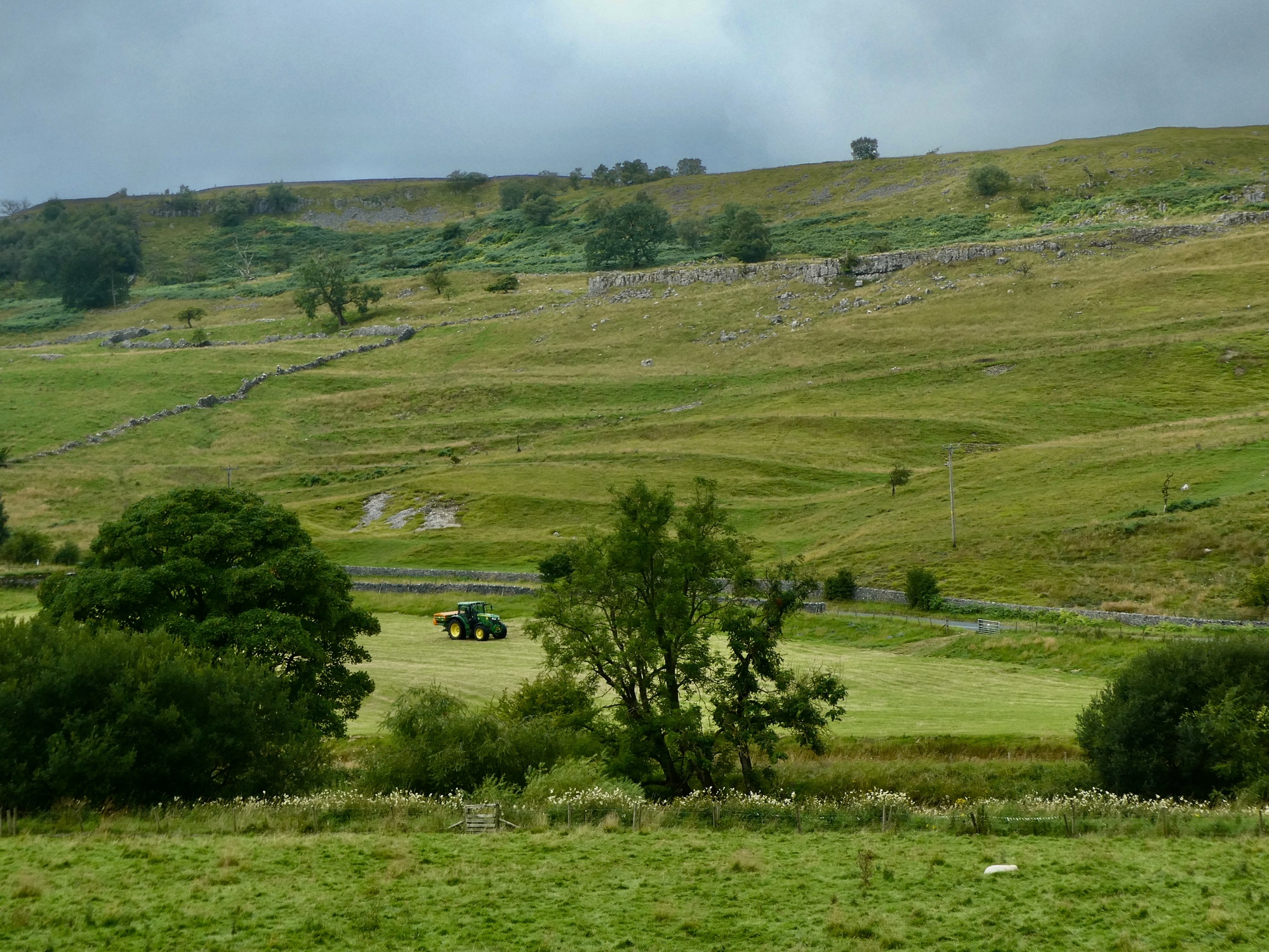
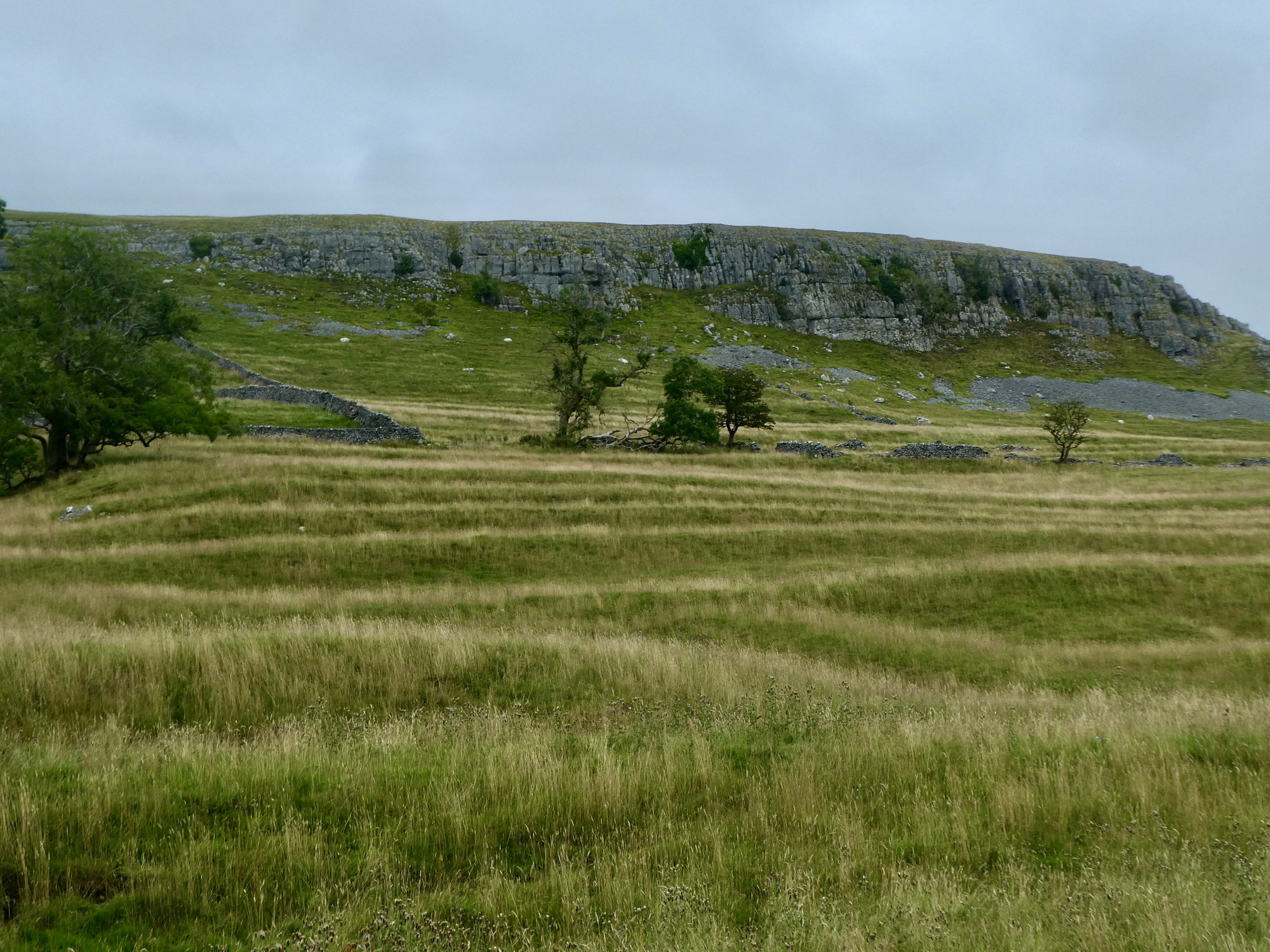
I’ve made the right decision though. Littondale is amazing - a gorgeous U-shaped valley carved out in the Ice Ages and replete with evocative sights that reflect its rural, agricultural history. Stone walls run up the slopes on both sides of the river, fields are littered with stone barns and structures in various stages of disintegration, limestone scars show through on either side of the small river. Especially interesting are several ribboned fields rising up the opposite bank. At first I thought these might be examples of ridge and furrow farming like I saw a bit of down in I think Sussex two summers ago, but they’re something similar but different: they’re strip lynchets, linear earthworks dating back to medieval times that consist of a series of parallel, stepped terraces on the slopes of hills or inclines.

| Heart | 1 | Comment | 0 | Link |

| Heart | 3 | Comment | 1 | Link |
11 months ago

| Heart | 1 | Comment | 3 | Link |
11 months ago
https://youtu.be/AuGbJiwedMY?si=VC0centKL12nDmvh
11 months ago

| Heart | 4 | Comment | 0 | Link |

| Heart | 3 | Comment | 0 | Link |

| Heart | 2 | Comment | 0 | Link |
As special as Littondale is, I don’t end up getting very deep into it. I’m less than two miles in when I come to Arncliffe, the largest of the few small communities that exist in here. And Arncliffe itself is an attraction, a picturesque ribbon town edging on the river with its large central green bordered by stone houses that look like they haven’t changed in a century. I wonder if Graham Finch has an old postcard from here - it would be interesting to compare against its present day appearance.

| Heart | 3 | Comment | 0 | Link |

| Heart | 2 | Comment | 0 | Link |

| Heart | 2 | Comment | 0 | Link |
My plan from here had been to keep biking up the dale to pavement’s end at Foxup, but when I bike west out of the village I’m surprised to see there’s a second road branching off to the south. The junction is at the confluence of the river Skirfare that I’ve been following and its tributary, Cowside Beck. The road west to Foxup follows the Skirdale, and the one south follows the Cowside and eventually drops to Malham Tarn. Continuing on beyond that would take me to Malham Cove and the option to cross west back to Grassington.
I don’t have time to bike to Malham and return that way though; and hell, I don’t even have time to continue west to Foxup because I’ve poked along so slowly up to now. If I’m going to make it back dry and in time for our lunch plans I need to turn around much sooner than that.
So I decide to follow the Cowside south for a short distance until I find a natural turnaround spot. One shows up in barely a quarter mile when the road suddenly angles away from the Beck and starts angling steeply ou the side if a slope. When I turn back I’m mesmerized by a grey heron flying in low and settling along the beck and stop to watch him stalk for a few minutes hoping he’ll become visible enough for a decent shot.

| Heart | 3 | Comment | 0 | Link |

| Heart | 4 | Comment | 0 | Link |

| Heart | 0 | Comment | 0 | Link |
After covering only eight miles in about two and a half hours and with the sky turning greyer and more menacing I decide to head home. When I pass through Arncliffe though I decide to check out the road on the other side of the small river - and isn’t it amazing that in such a quiet, empty valley there are paved roads on both sides of it for several miles?
I knew this road was over here, and for some reason had the impression it was busier. Not the case though, and in fact it’s narrower and even quieter; and the two miles back to the mouth of the dale goes as slowly as in the other direction because it’s interesting too.

| Heart | 3 | Comment | 0 | Link |

| Heart | 1 | Comment | 0 | Link |

| Heart | 0 | Comment | 0 | Link |

| Heart | 2 | Comment | 0 | Link |

| Heart | 1 | Comment | 0 | Link |

| Heart | 2 | Comment | 0 | Link |
By the time I make it back to the Wharfe I really do need to hustle if I’m going to get back dry, but fortunately it’s only an easy five miles and goes fast. As I bike I’m thinking about what an exceptional place this corner of the world is and how brilliant it would be to return for a longer stay some year.
Today's ride: 16 miles (26 km)
Total: 3,161 miles (5,087 km)
| Rate this entry's writing | Heart | 10 |
| Comment on this entry | Comment | 3 |
OK, so maybe not such a great idea...
11 months ago
11 months ago
So many places, so little time. Would be interesting to see a comparison of days you'd want to add versus days actually spent in places you decided you could have skipped. I'm betting your trip would be considerably longer.
11 months ago


