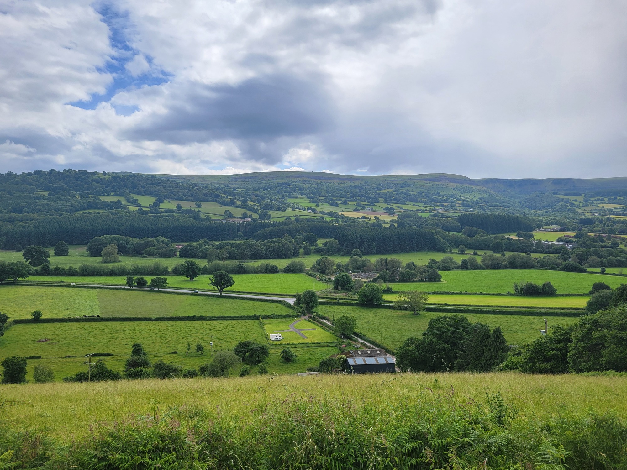
I make a feeble attempt to talk Rachael into joining me today but for some reason she’s not sold by my description of it as an easy ride except for the hard parts. She’s found a walk up the Blorenge which sounds perfect for her, so it’s just me and the sheep today in the foothills of the Black Mountains. I’ve come up with that a ride that I’m amused now to see is shaped like a rabbit, just trying to find something that looks quiet with a reasonable length and difficulty.
Conditions are beautiful when we both start out, enjoying what looks like will be one of the last fine days we’ll see for a while - a few days down the road it looks like showers or worse are returning for a prolonged spell. The first few miles are relaxed as I bike north paralleling the Gavenny River, but it’s not long until I’m looking at another Welsh cliff and making good use of my lowest gear, stopping at breaks in the hedgerows to admire the stunning scenery. That’s what I came here for, might as well take my time to enjoy it.
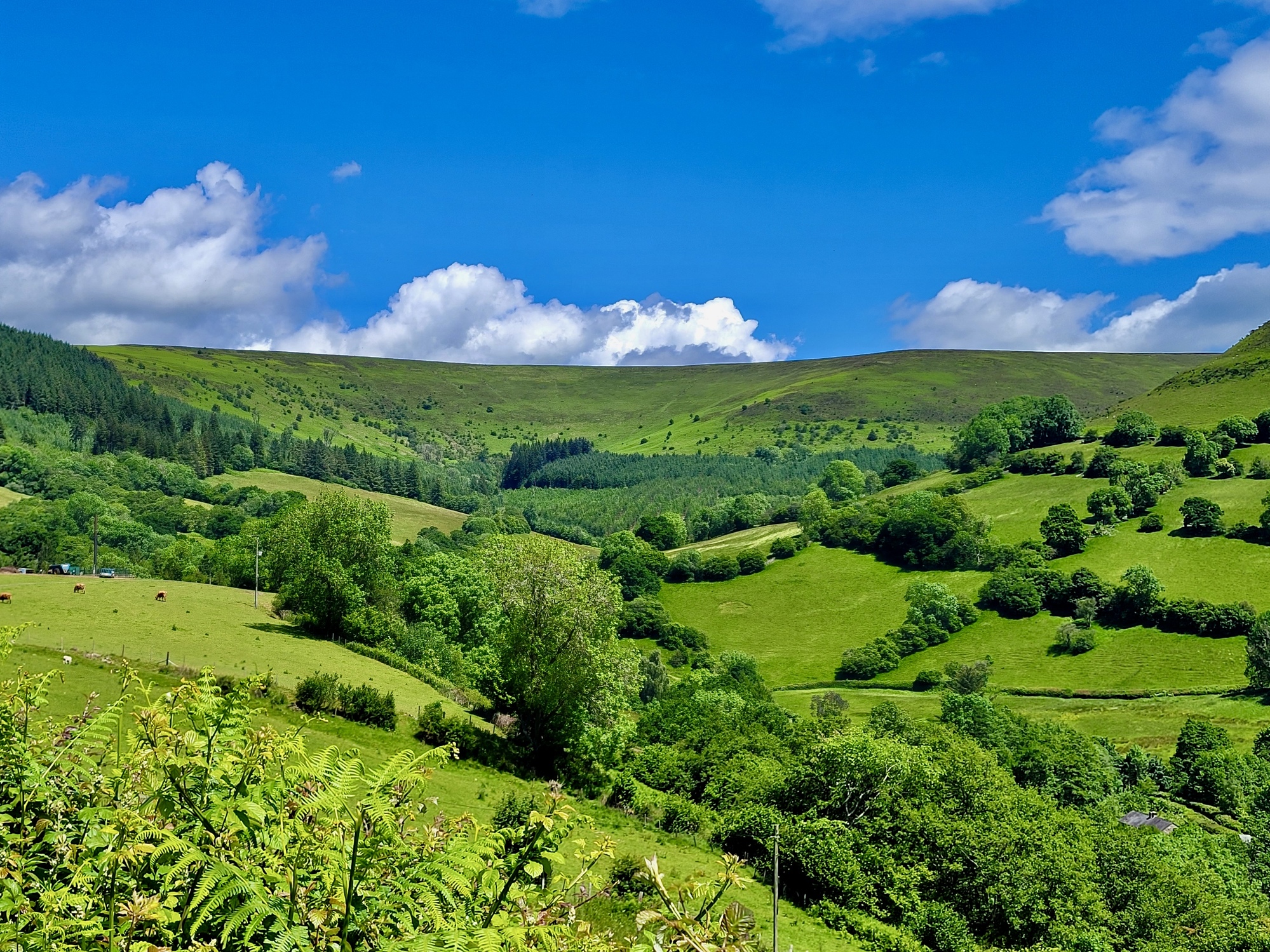
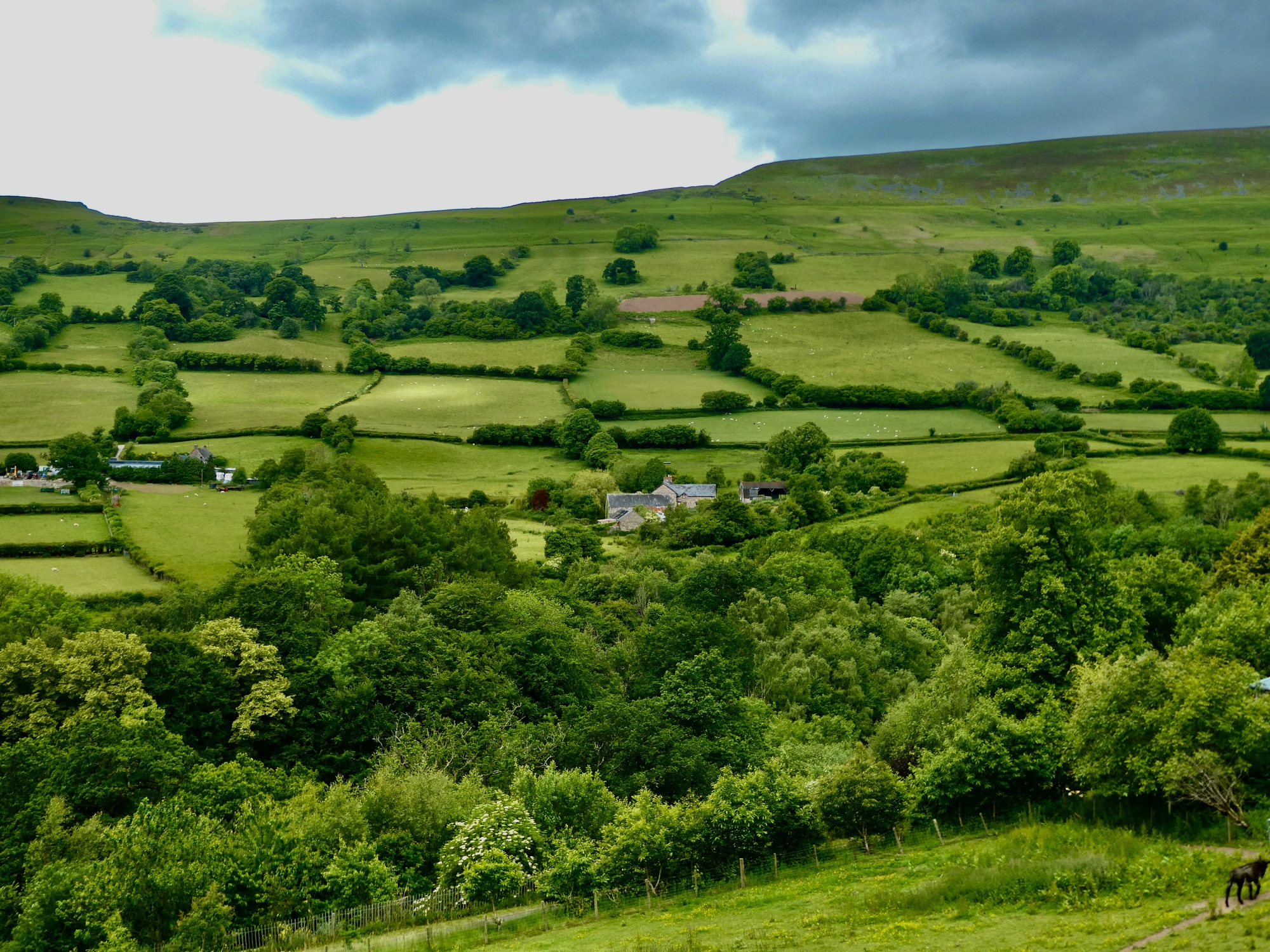
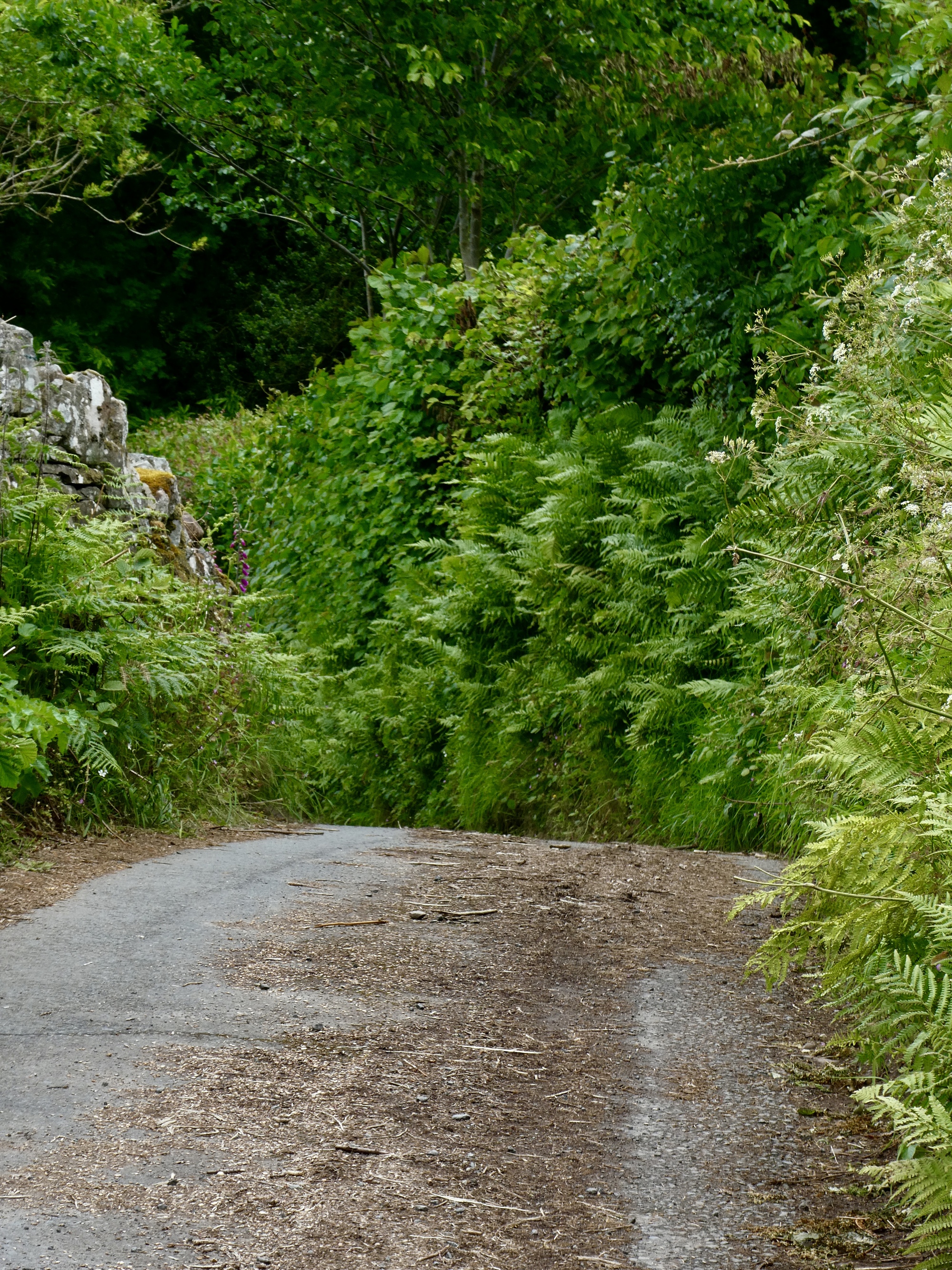
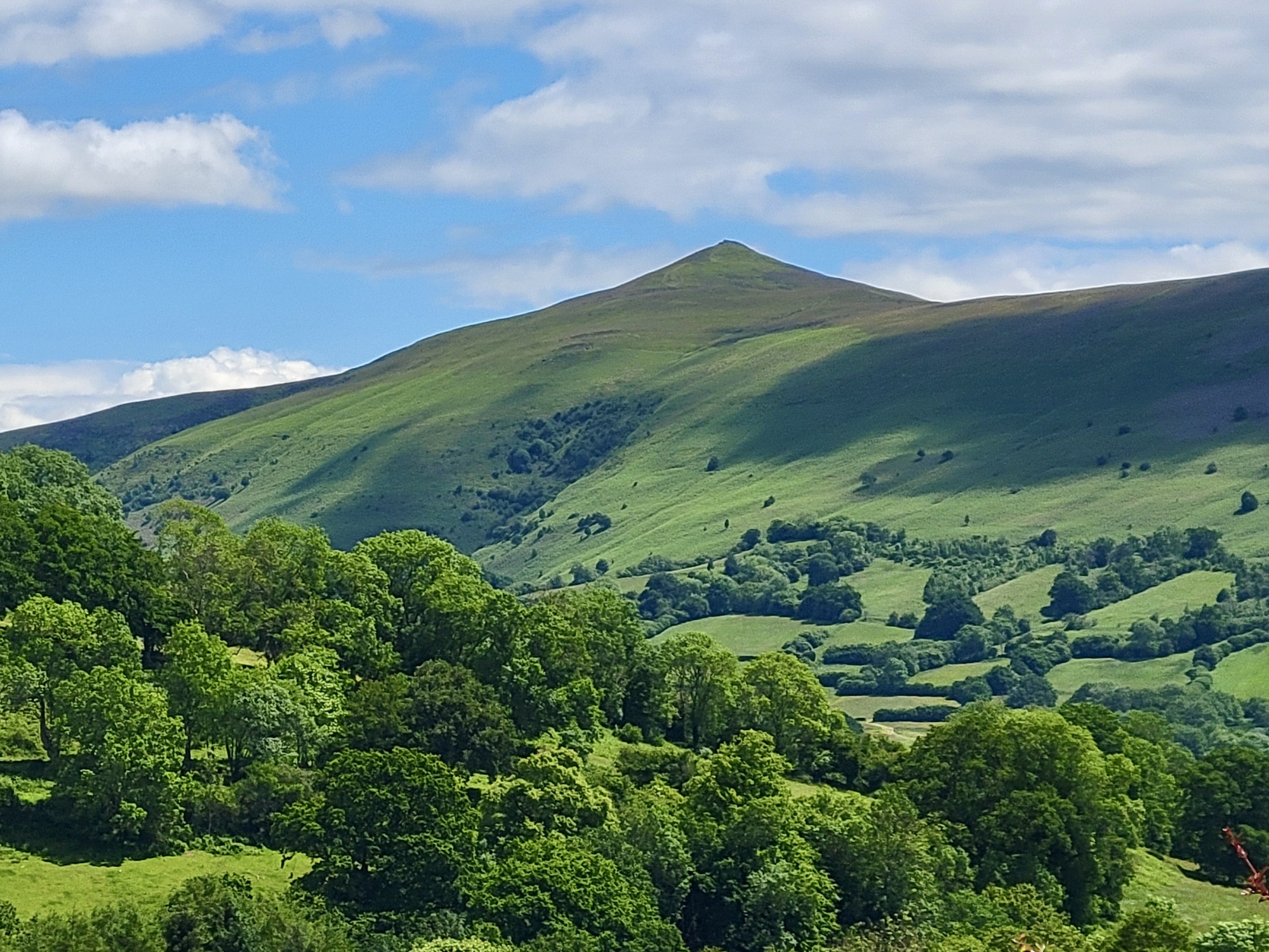
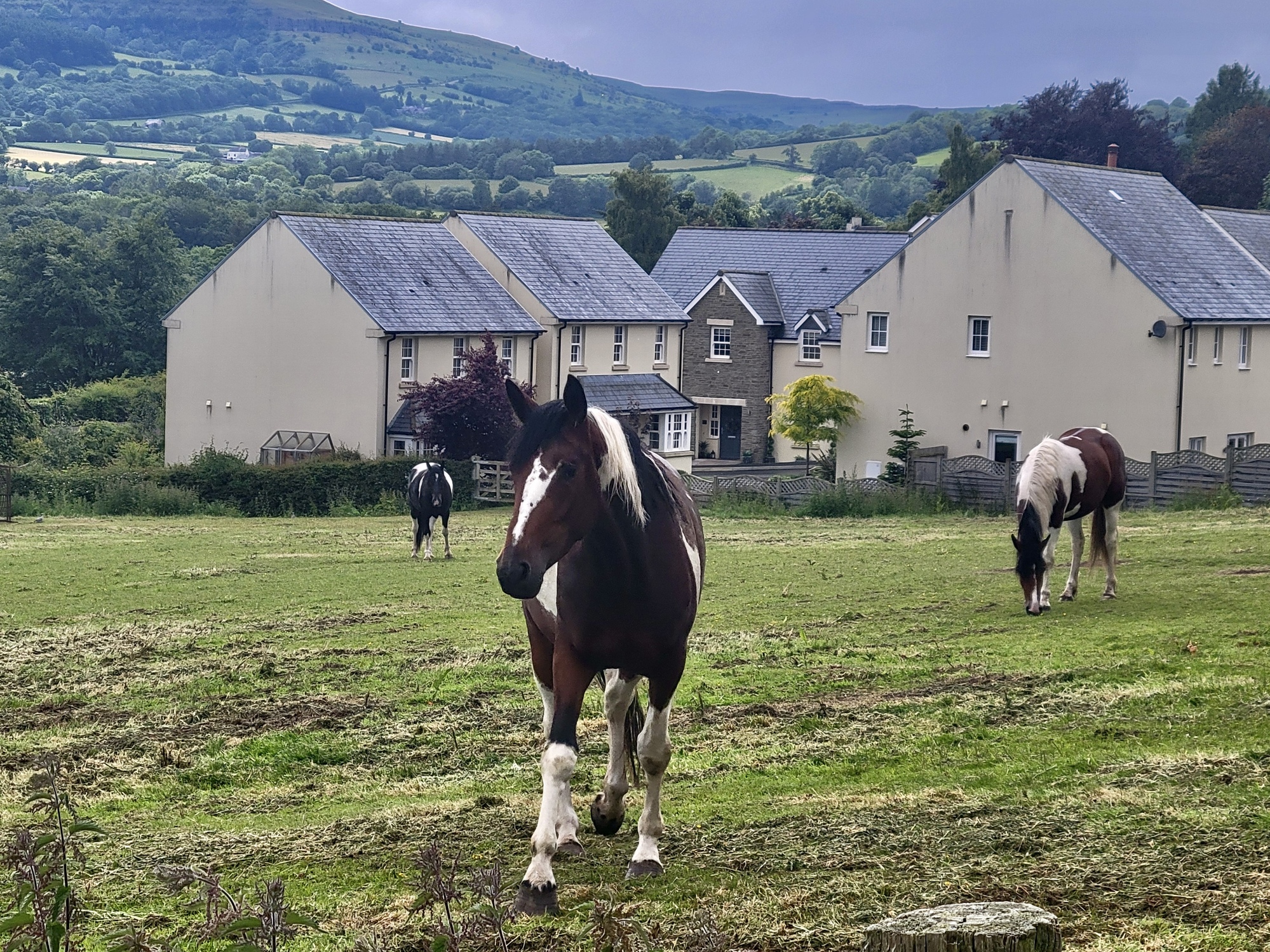
Fantastic country, and more solidly green than when we were here two summers ago in a historic drought.
Scott AndersonTo Kathleen JonesWell, to be honest I do auto-adjust photos to improve their clarity and sharpness. That’s not what’s going on here though - it’s really this green. Reply to this comment 1 year ago
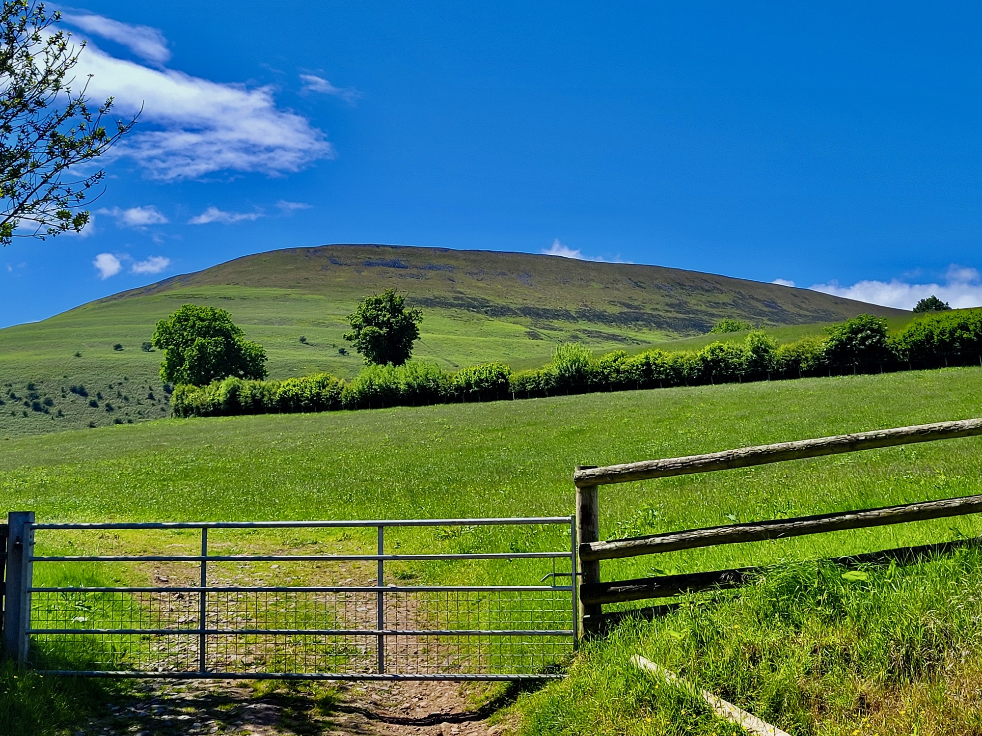
After about three miles I come to a high point and then start ratcheting my way down to to a river, the Grwyne Fawr - the main one draining the south side of the Black Mountains. I didn’t notice at the time, but my route is circling Sugar Loaf, one of the main peaks near Abergavenny.
Might as well slow down and take it all in, else I’d just be zipping up this hill. Looking at the map now, I think maybe this is the eastern face of Sugar Loaf.
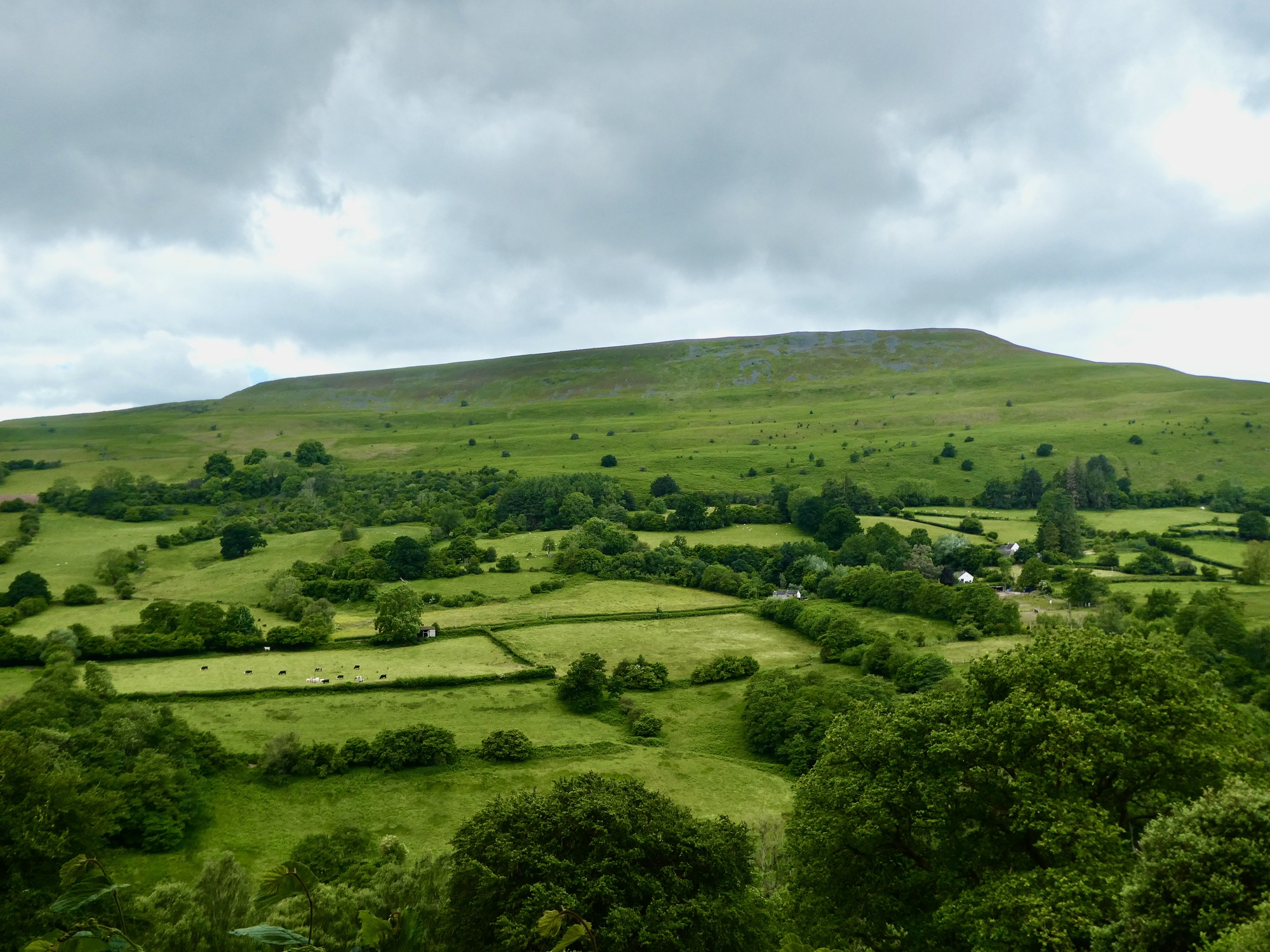
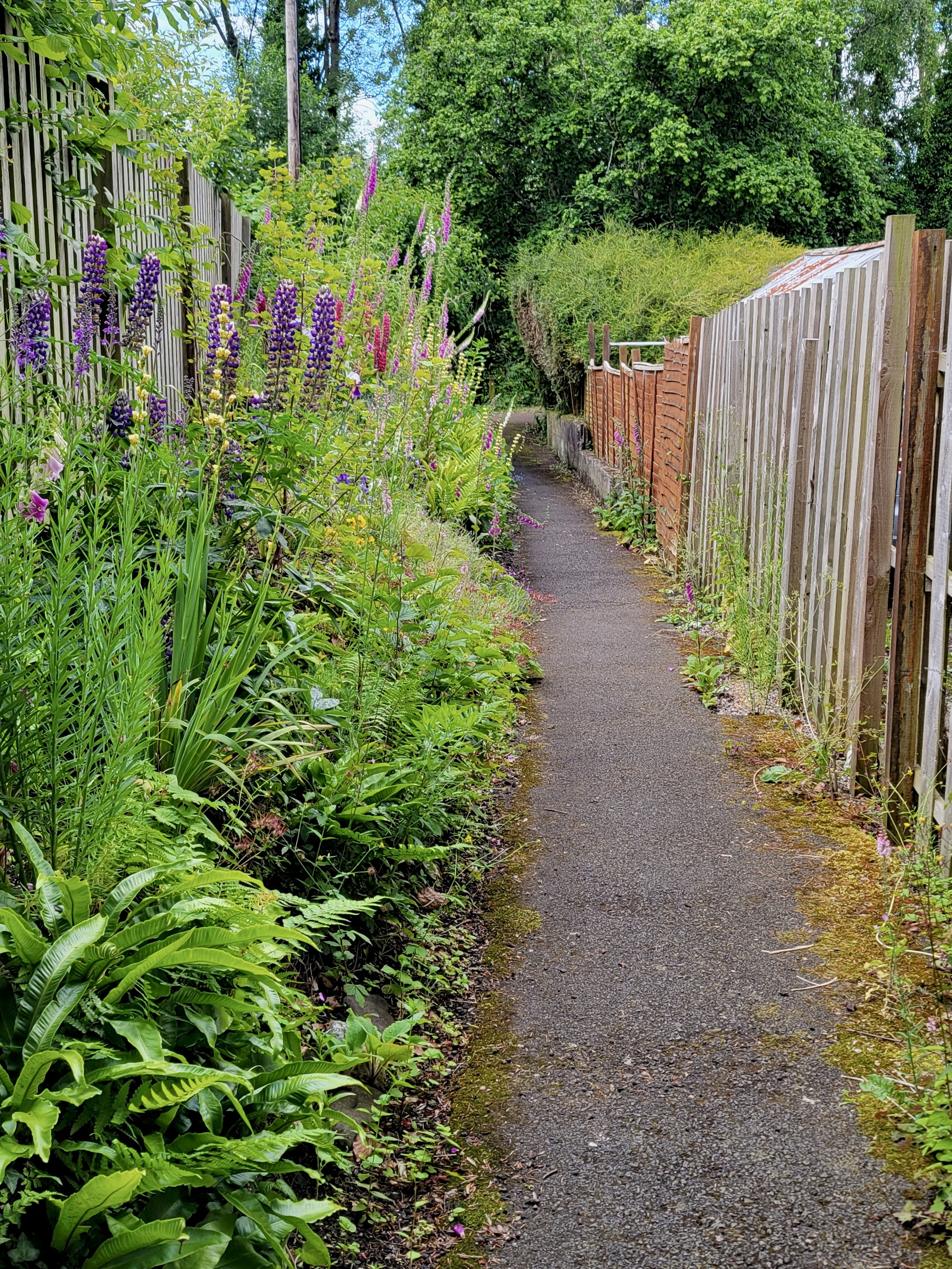
Dropping toward the Grwyne Fawr, which isn’t much more than a stream yet. I love the mosaic look of these small pastures bounded by hedgerows - so much more interesting than the huge pastures we see back home.
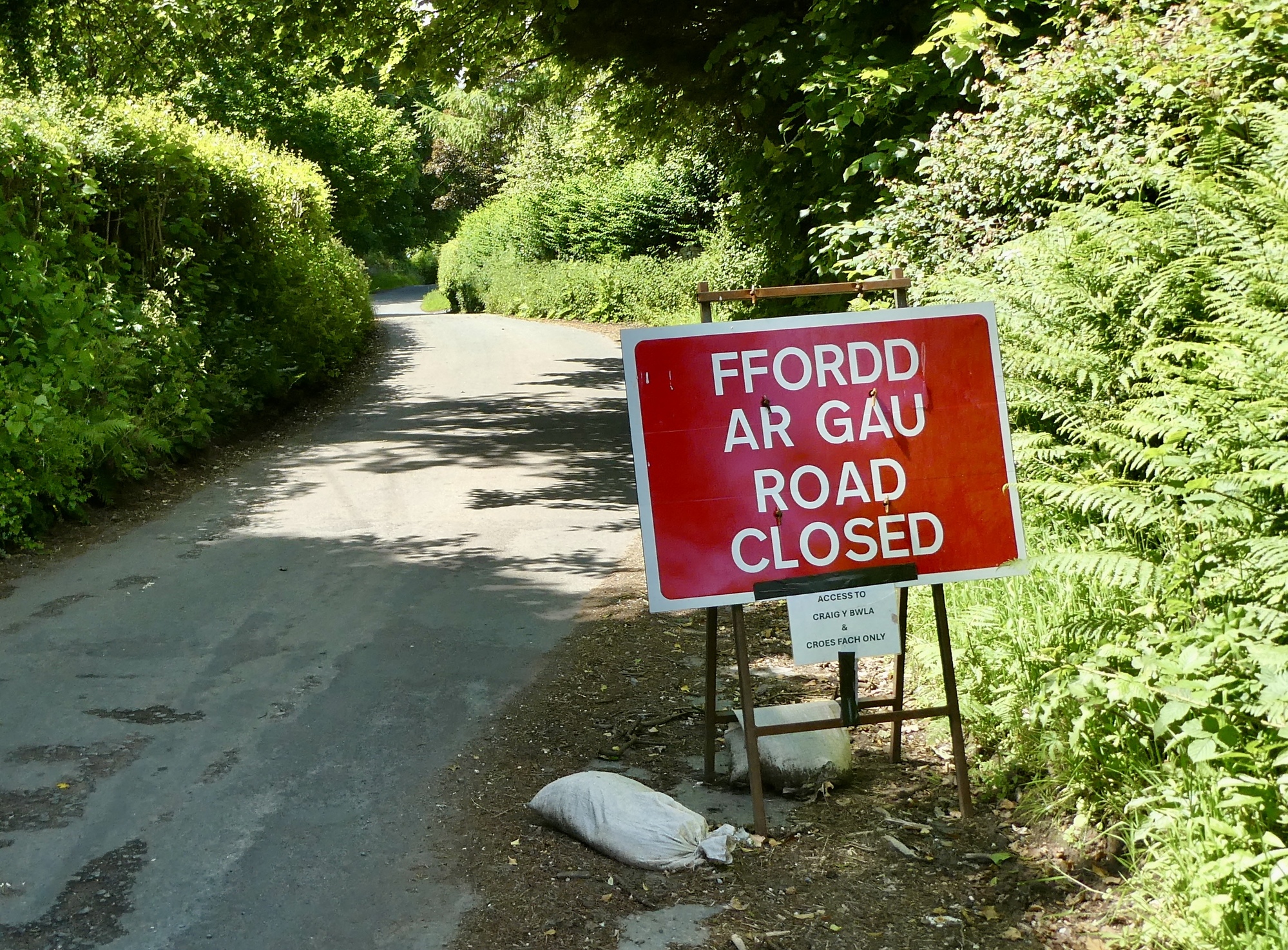
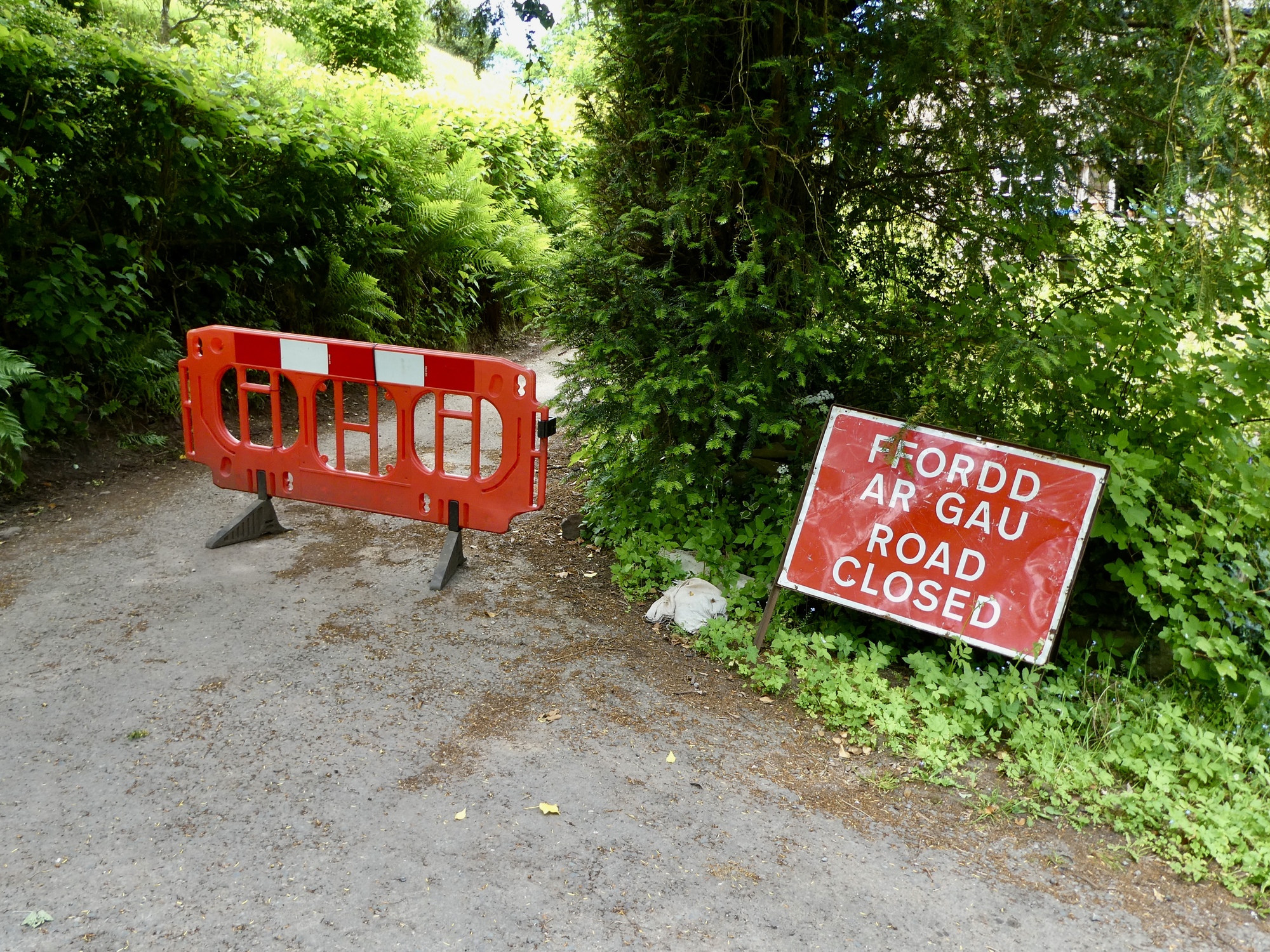
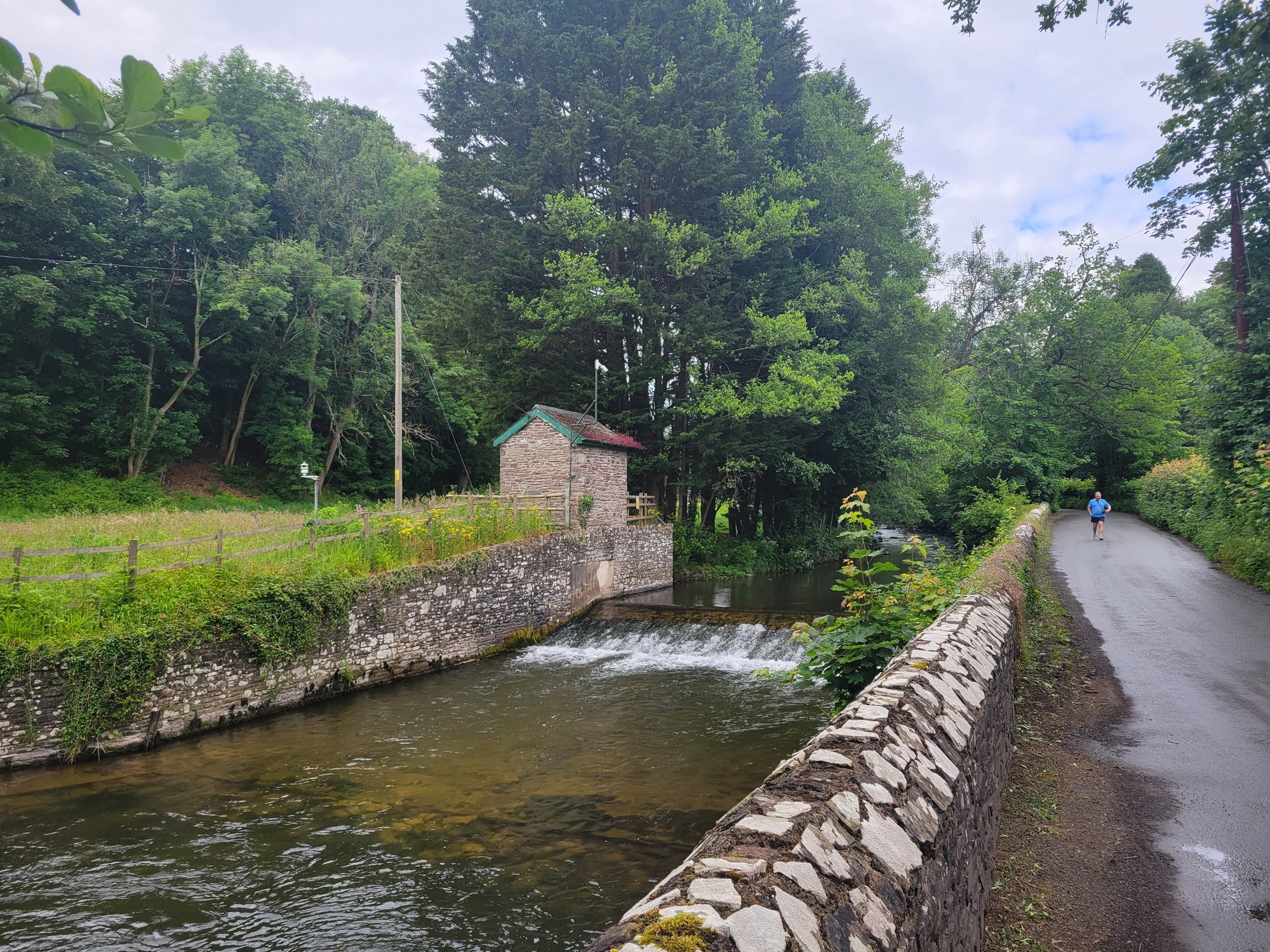
There’s not much to the Grwyne Fawr when I come to it. There’s a small single span stone arched bridge, but it’s all too grown up around it to bother with a shot. Not long after I come to a road closure warning, that makes me wonder if my loop is shortly going to turn into an out and back. I pull out the phone to look up the names mentioned on the sign to see if I’m likely to be affected, but there’s no reception. I try zooming in on the Garmin next, but then have a laugh at my expense when it sinks in that Fford ar Gau isn’t the name of a village - it’s Welsh for road closed, you idiot.
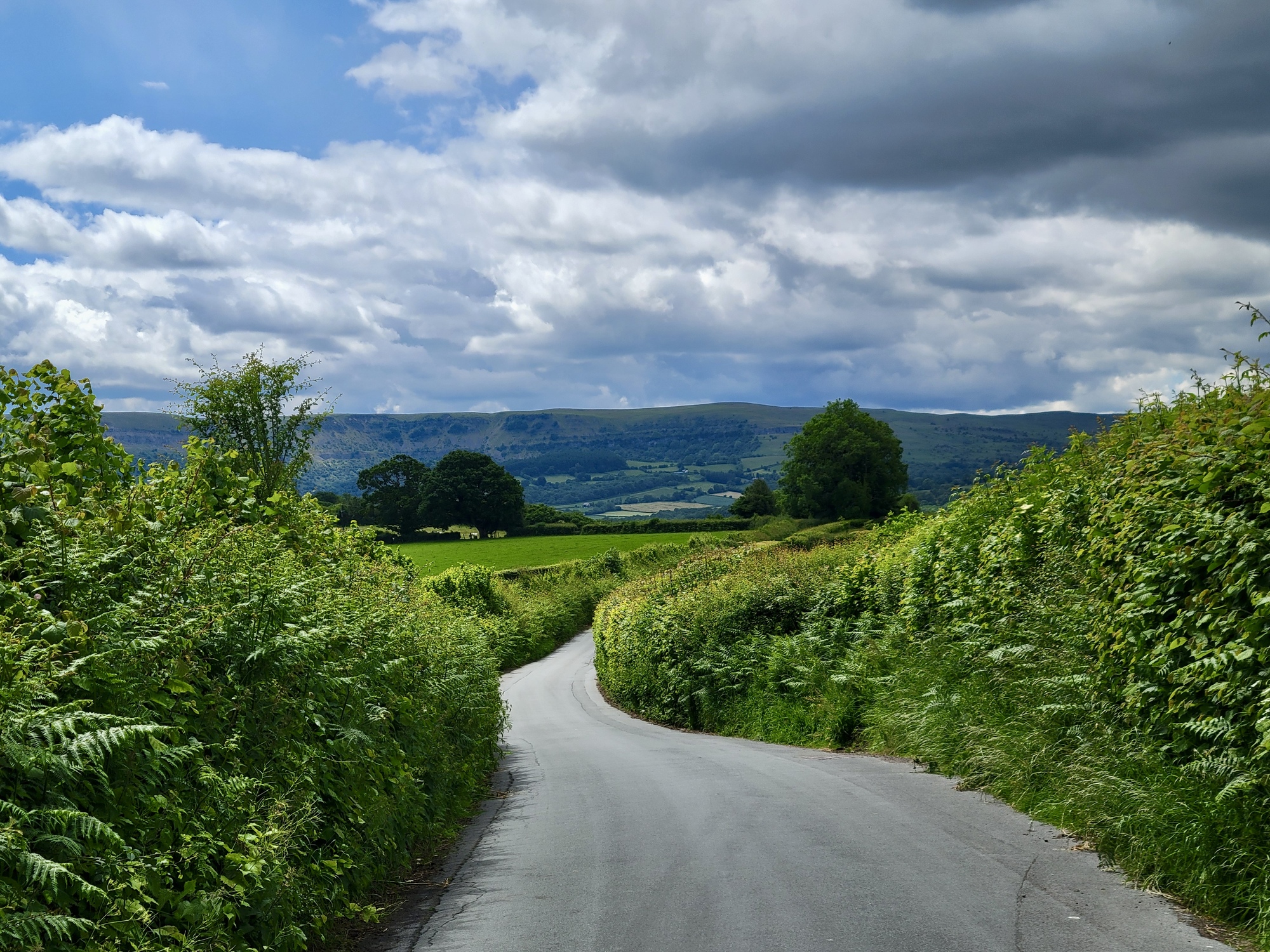
After that, I enjoy a few miles of downhill as I follow the river downstream until I come to its tributary the Grwyne Fechan and branch off to follow it up to a crossing a few miles to the north. I’ve got the road, such as it is, completely to myself. looking back now, I don’t remember seeing another car for at least the next hour. The only road traffic is a walker, and then two women on horseback who thank me for getting off the bike and waiting until they’ve passed.
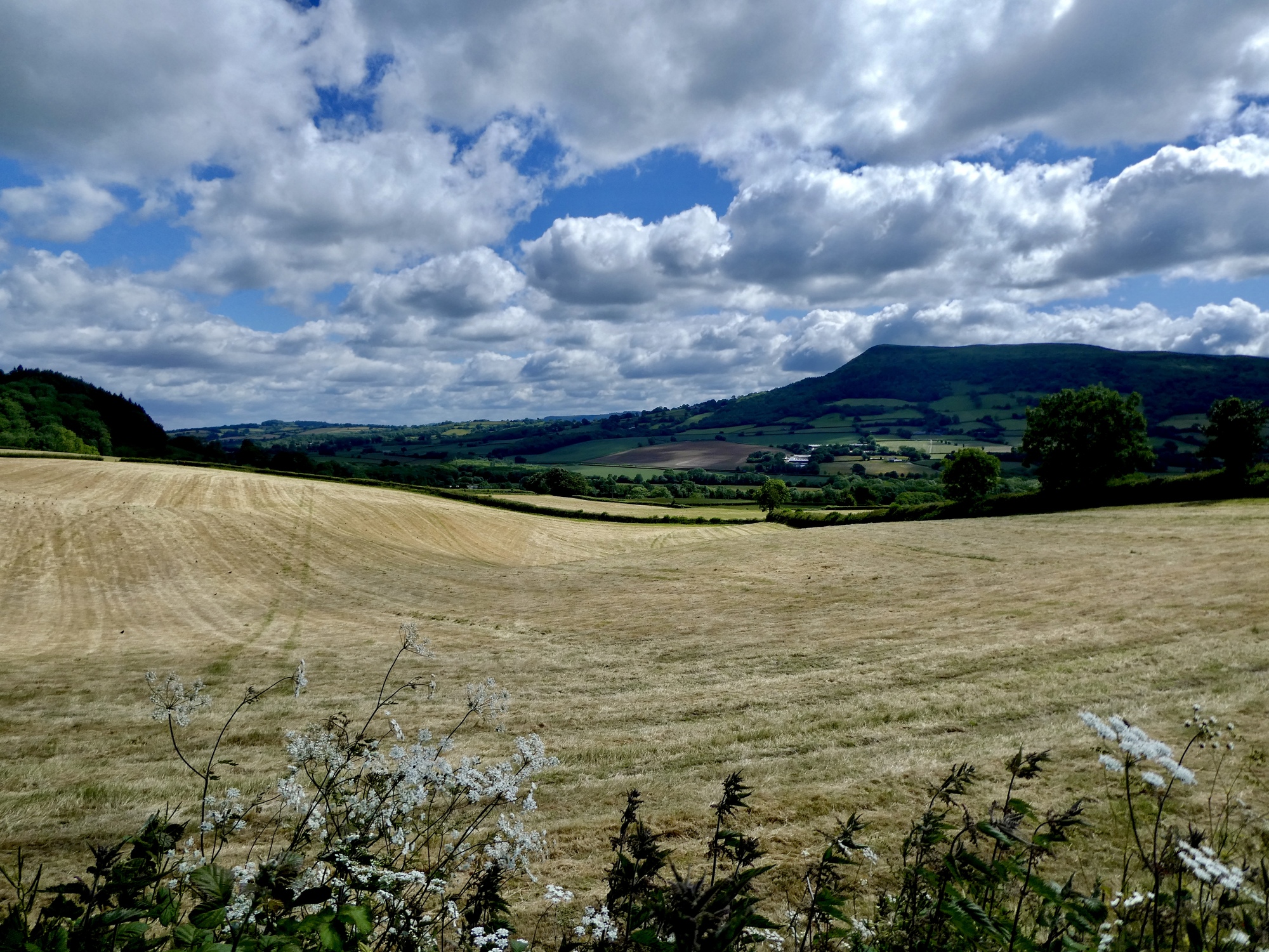
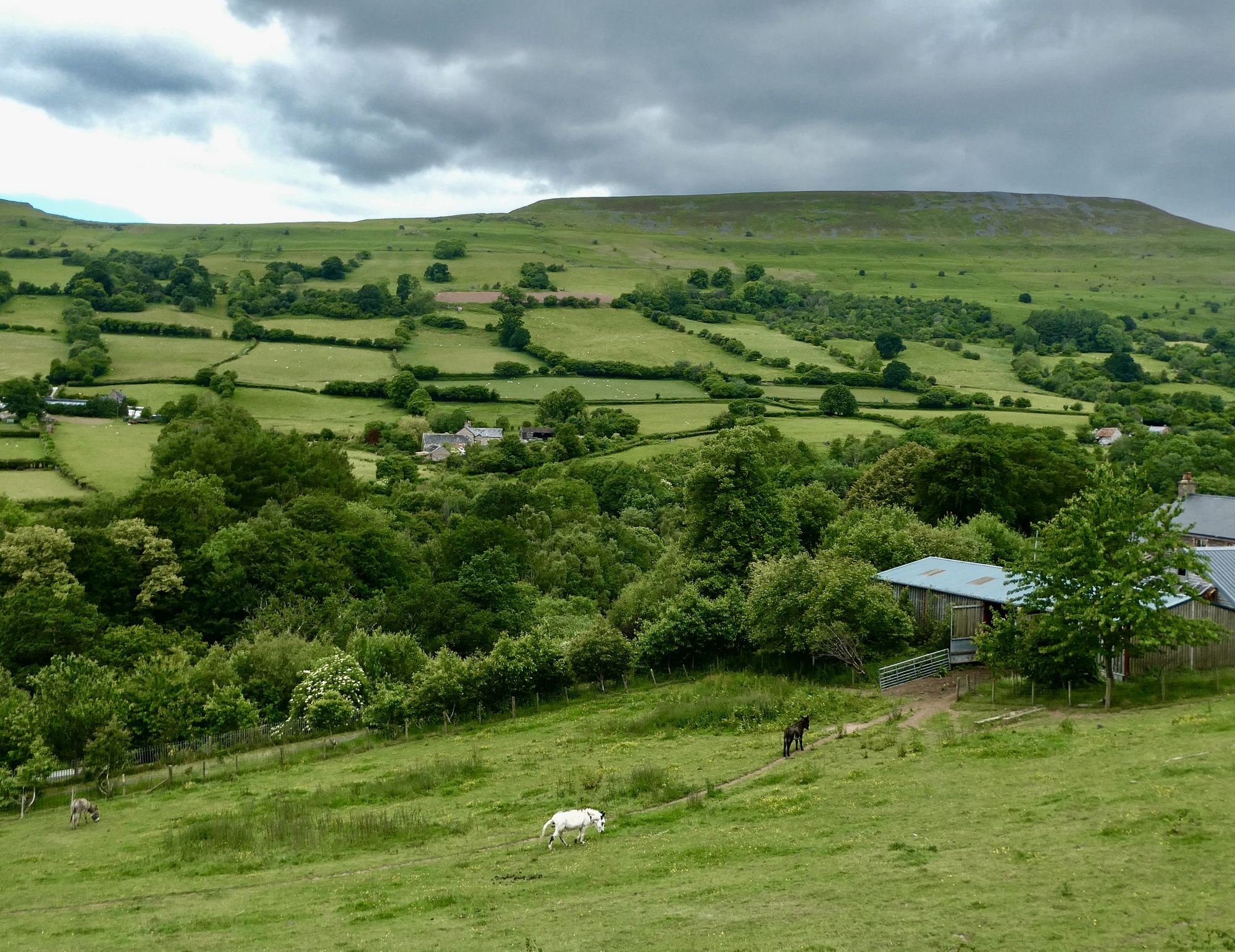
Pretty quiet road. Pretty grey sky ahead too, and not what was expected.
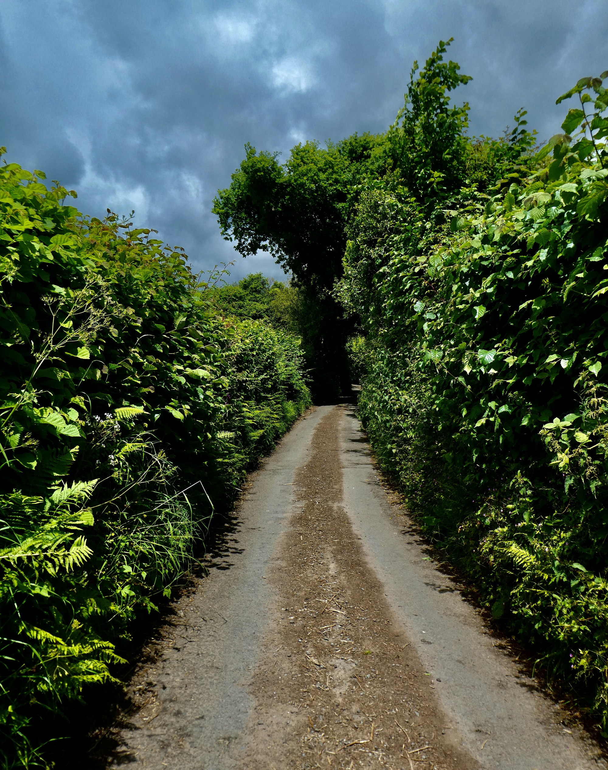
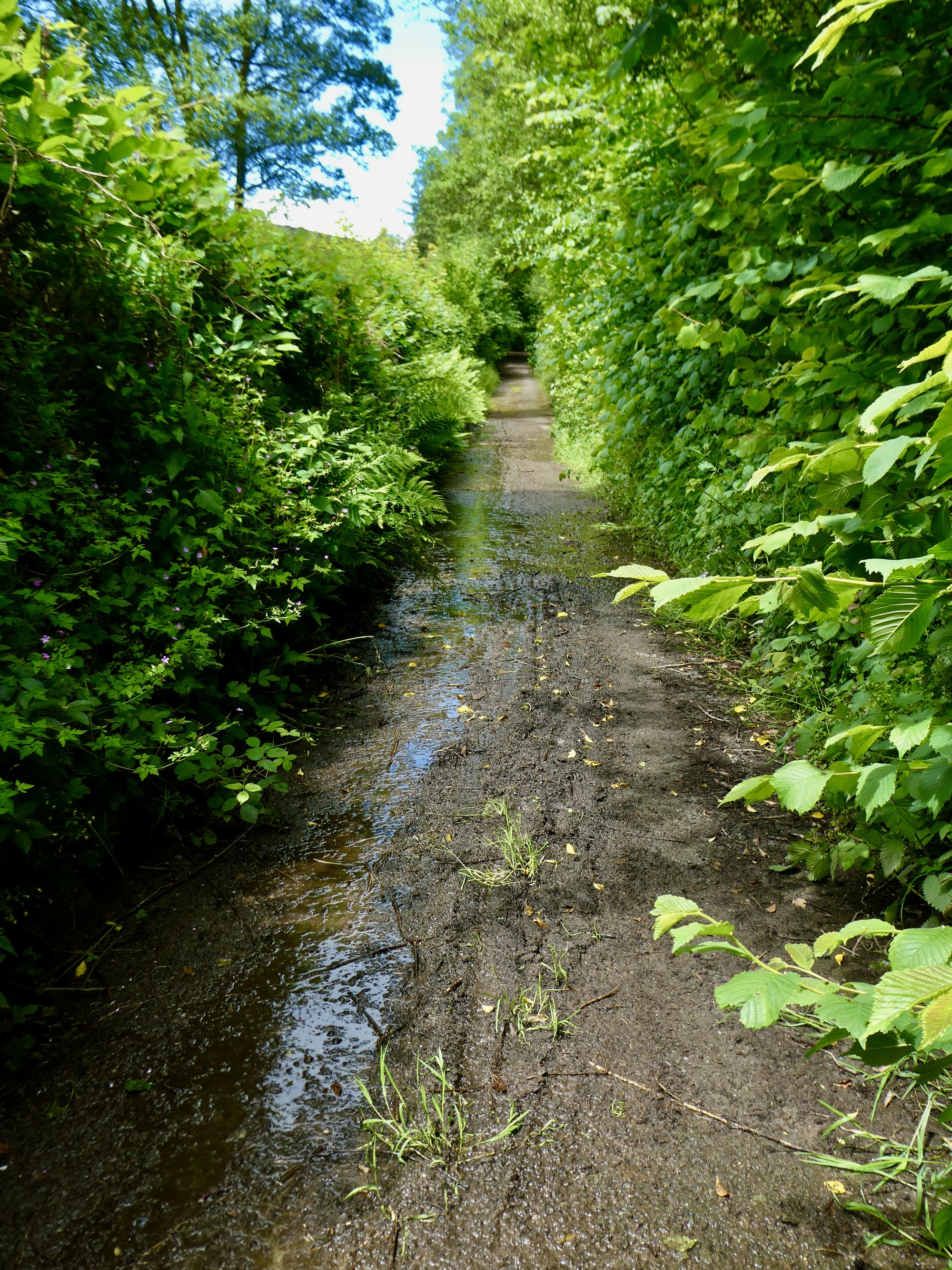
After a few miles I finally come to the road closure but it doesn’t take long to conclude that it’s really just unsuitable for cars. It looks unmaintained and more like a walking path, but that’s fine - I’m going uphill again so I’m not moving very fast anyway. I’m concerned that the bridge might be out when I come to it, and also losing confidence in the sky. It’s grey, there are even a few sprinkles, but then it passes and things brighten up again.
And my other concern is the camera, which I stupidly forgot to charge last night. I quit using it when the red warning indicator comes on, hoping I’m saving a few shots in case a bird comes along down the road. I make a note to do the same thing I just advised Rachael on, to carry a charged battery in the underbag as a backup.
So here’s the road closure, finally. I can always turn back it it doesn’t work, and at least I can be confident that no cars will be along. And I’m educated this time, so I remember right off that Fford ar Gau isn’t a place name. I’m a very quick study.
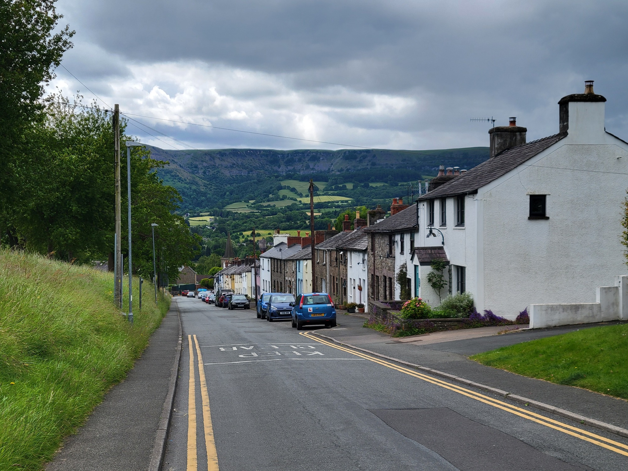
The bridge is still in place when I come to it so I cross the creek and start heading south on the other bank. As I bike I see the sky darkening again; and by the time I’m dropping into Crickhowell the hills to the west are definitely looking ominous. It’s the only place of any size I’ll pass through so I resolve to look for shelter when I get there and hide out for awhile.
I’m still dry when I drop into the village, but then I come to a three way junction with a control light and join the long queue to wait for the green. It’s a very long wait - it must be a full two minutes, and in the meantime it starts to rain. Fortunately I haven’t gotten too wet by the time I make it to the Dragon Inn; and fortunately too there’s a suitable space for the bike - underneath an umbrella by a picnic table, since no one will want to be eating outside right now; and by a window where I can keep an eye on it since I didn’t bring a lock with me.
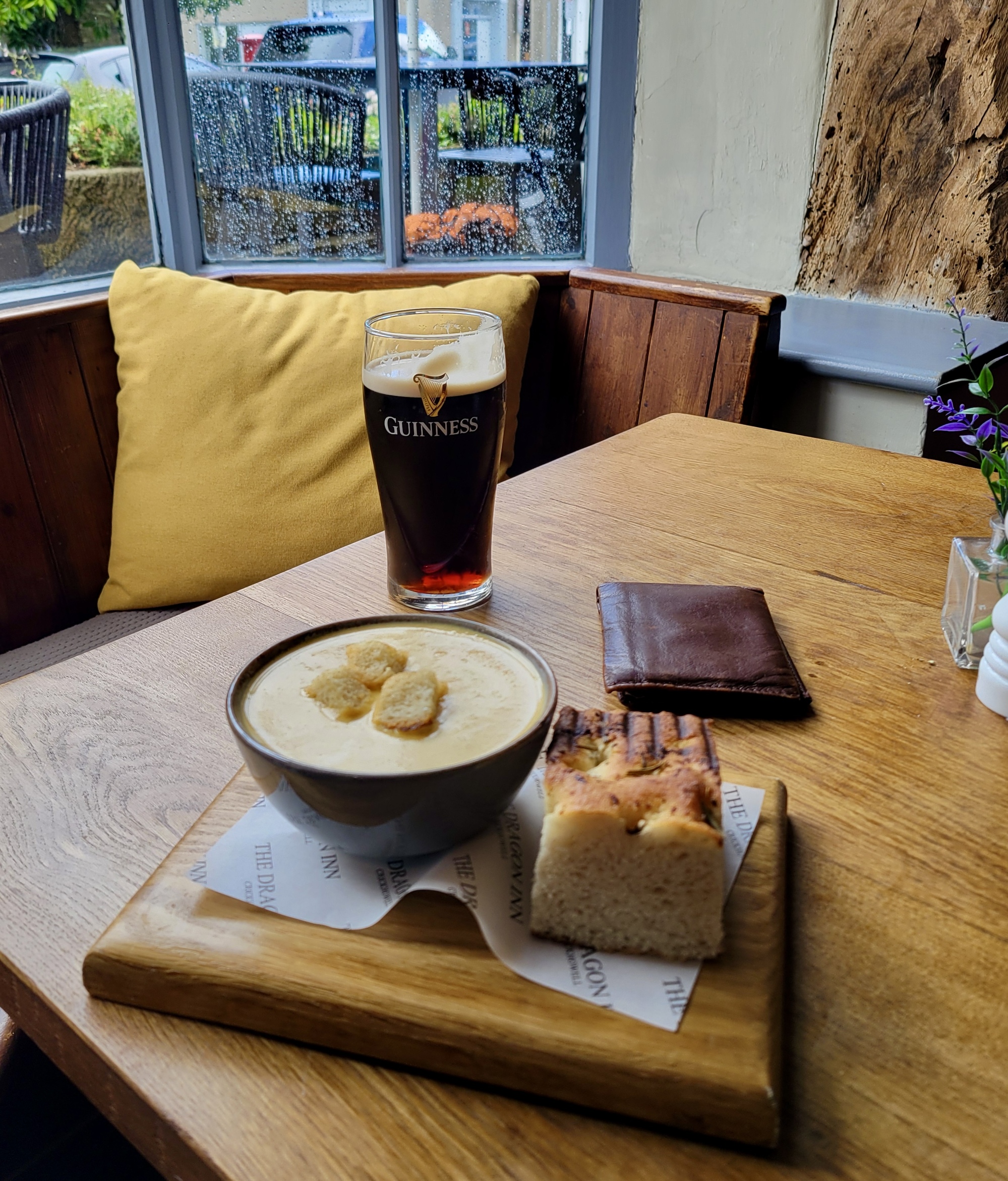
The Dragon Inn makes a great refuge for at least the next hour, as I enjoy a killer bowl of butternut squash soup and a beverage on the side. As soon as I’ve ordered I pull up email to check Rachael’s position on her hike, hoping that maybe she’s home already. I see that she must still be five miles from it though, nearly at the farthest point of her walk, and moving fast. I worry for her until a few hours later when I finally get home, imagining her getting drenched and feeling miserable. It’s a relief when I finally do arrive and hear she’s in good spirits. Tough lady!
An excellent port in a storm. Actually though, that’s a stout.
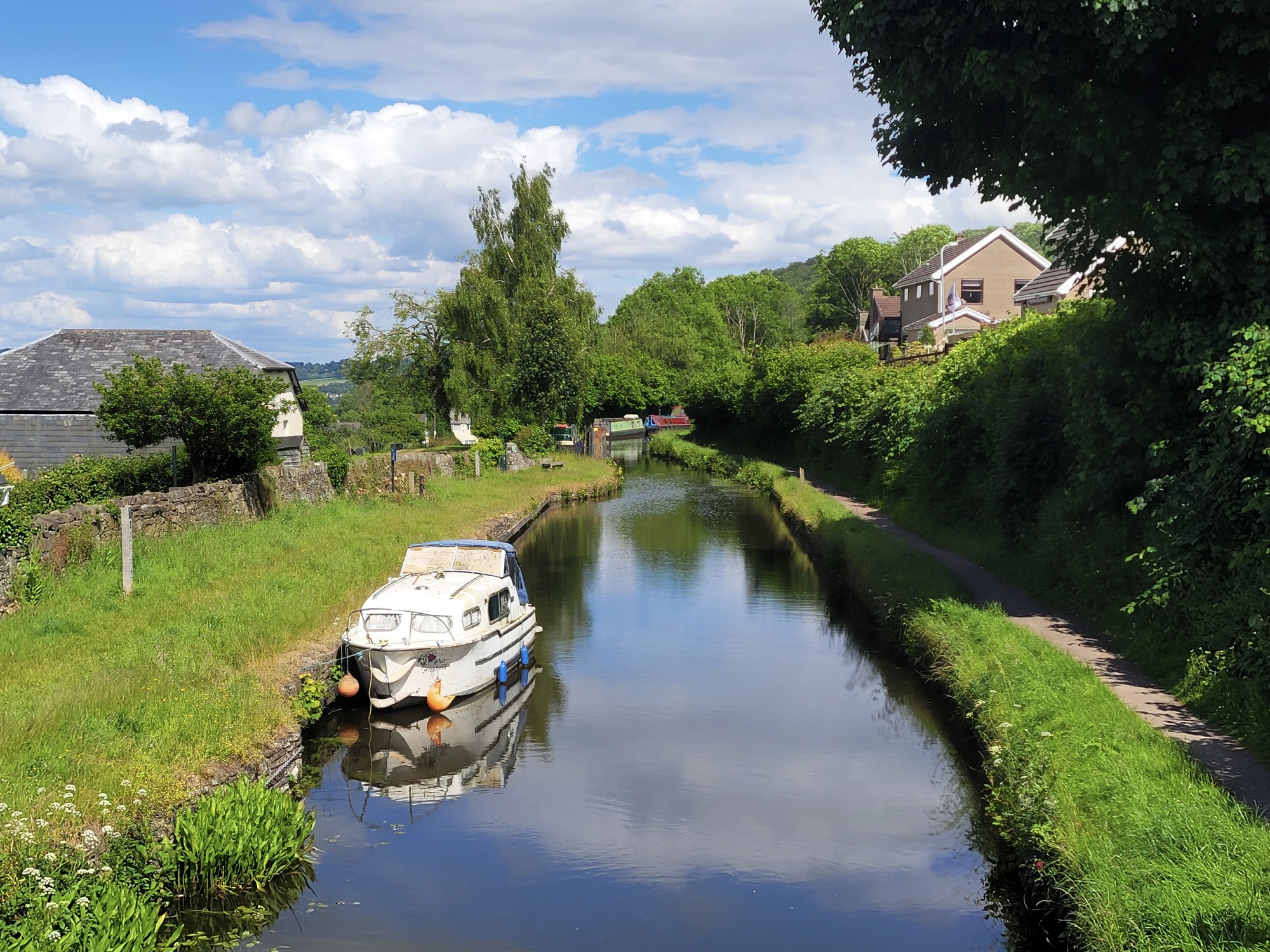
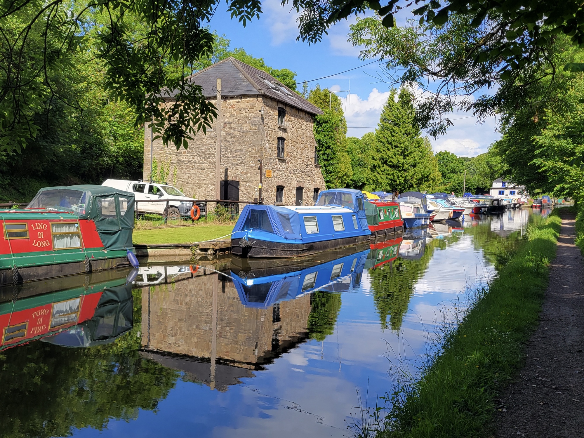
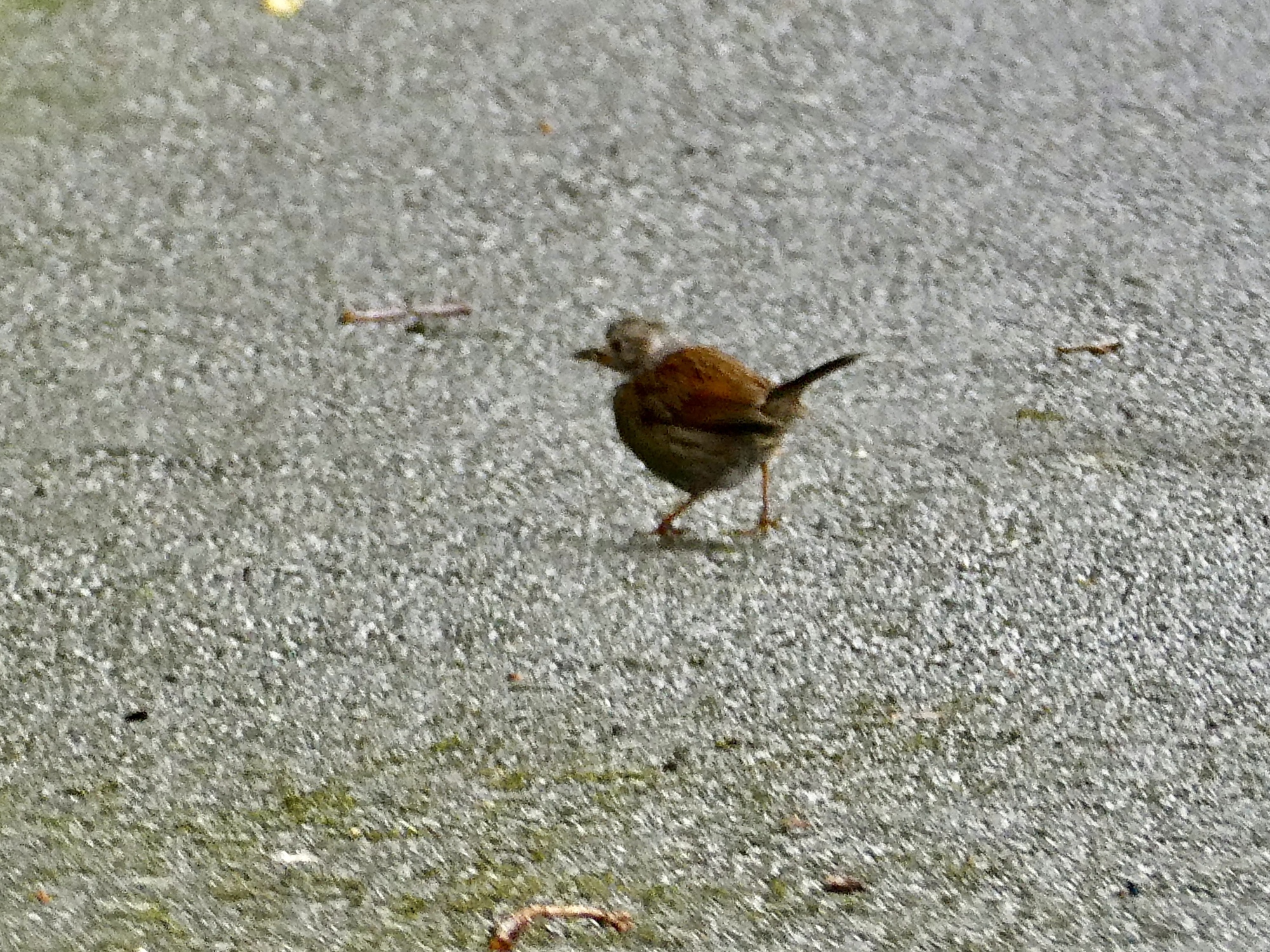
The squall passes after about an hour, and the rest of the way home stays dry and even turns sunny again toward the end. I cut my ride short by about six miles from what I had planned to make up for the time, and enjoy a ride along another stretch of the Monmouth to Brecon Canal (the same canal we biked along a few days ago). My camera really is dead, but I manage a few shots with the phone - including, amazingly enough, one that captures the first new bird I’ve seen in several days.
Fortunately conditions improved after my meal and stayed dry the rest of the way.
#252: Dunnock, another lifer - I’m lucky to be able to get an identifiable shot with the phone. Now that I know the bird I imagine I’ll see others. They look like sparrows, except for the bill - it’s slender, more like the bill a thrush would have.
I get home dry, am relieved to find that Rachael is fine, and not long after we’re walking to Anatolia, a Turkish restaurant. Its an excellent place, and we’re charmed by the owner - we’re his only customers at first so he drops by the table several times for an engaging chat. you should give him your business too if you come this way.
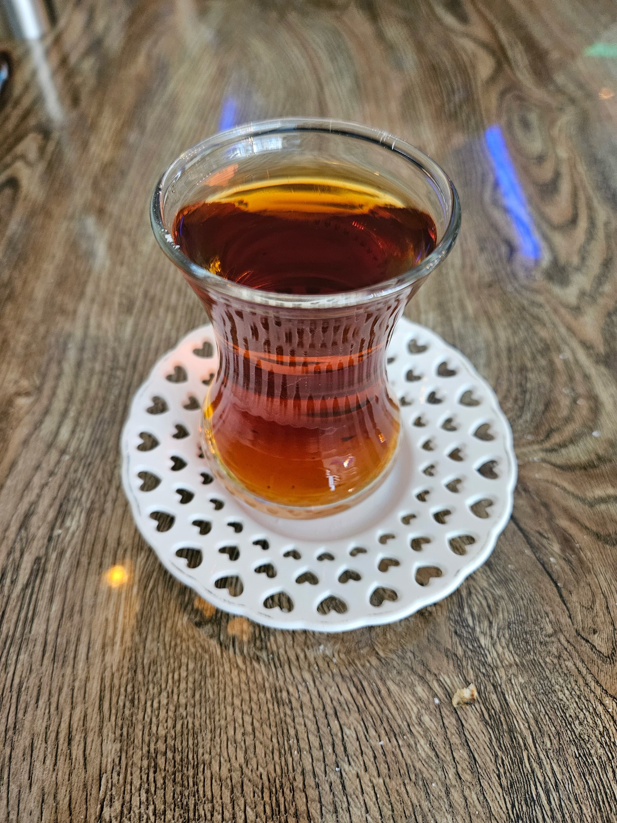
A cup of Turkish tea is the traditional way to end the meal, our host tells us.
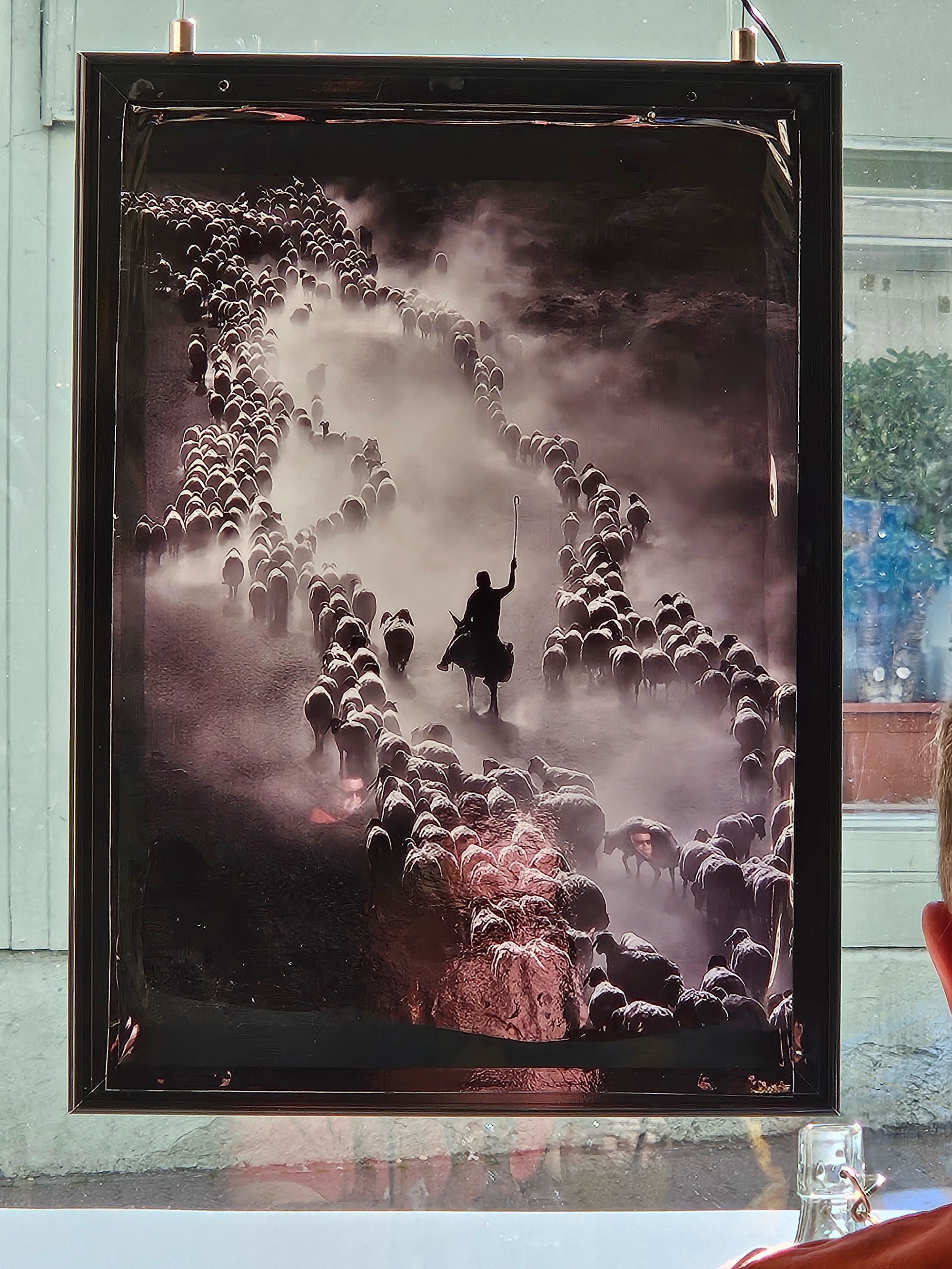
Rachael pointed out this incredible photo on the wall behind my back. Our host tells us it’s in Turkey of course, and I think near his home in Antalya. He said it was a prize winner in the National Geographic’s photo of the year contest a few years back. I’ll have to look it up.
1 year ago
1 year ago