February 13, 2025
Routing Tools - almost killed the ride
The last time we rode in Spain, which was just one year ago, we just grabbed the EV 8 track and set off merrily along the Mediterranean coast. EV 8 often led us astray - into deep sand or up impossibly steep headlands, but somehow we just pedaled through (or around) it. Time has mellowed the memory of most of those sand traps or mountains, but not so much that we would want to just barge into them again. Part of this is that we were young then, in 2024. Now in 2025, enough bits of our minds and bodies have fallen off, or at least weakened, that the game feels different.
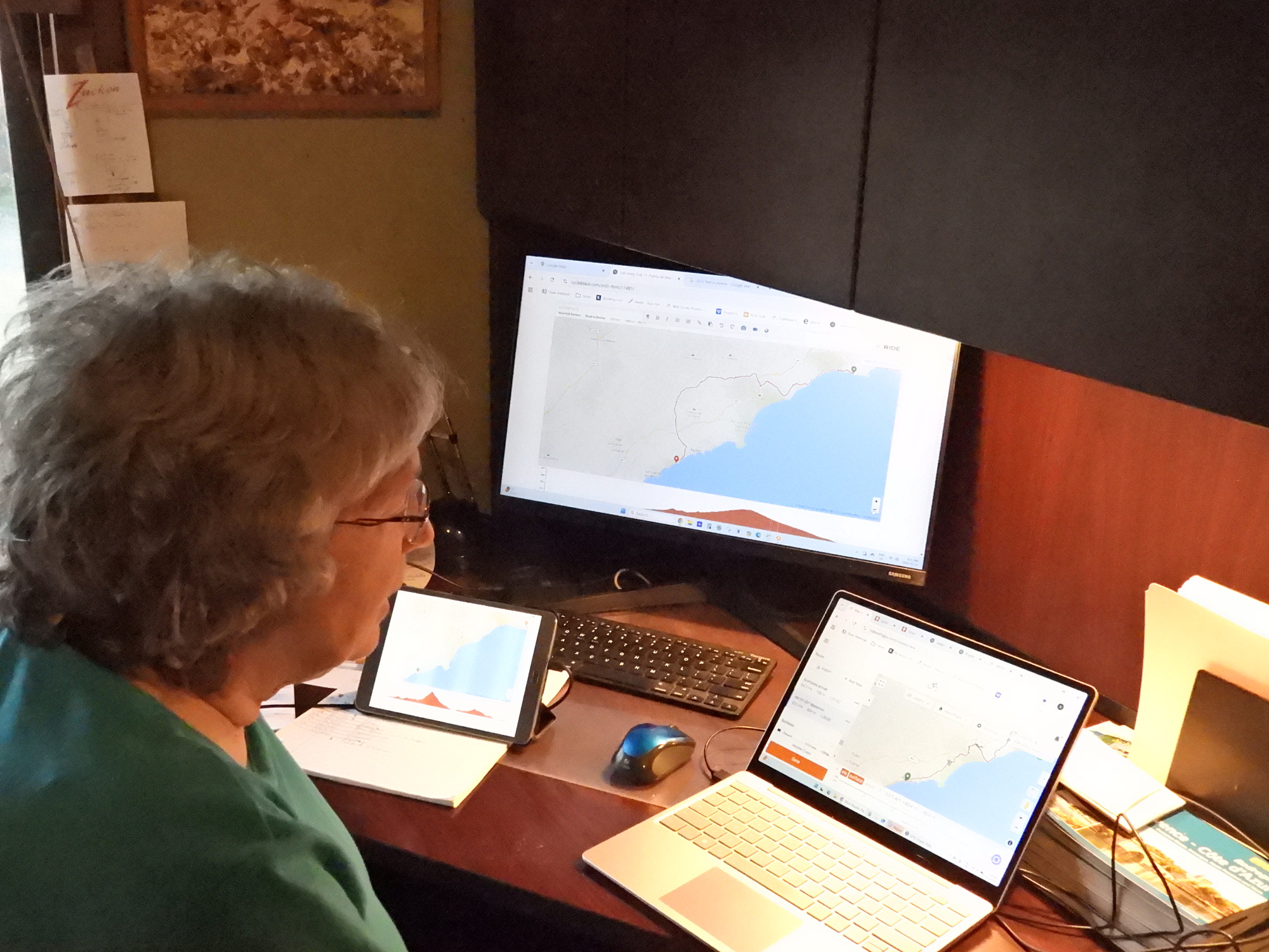
That background plunged us more deeply than previously into the wacky world of the routing algorithms. Routing algorithms, in their simplest concept, are programs/apps/websites that ask you where you want to cycle from and to, and then produce a recommended route that can go into your GPS or phone GPS app, usually as a .gpx file, to guide you along the way. Hah! That description sounds so simple. But what if you are plotting 4000 or more kms over 90 days? What if you need to stop at specific sleeping points, or to determine where the sleeping points should be? What if this depends on how much climbing a day may entail, what if there is gravel or sand in the way? Or giant roads? What if you want to detour to a special birding site or tourist thing? What if you want the route to at least partially follow a way that somebody told you about, or sent a custom .gpx file for? etc. etc.
All of these functions or requirements can in principle be handled, and there are lots of tools around for it. But that is almost where the problem begins. The tools that we know about, or most might want to use, are Ride with GPS (RWGPS), Komoot.com, Bikemap.net, Google Maps, Google MY Maps, cycle.travel, geovelo.com, gps visualiser.com, gpxsee.com, myrouteapp.com, brouter.de, joewein.net, gpx.studio, mapstogpx.com, strava.com, and more. No single one of these does everything that might be required. To add to the mix, many now have free and premium paid versions, and the features are strategically sprinkled so that without paying you will soon hit a roadblock in trying to use a given product. And paying, in the modern age, now usually means an endless subscription charge.
There will be some experienced users reading this that are thinking "why confuse yourself trying to understand and use so many tools, I just use (fill in product name, probably RWGPS) and it's all fine. " But I think I can easily show many (for us) necessary things that just one tool can not do. I may be wrong, but the point of this entry is to describe our frustration trying to find and store routes that we think we can achieve, using the tools that we think we need to use. If we are getting frustrated for no reason, how frustrating is that!
In writing this just now, we are just coming off about three days of basically non stop tearing our hair out with this problem. Underlying it is the concern that we may not be able to make the distances and elevations that comprise the routes, and that there will be no convenient train rescue available, if we screw up with the planning.
As we continued to struggle with routing, Dodie became more discouraged and fearful, and for a time we went over what we we would need to do to cancel the trip and all its bookings already done. When the complexity of cancelling seemed about as much as for pushing on to find routes out of Spain, we pushed on. But if there had been a big red easy to use "Forget It!" button on the desk, we would have pounced on it!
To give a flavour of what we are whining about, I wrote up an example of the problems we were trying to solve. That example ran to several pages, and when I came back to proofread it, it gave me a headache. So you will be pleased to know that I deleted it.
The fact is that there is no easy route through much of Spain. But we somehow have a route now that we are willing to try. It has days that are long and it has days that involve a lot of climbing. There is a chance that we will make it. If you read on, and we carry on, we'll all find out in due course how it works out!
Bonus story: Maybe through too much staring at screens, Dodie developed an infection in one eye. (Oh,oh, Scott's vision story is much on our minds). We took her to the optometrist and discovered that they could only see her in a few days. So we went to the pharmacy and got an antibiotic eye cream. Arriving home, we had a call from the optometrist - they found an opening, more or less right now. So back we went. They prescribed a different cream, and a program of lying with a heated black pad over the eye, three times per day. As I write, the eye seems to be improving. But there is a silver lining to the story. Waiting at the doctor, the pharmacy, or for the eye pad to work its magic, I had extra time to research one of the glitches that had slowed us down in developing the best cycling routes.
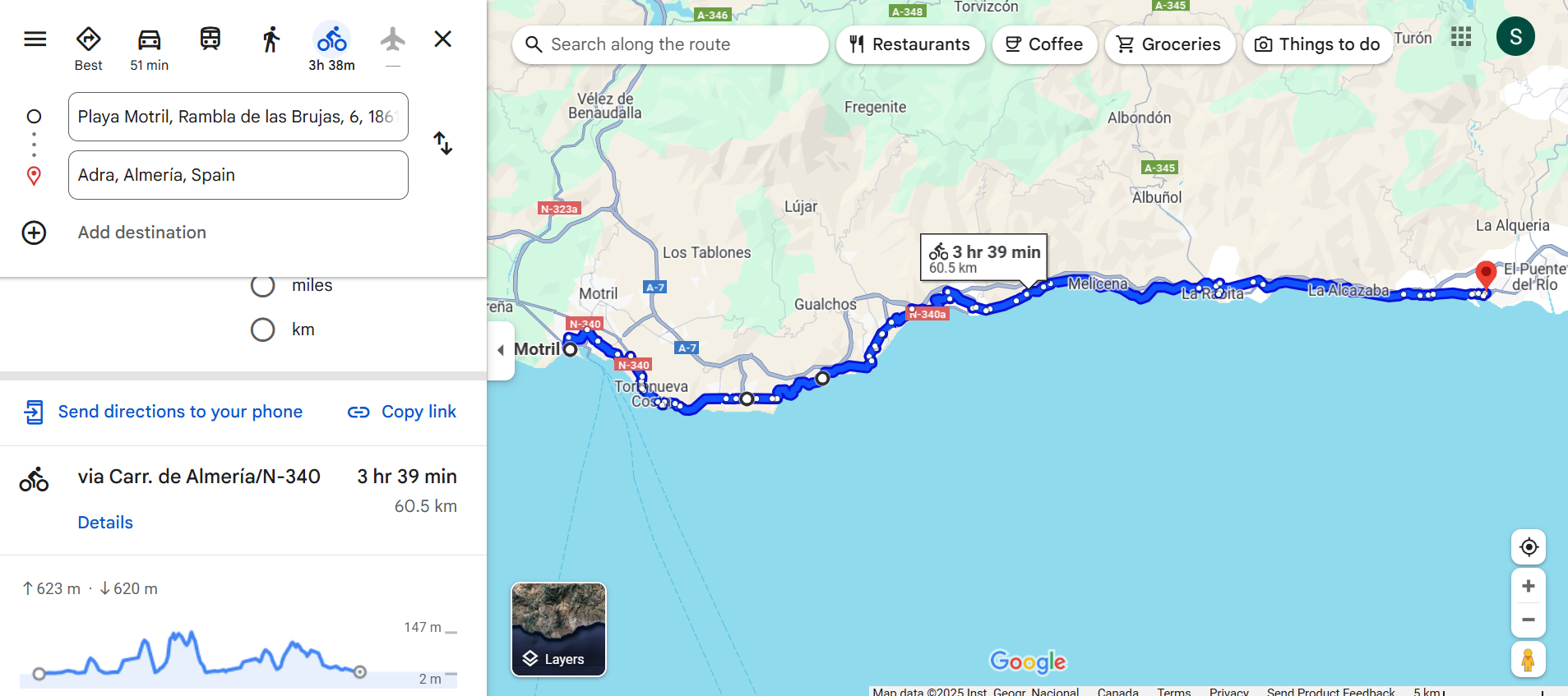
The glitch involves the fact that the widely known Google Maps can often suggest more than one good cycle route from one place to another, and for these it clearly supplies not only the distance but also the amount of climbing involved. We would often want to take one of these suggestions, but Maps had no native way to save its results into the .gpx files used by our GPS app.
With some time to noodle around, I found the answer, in the form of a web site called mapstogpx.com, and I found a Youtube about how to use it. So now if Google Maps suggests a route with acceptable distance and climb, we can grab it as a .gpx directly. That has been quite a boon!
| Rate this entry's writing | Heart | 12 |
| Comment on this entry | Comment | 5 |
4 months ago
The most astounding occurrence I recall is our ride from Marina di Pisa to Castelnuovo di Garfagnana (https://www.cycleblaze.com/journals/italy2020/marina-di-pisa-to-castelnuovo-di-garfagnana/). My RWGPS route (edited to start and finish at our pre-booked lodgings) predicted 84 km and 1173 m climbing, not a day I was looking forward to. As I opened this route in the route planner today so I could overlay my actual track, which shows 88 km and 511 m climbing, to check whether we had somehow gone around a mountain, the original route changed its climbing prediction to 1007 m. We did vary a bit from the plan, but no big climbs were avoided. In fact, I remember wondering, as the km to go dwindled, just how steep the last part was going to be.
And "actual elevation gain" is dependent on the device used to record the ride. As I wrote in my summary page from that tour, we rode together but somehow, while I climbed 29,364 m, Al climbed an additional 2628 m or 9% more. We were pretty close riding to Castelnuovo di Garfagnana since his Garmin measured 512 m.
4 months ago
4 months ago
4 months ago