February 9, 2023
(Not) Camping, Still Riding, Day 3
Another good ride
PHEW. THAT WAS HARDER than I expected, despite my cutting several miles off the plan, and despite my cunning (and successful) strategy to arrange for a tailwind for much of the second half of the ride.
Miles, even relatively easy ones, add up after a while. It's the third riding day in a row for me, the longest string of consecutive days in the saddle since the end of November.
The forecast told me to expect a high around 63F and winds from the south, building from 9 mph to twice that in the interval between 10:00 and 2:00. Based on that, I decide on a 10:00 ride start and a loop that takes me south to begin and finishes mostly northbound.
The 10:00 departure time affords me the opportunity for a lazy morning. I take maximum advantage, even working in a solid hour-long nap after breakfast (last night's pizza leftovers, now cold).

| Heart | 0 | Comment | 0 | Link |
At 10 it's still only 48 outside and the ground's wet from light overnight showers so there's a bit of damp chill to the air. I've elected to skip wearing riding tights today, going only with shorts and knee-high compression socks (makes my doctor happy and besides, they're all I have with me). Up top I have a thin long-sleeve base layer made of good wicking material, a regular jersey, arm warmers, and a thin-but-warm beanie under my helmet. As backup I stick my windproof vest in a jersey pocket, just in case. The vest never gets deployed but it's nice to know it's there if needed.
Heading south I cover the same bit of road I've been on twice already on this trip, but that's fine. Traffic's light as I've come to expect and the road is pleasant.

| Heart | 0 | Comment | 0 | Link |

| Heart | 0 | Comment | 0 | Link |
I decide that I'm warm enough- just enough, but enough- as long as I keep spinning.
The past two days have left their mark, so it's an easy spin in a relatively low gear. Turning onto a side road that parallels a small stream, I'm lulled into a false sense of security because I'm riding gently downstream. This is easy!
Adding to the list of woodpeckers I've seen this week (yesterday I saw a pileated and a smaller one - red-headed, maybe? not a hairy or a downy, I think), a bird I take to be a flicker flashes through my field of view, stops for a moment on a tree trunk near the road, and moves on soon after.
After a lovely mile and a quarter of drifting with the current it's time for my wake-up call. My next road rises gently away from the stream, slowing my pace but not really taxing me badly. I hear the warble and trill of a red-winged backbird somewhere off to my right but I must be far enough from its nest that I'm not regarded as a threat so it doesn't dive-bomb me.
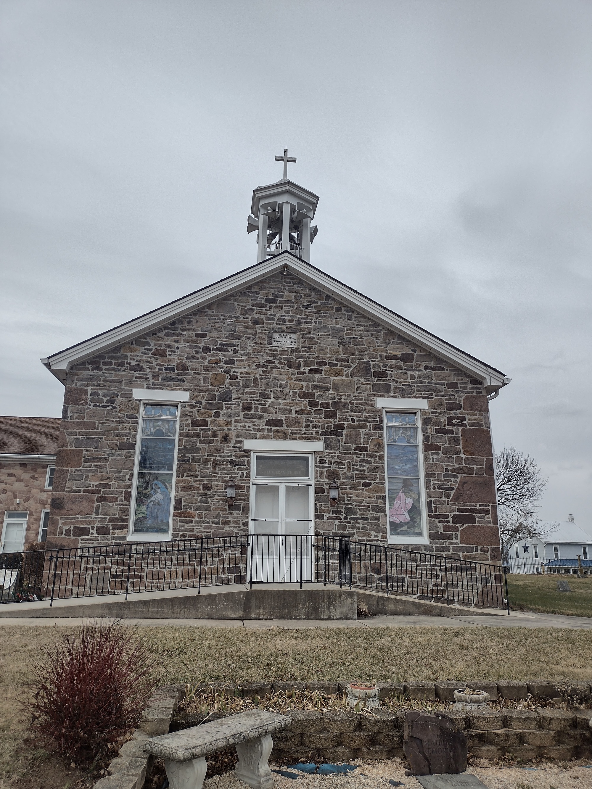
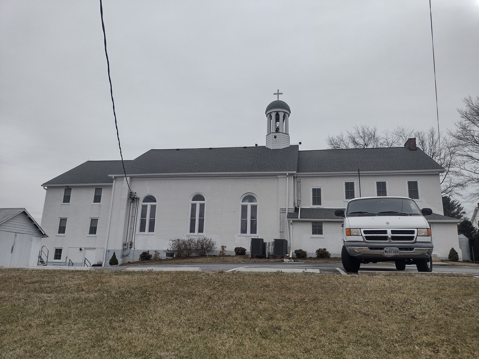
Another few miles and it's time for a momentary deviation from the plan. I can see a church sitting at the crest of a small rise, a quarter of a mile or so off the route. Since I've claimed them as mine to photograph, I'm sort of honor-bound to record this one, yes?

| Heart | 3 | Comment | 0 | Link |

| Heart | 0 | Comment | 0 | Link |
The gravestones nearest the church door, which I took as meaning the oldest, were faded and eroded to the point of illegibility. The oldest date-of-death I could make out was from around 1873, if I recall correctly. Assuming that is correct and that it occurred not long after the founding of the congregation, that makes it 150 or so years old. I'd lay odds this is the original building, too.
[Later: I'm wrong about the date, off by 40 years. According to the current congregation's "History" web page the building dates to 1833 and was originally built as a Methodist establishment. It's been leased by the current congregation, self-described as "a small mission in the Charismatic Episcopal Church (called Lamb of God Church)" since Christmas Eve, 2005.]
Back on route it's not long before I am compelled to stop yet again, for another church photo. This one's accompanied by one of those wryly humorous and pithy sayings that seem to pop up on church marquees.
From Lewistown I continue south, eventually crossing U.S. 15. There's a nice little pocket of rural life tucked in between the highway and more open farmland to the east, and the ridge of the Catoctins just to the west. It's more wooded and there's a small stream (there are LOTS of small streams around here, so this is not remarkable) to add interest. Also, loads of fish-breeding ponds. The road I used to get to this spot is Fish Hatchery Road; I'd never really thought about the implications of that until this moment. They're not especially photogenic, though, so I don't stop to try.

| Heart | 0 | Comment | 0 | Link |
Continuing southeast, Bethel Lutheran Church soon comes into view. It is, in a sense, at the current line of demarcation between the ever-expanding sprawl surrounding Frederick and the little pockets of semi-frontier further out. As little as ten years ago the boundary was several miles to the east and south. I'm troubled to see that it has moved so far since then.

| Heart | 0 | Comment | 0 | Link |

| Heart | 0 | Comment | 0 | Link |

| Heart | 0 | Comment | 0 | Link |
In addition to the historic old buildings I begin passing much newer places: residences on several acres and set back a bit from the road but still jarring and looking decidedly out-of-place. These have all been built in the past decade, I think, and foretell the doom of the rural tranquility I've been privileged to enjoy until now.

| Heart | 3 | Comment | 0 | Link |

| Heart | 0 | Comment | 0 | Link |
Reaching the southern end of the loop it's time to turn east. It's now going on 11:20 but the sky is still gray and it's not much warmer than when I set out- a little, perhaps, but not much. The breeze is becoming more apparent, though. A half mile or so farther on I pause to reconsider what I'm about to do. As I drew it originally my route calls for me to continue east and a bit more south before turning north. I know I'll be disenchanted with the increasing sprawl I'll be seeing, and with the long drag up a frontage road next to U.S. 15.

| Heart | 0 | Comment | 0 | Link |
It takes just a moment's contemplation before I've decided to cut that bit off and take a road that short-circuits a few miles. Plus, I'm starting to notice that I'm getting the tiniest bit tired despite a relatively modest total mileage.
A few miles less won't hurt me; a few miles more just might. Finally, this: by turning north now I can begin taking advantage of whatever southerly wind there is. I've not been fighting- hardly noticing, in fact- any significant headwind so far but noon's not far off and with it higher wind speeds if the forecast is to be believed.
On my way, I see a repeat of the performance I witnessed Tuesday: a small raptor flies against the wind and hangs in the air over a fixed spot of open field. As I watch I see it plunge and dive-bomb an unseen quarry in the grass. It misses, climbs to an altitude of fifteen or twenty feet, moves a bit farther along, and repeats the show: hover, dive, climb, and try again. And again. In all I watch four or five repetitions before the bird's too far away to be easily seen against the distant trees. Time to move along. Soon enough I re-cross U.S. 15 and find myself back in the open farmland to its east.

| Heart | 1 | Comment | 0 | Link |

| Heart | 1 | Comment | 2 | Link |
2 years ago

| Heart | 0 | Comment | 0 | Link |
My route plan calls for me to continue north for three or four miles farther north past the intersection of MD 77/Rocky Ridge Road and then turn back south, but I can cut some distance by making the left onto 77 here. I'm definitely tiring now, and getting hungry. The beginnings of a bonk can be felt stirring; if I'm not careful things could get ugly real fast. Decision made, I make the left.
Of course bonking's entirely a problem of my own making: I knew there wouldn't be any country stores or gas station mini-marts along the way, and I left without any food in my pockets. Stupid. Even shortened, though, the day's ride will be 31 or 32 miles so it's not a total cop-out.

| Heart | 0 | Comment | 0 | Link |

| Heart | 0 | Comment | 0 | Link |

| Heart | 0 | Comment | 0 | Link |

| Heart | 0 | Comment | 0 | Link |

| Heart | 1 | Comment | 0 | Link |
Riding into town, I divert for a mile or so up MD 550. I know there are two fast food places along the way, and I'm now really hungry. Even though I have less than two miles back to the hotel, where a hot shower and fresh, clean clothes await, I need to eat and I need to do it now.
Nutritional crisis averted (burger, fries, chocolate shake), I retrace my diversion and make my way back to the hotel. In all I've done 32.5 miles and I'm satisfied with that. I'll stay the night here in Thurmont- the hotel room's already paid for- but I'm having second thoughts about riding tomorrow. That's a decision, for later, though and there's nothing to gain by jumping too quickly in any one direction.
Today's ride: 33 miles (53 km)
Total: 188 miles (303 km)
| Rate this entry's writing | Heart | 4 |
| Comment on this entry | Comment | 2 |
Also I am enjoying your travels with you. Mainly my rides have become day rides, but more often than not, I get to connect several days together but mostly around home. My home state is Maryland but I am not all the familiar with western parts of the states and find your finds and photos very interesting.
2 years ago
2 years ago


