June 1, 2024
Shinnston to Morgantown
Beautiful Trails and a Few Necessary Roads
Barring anything unusual, today will be the last day of this portion of the Mountain State Tour. I left home a week ago to make an elongated loop through some Northern and Western portions of the state. So far, on this leg of the tour, I have passed through the following counties:
- Brooke,
- Ohio,
- Marshall,
- Wetzel,
- Tyler,
- Pleasants,
- Ritchie,
- Doddridge, and
- Harrison.
Today, I was able to add Marion and Monongalia to the list. Not a bad week's work... and it's been fun!
The cold front that moved into this area a few days ago sparked rainstorms that drenched me on several occasions, earlier in the week. The rain was followed by cooler and drier conditions, which were welcome. The net result has been several very cool mornings. This one was by far the coldest. I'm not complaining because June can be very hot and humid around here.
My little motel was halfway down a big hill that led into Shinnston proper. Getting down it and into town was quite chilly. Since I was hungry and McDonalds was open, I decided to stop. Inside, the requisite group of older guys (like me) were socializing. I ended up sitting near them after getting my big breakfast and senior coffee. I usually don't eat that much but after a week on the road, my internal motor was running hard and in need of fuel. The guys were talking mostly about local events and people they know. They were razzing each other a bit, as only guys who know each other very well can do. This was an opportunity to take in some local flavor, which to me is a big part of any bicycle tour.
A fellow with a big bale of hay on the back of his flatbed pickup truck came in and the topic turned to haying, taking care of cattle, and the kinds of grasses that make up good hay. My ears perked up because a long time ago (1973-1977) I had a Summer job baling hay. The fellow definitely knew his business and why things are done the way they are. The best grasses, according to him, are Alfalfa, Timothy, Vetch, Fescue, and Clover. He mentioned a product that, when fed to dairy cows, can stop them from producing milk. I can't remember what it was now. If it comes to me, I'll return and revise this section. He was a nice fellow and we spoke for a bit. His farm is out on Route 20, near Lumberport and the power plant. He likes country music and told me about an upcoming event near Elkins, West Virginia. Hmmmm... that may be another destination on this tour.
Eventually, the group started breaking up to go about their various businesses for the day. Since mine involved 45 miles to Morgantown, I had to get my butt off that McDonald's seat and onto my Brooks Saddle. So, I did. By then it was warmer but certainly not warm. I donned my windbreaker and headed out.

| Heart | 0 | Comment | 0 | Link |
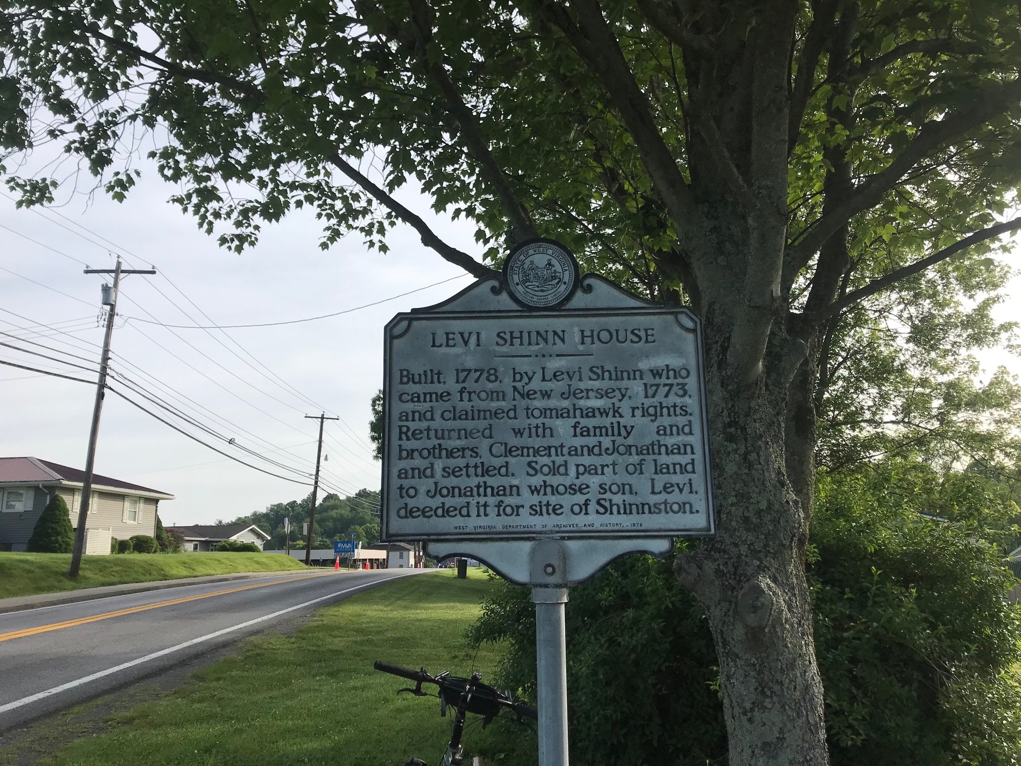
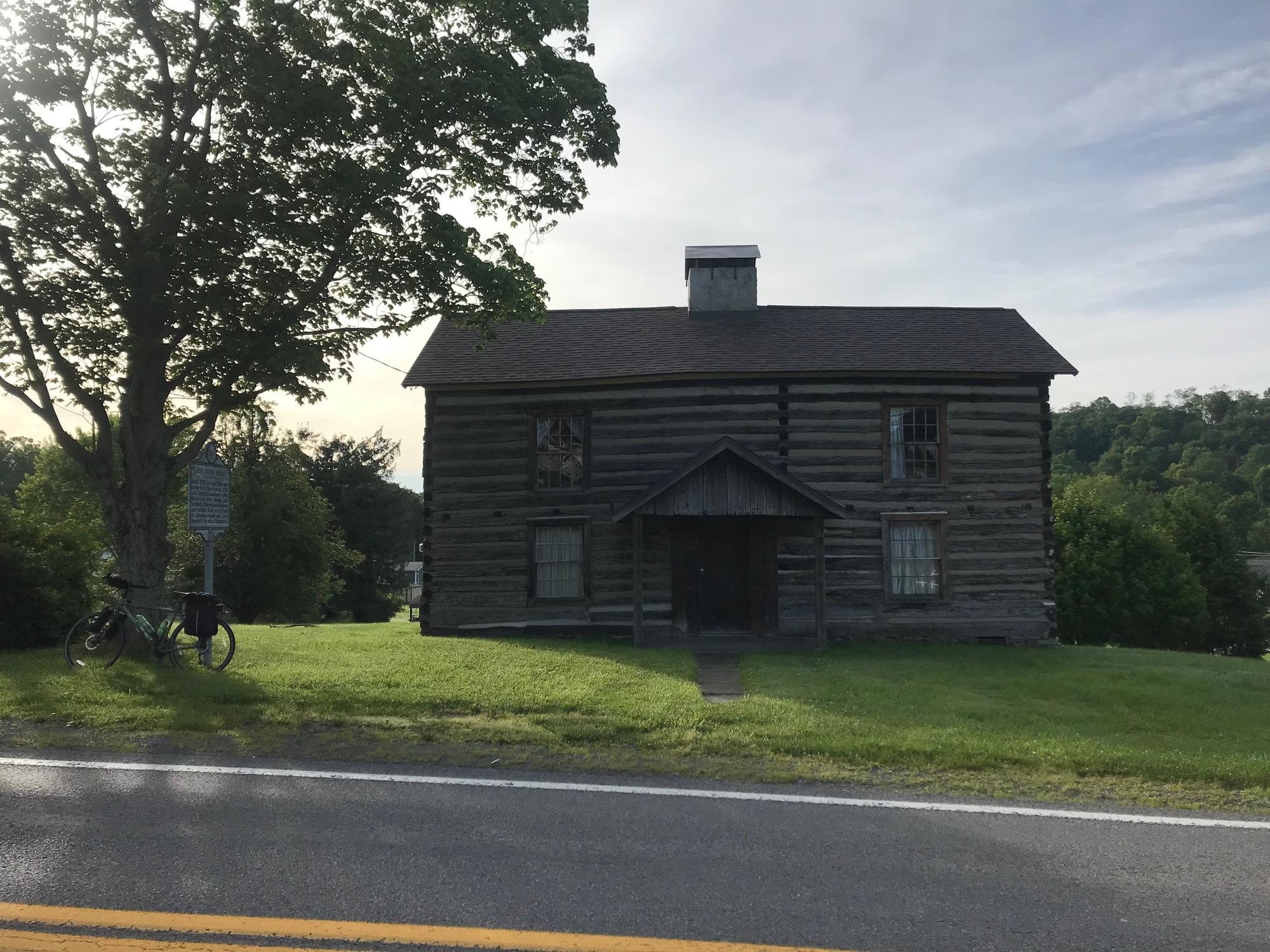
Shinnston was named for Levi Schinn, an early settler who helped found the town. I've been through here on several other occasions, nearly always by bicycle. There was (is) a Bed and Breakfast, called the Gillum House. It was run by an older couple, but I am not sure if it is still operating at this time. The bike shop on Pike Street has been there for a long time and has a decent reputation but I have never needed services when passing through, so I cannot confirm or deny.
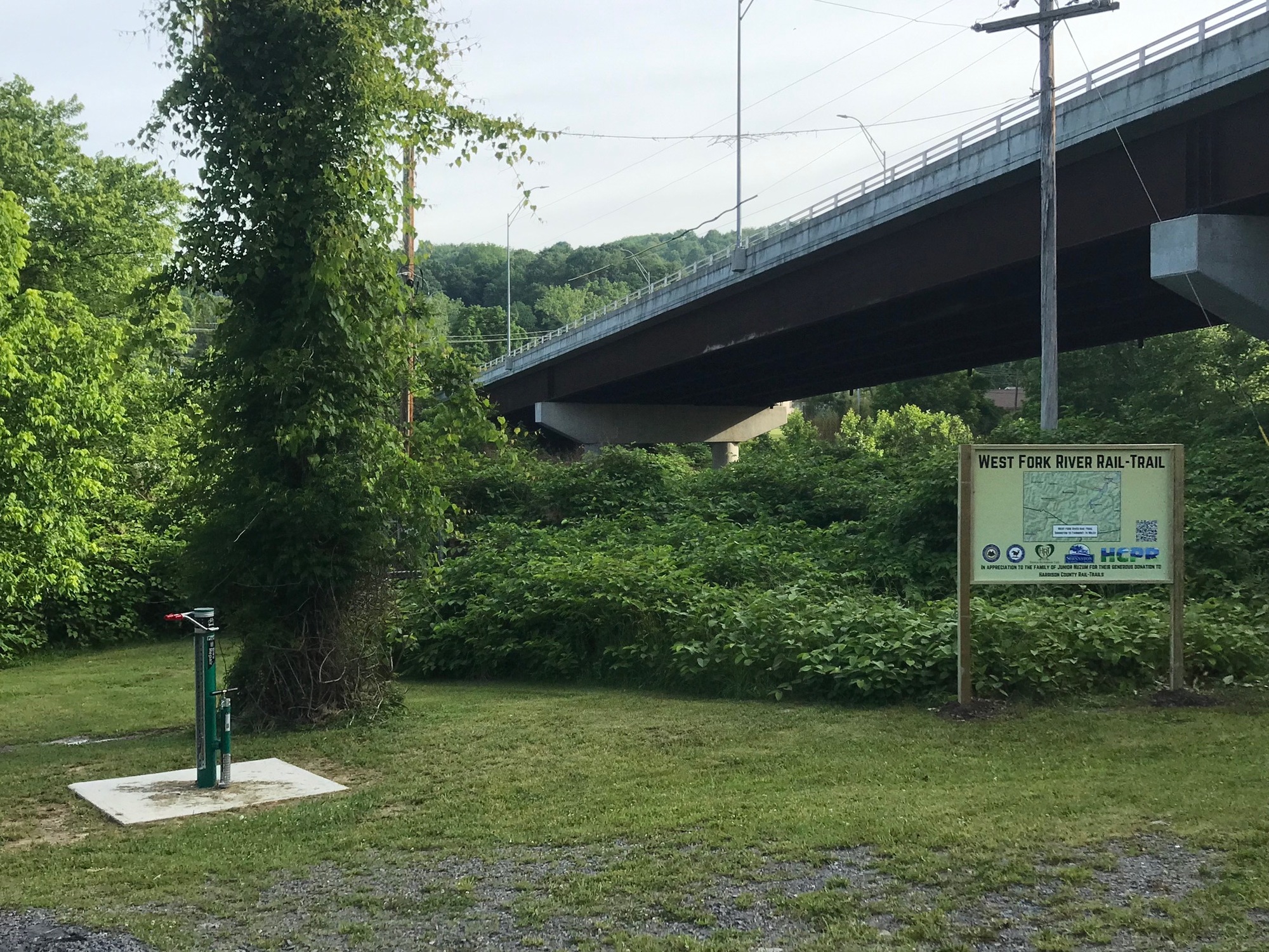
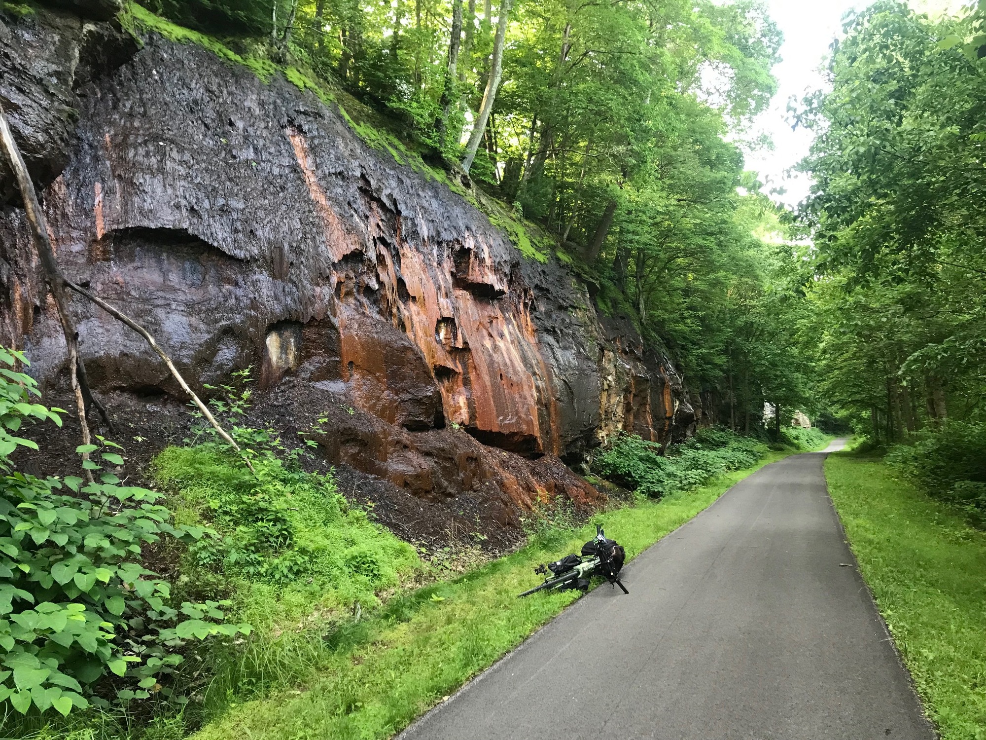
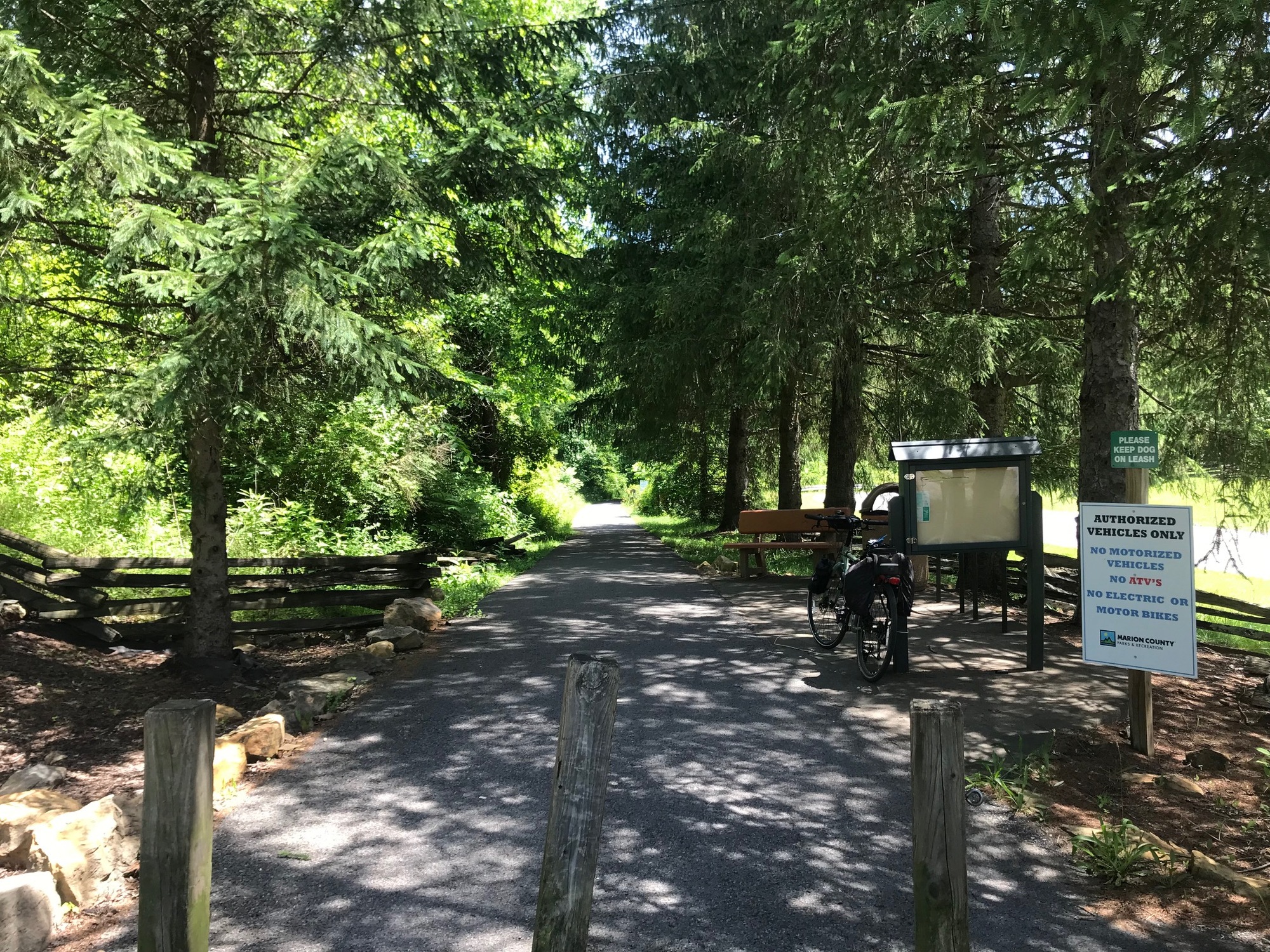
The trails system that leads into Shinnston has continued to improve over time. I can remember it being very rough, back ten years or so ago. When we came through in 2017, it had definitely been improved. Upon reaching it today, I found it to be paved through town and spruced up with plantings, signage, and a trailhead with a pavilion. The trail used to be called the Harrison County Trail but is now called the West Fork River Trail (WFRT). That makes sense because it follows the river of the same name and connects to the WFRT that runs all the way to Fairmont.

| Heart | 0 | Comment | 0 | Link |
For a long time, the trail heading South to Clarksburg was closed near Spelter, due to a toxic clean up project. Apparently, it is now open. I could have come that way, yesterday, had it not been so late. However, for me yesterday, coming into Clarksburg to reach the trail would have been difficult. It would have involved getting onto the narrow and high speed limited access highway (US-50) to cross the West Fork River. It is the only crossing in that area and it is a dangerous road for a bicycle, so I opted out. The only other way was a more Southerly approach to crossing the river. It would have added several more miles to my day. As you may remember, it was getting late and I was becoming fatigued by the time I reached Clarksburg. So, I chose the mad dash on Shinnston Pike. Had things been different, I could have taken the time to go South, cross the river, and find the trailhead in Clarksburg. Then, I could have ridden the WFRT to Shinnston, quietly passing through Hepzibah and Spelter along the way. I'm not complaining. The way the day went, I simply didn't have the time to go that route. I bring all of this up for anyone else who may have the time to take the WFRT instead of the road. It is simply a better way to go, if you're not getting there at the end of an already long day.
Back to the ride for today... The trail Northward from Shinnston passes on some back streets near the river before heading into the woods. When not paved, the trail surface was a fine grade of crushed stone, which made for a smooth and very pleasant ride. I enjoyed the ride exponentially more than what was afforded by the rough surface of the North Bend Trail. However, the great scenery on both trails effectively made the experiences a wash.

| Heart | 0 | Comment | 0 | Link |
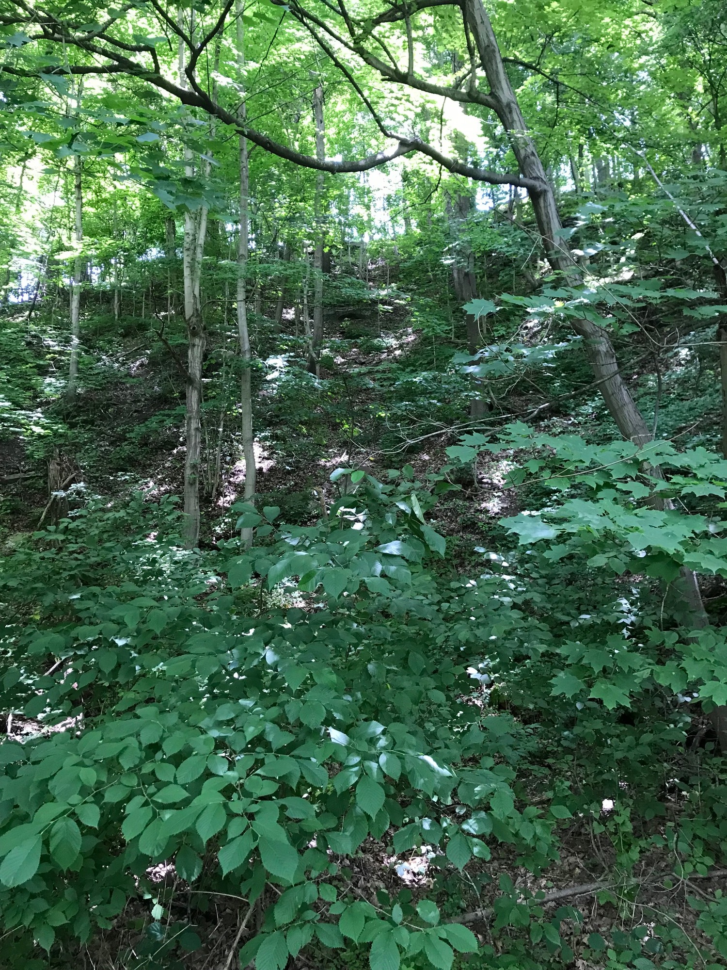
The WFRT continued through pleasantly green and wooded terrain. Very few other trail users were about. Small waterfalls came off the hillside rocks in spots. Deer and other smaller wildlife were running about. The birds were singing and wildflowers blooming. I was very impressed with the trail improvements made here in Harrison County.

| Heart | 0 | Comment | 2 | Link |
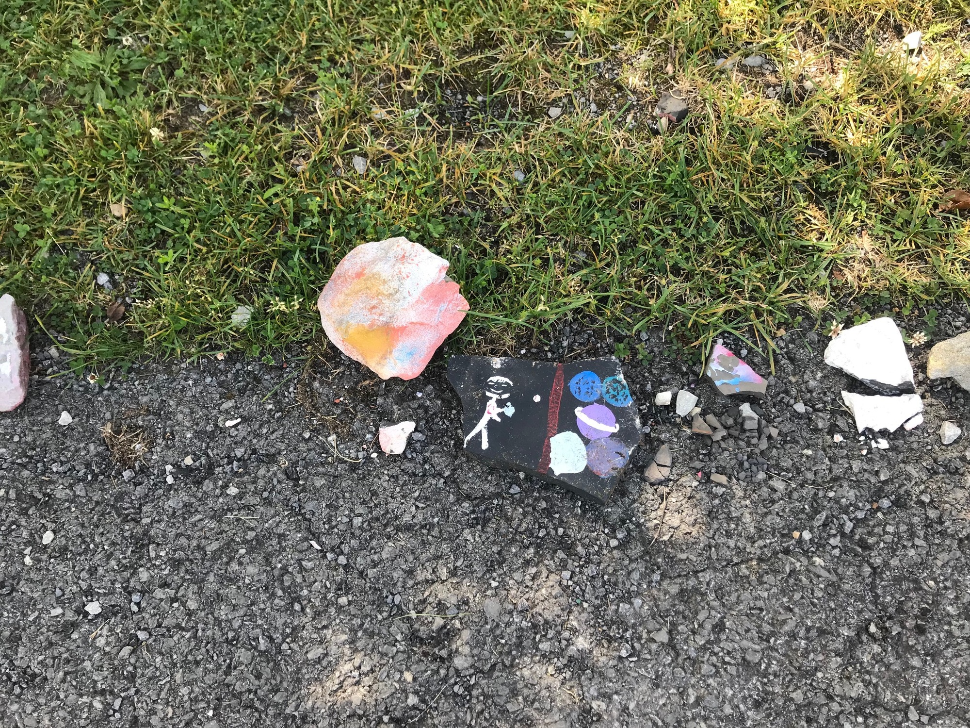
https://en.wikipedia.org/wiki/Asclepias
----->Bill
1 year ago
1 year ago
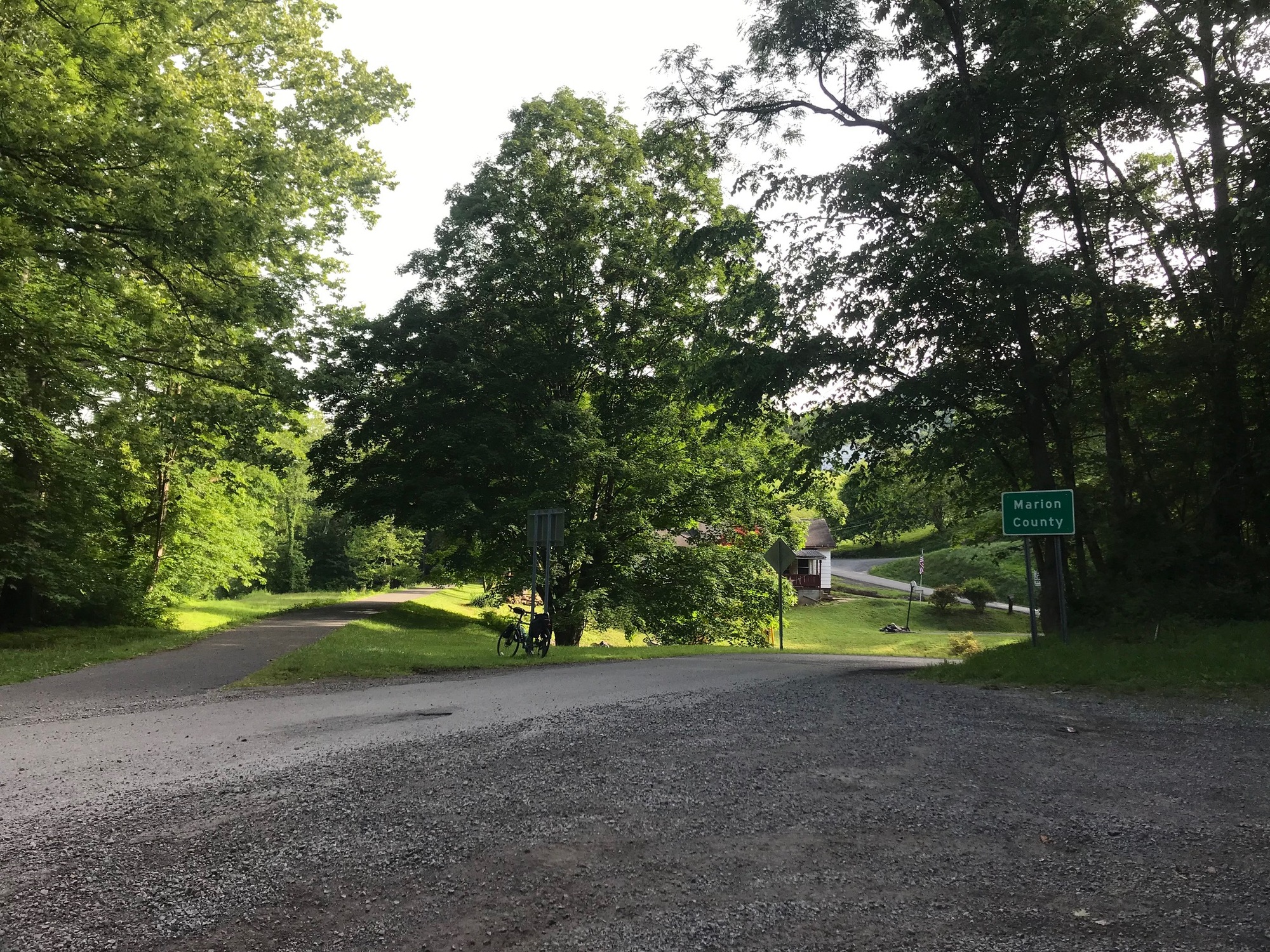
The trail entered Marion County, where the city of Fairmont is the Seat. The trail does not run continuously through Fairmont, so I knew there would be some road riding to connect back to the trail system. Four trails comprise the route between Shinnston and Morgantown. They are, the WFRT, the Marion County Trail, the Caperton (within Morgantown city limits) and the Mon River Trail (on either side of the Caperton). From the WFRT, I would need to get to the Marion County Trail, in the Northeastern part of Fairmont. But first, I needed to pass through Worthington and Monongah.
Worthington has a very nice park, through which the trail passes. The pleasant and peaceful wooded character continued all the way to Monongah. A theme for much of the day was to be on the trail and in a gorge with the river and steep rocky and wooded hills on either side. The woods were a lush green with the morning dew still on the leaves of the trees, plants, and grasses.

| Heart | 0 | Comment | 0 | Link |

| Heart | 0 | Comment | 0 | Link |

| Heart | 0 | Comment | 0 | Link |
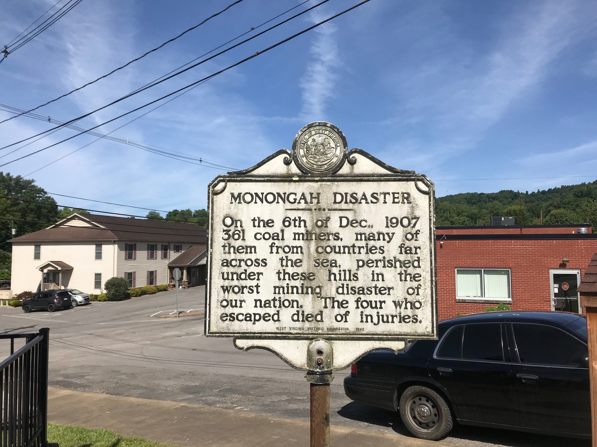
At Monongah, the trail enters the town and there is a trailhead with restroom facilities and a small park. A small sign said the trail was closed but since there were no barriers, I continued on. About a half mile later, there was a blue gate across the trail with a hand painted sign that said the trail was closed. No explanation was offered. I went around the gate for another half mile to find a huge landslide that completely blocked the trail. It was only about 3 miles to Fairmont but I could go no further.

| Heart | 0 | Comment | 0 | Link |
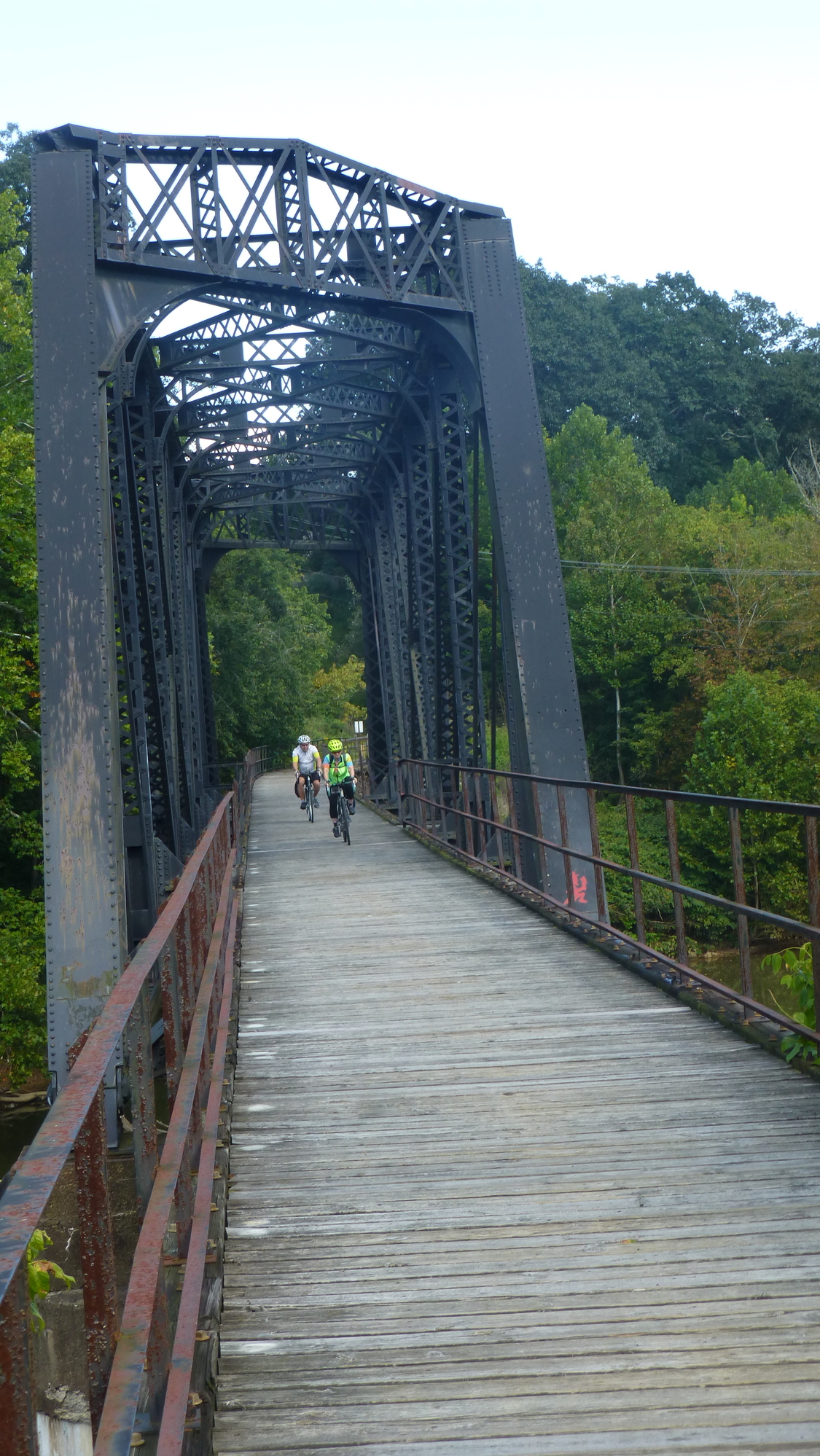
Back at the trailhead, I looked at a map and reconfigured my route. I would have to use roads through Monongah, to and through Fairmont, to reach the Marion County Trail. It ended up adding a couple of miles to my day but I got to see some areas that one does not see when the trails are completely open. I did miss the neat railroad bridge on the WFRT that is close to Fairmont. But I have a photo from 2017 (below) when we rode over it. Hopefully, the landslide will be cleared soon and the full ride on the trail can be experienced.

| Heart | 0 | Comment | 0 | Link |
Eventually, I got through Monongah on Old Monongah Road and took it into Fairmont where it met Mary Lou Retton Drive (MLRD). I didn't see anything other than the name of the road to give tribute to the gymnastics star and native daughter. MLRD merged onto US-250, the main drag in Fairmont.
| Heart | 0 | Comment | 0 | Link |
The Monongahela River has its origins near Fairmont. It flows Northward from there to Pittsburgh. At the Golden Triangle, it meets the Allegheny River to form the Ohio River. I crossed the Mighty Mon on a high bridge to enter the heart of Fairmont. From there, I was directed across town to where the Marion County Trail (MCT) began. It wasn't the easiest thing to find but two local guys got me pointed in the right direction and I was soon back in business.

| Heart | 0 | Comment | 0 | Link |

| Heart | 0 | Comment | 0 | Link |
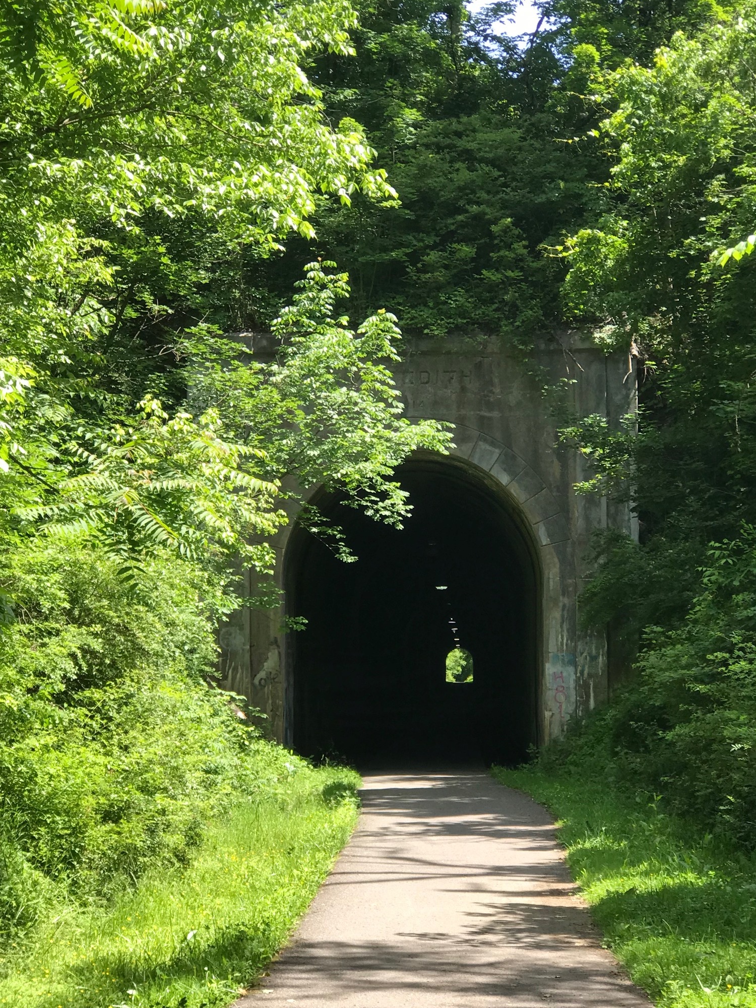
Within the first mile, the MCT passes through the lighted Meredith Tunnel. The tunnel is a straight shot and has lights on the ceiling. It appears to be in very good condition.
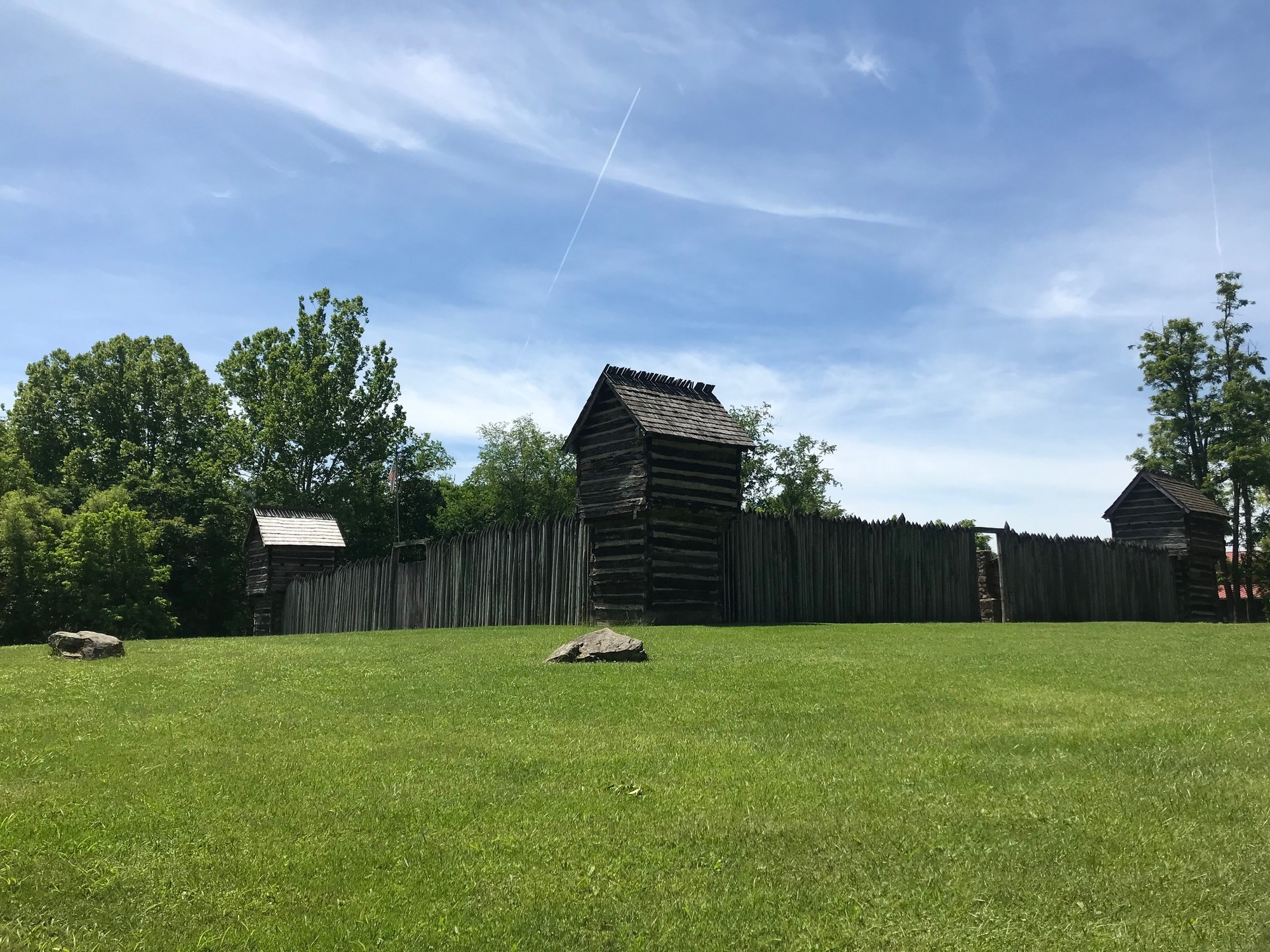
The MCT is relatively short but passes by Pickett's Fort, a former military outpost that has been preserved and is now a state park. Inside, visitors can see how the fort once operated, its historical significance, and get a flavor of what life was like back in the early history of this area.
Within about 3 miles, the MCT makes a curve to the right, crosses a stream, and becomes the Monongahela River Trail, aka the Mon River Trail. As the name suggests, it runs alongside the Monongahela. From this point, it was about 23 miles to my destination near the Ruby McQuain Amphitheater in Morgantown. As the crow files, it is only about 12 miles to Morgantown, but the trail follows the many bends in the river, effectively doubling the distance. Although I was anxious to get there, I made sure to take the time to check things out along the way.

| Heart | 0 | Comment | 0 | Link |

| Heart | 0 | Comment | 0 | Link |
Like the WFRT, the Mon River Trail follows the river through a beautiful wooded valley. Steep wooded hillsides make the setting rather remote at times. In those spots, it's simply you, your bike, the river, the trail and the woods... and maybe some wildlife too.
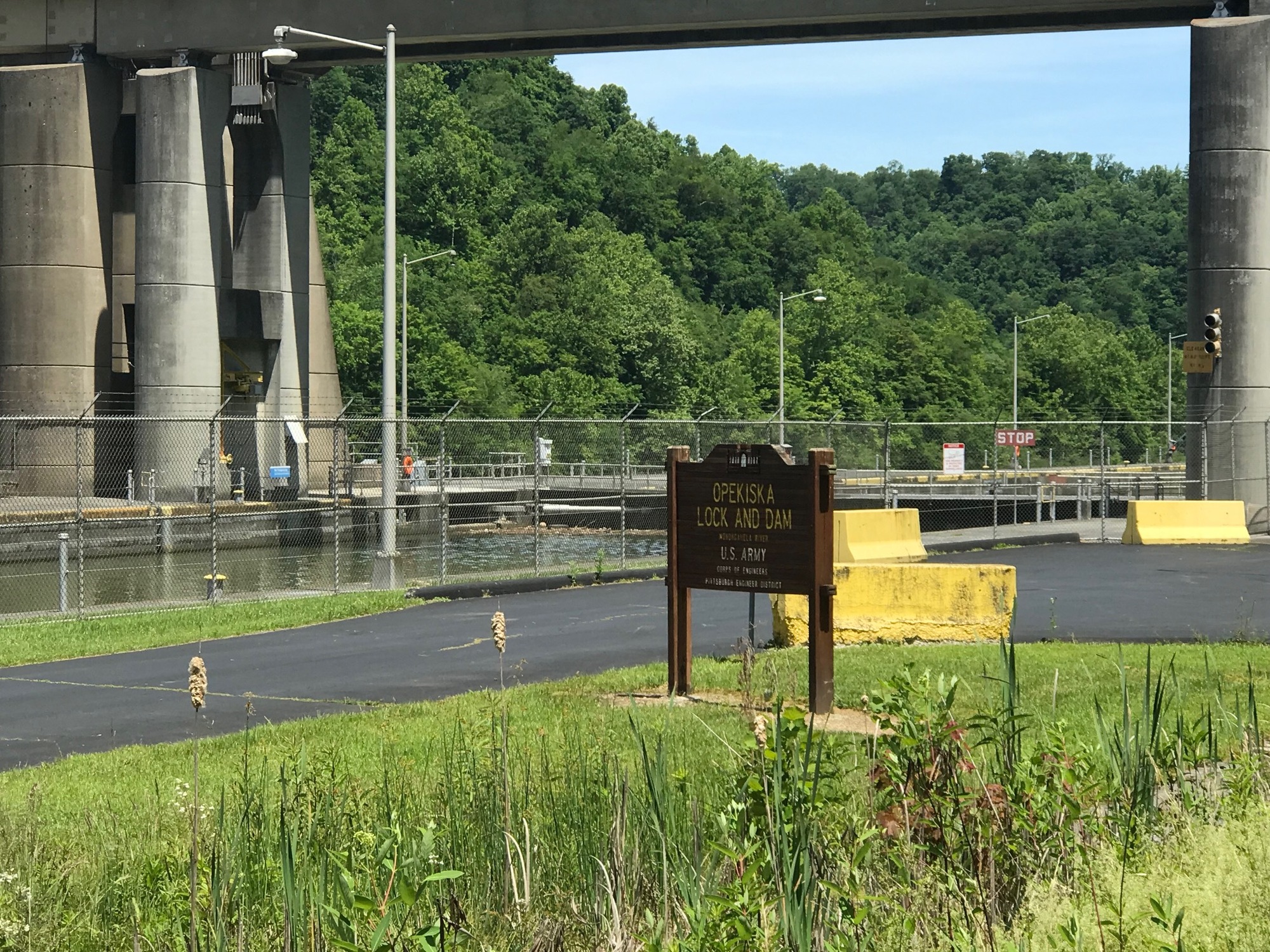
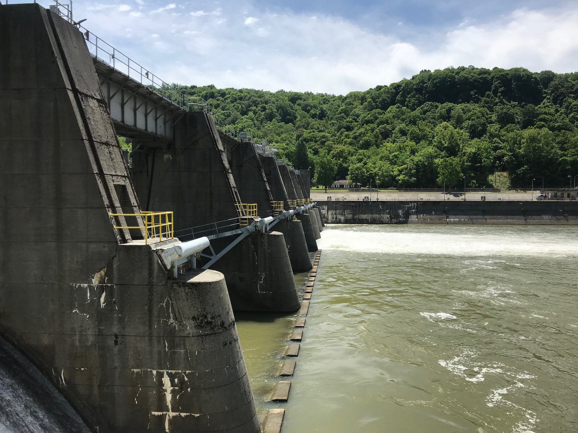
There are two huge lock and dam facilities on this stretch, the Opekiska and the Hildebrand. Both are impressive structures. With all of the recent heavy rains and slides, there was a tremendous amount of debris backed up at both complexes. The Opekiska had the larger accumulation on its downstream side. At the Hildebrand, a short path through the woods brings you right next to the dam.

| Heart | 0 | Comment | 0 | Link |

| Heart | 0 | Comment | 0 | Link |

| Heart | 0 | Comment | 0 | Link |
From the Hildebrand, it was about 14 miles to the finish. As one gets closer to Morgantown, there is more civilization and there are more trail users. The main campus of West Virginia University (WVU) is located there, which contributes to making it a relatively large city. However, there are still some peaceful and scenic areas to be enjoyed before reaching the city.

| Heart | 0 | Comment | 0 | Link |
At milepost 12, the crushed limestone trail surface becomes paved with asphalt and roughly marks the beginning of the Caperton Trail. It lies within Morgantown city limits and is named for a former Governor, Gaston Caperton. There are definitely more users and buildings when this point is reached. I was actually headed to the neighborhood between mileposts 8 and 9, so my trek was nearly done. Eventually, I reached the finish and met my wife, who I hadn't seen for a week. We went into the Mountain State Brewing Company establishment for a good meal, to catch up, and to spend a little time before heading home.

| Heart | 0 | Comment | 0 | Link |

| Heart | 0 | Comment | 0 | Link |

| Heart | 0 | Comment | 0 | Link |
This little leg of the larger adventure is now over. It was wonderful despite some of the weather adversity that came my way. I got a really good look at life in some very remote parts of the Mountaineer State and experienced some of its wonderful trails, as well. Since there is still more to see and experience, look for another installment of this tour to appear soon. Until we share the next segment of this tour, all the best to you.
Today's ride: 45 miles (72 km)
Total: 799 miles (1,286 km)
| Rate this entry's writing | Heart | 0 |
| Comment on this entry | Comment | 0 |