May 30, 2024
Overland to the North Bend Trail
Problem Solving and Staying On Task
There were three route options for getting to Parkersburg and none of them were acceptable. Brief descriptions of them are:
(1) Get a ride from innkeeper Charles, who was driving there at 11:00 am. I’d be there by Noon, which was about when I would have arrived, had I decided to ride there. But taking a ride would have been cheating, so I ruled it out, declining respectfully, of course.
(2) Take the Sistersville Ferry across the Ohio River to Fly (Ohio). Then ride OH-7 to either Marietta or Belpre. Cross a bridge from either place and end up back in West Virginia. But I did that before (1983) and since this journal is about biking in the Mountaineer State, not the Buckeye State, that option was disregarded. On the prior beautiful evening, I checked out the shoreline and the ferry seen in the photos posted below.

| Heart | 0 | Comment | 0 | Link |

| Heart | 0 | Comment | 0 | Link |

| Heart | 0 | Comment | 0 | Link |
(3) Ride the busy and shoulder-less WV-2 to Parkersburg. Well, I rode it for 1.5 miles and it was not a pleasant experience. Thirty-five miles of that dangerous nonsense was not going to happen. Too much traffic and nowhere for a vulnerable cyclist to avoid it. I stopped on the grass, checked out a map, and adjusted my route accordingly.
The executive decision was made to skip Parkersburg on this tour. I have ridden there before, on several occasions and I have written about it. Because I can reference it (and will do so, as an addendum to this chapter), there was no pressing reason to ride there on this trip.
Furthermore, since my goal was to get to the North Bend Rail Trail and see some more West Virginia backcountry, I got creative. It is possible to get to the trail via the network of backroads that exist. Once I found them on the map, these more inviting country roads were beckoning me and the decision to go that way was not that difficult to make after all.
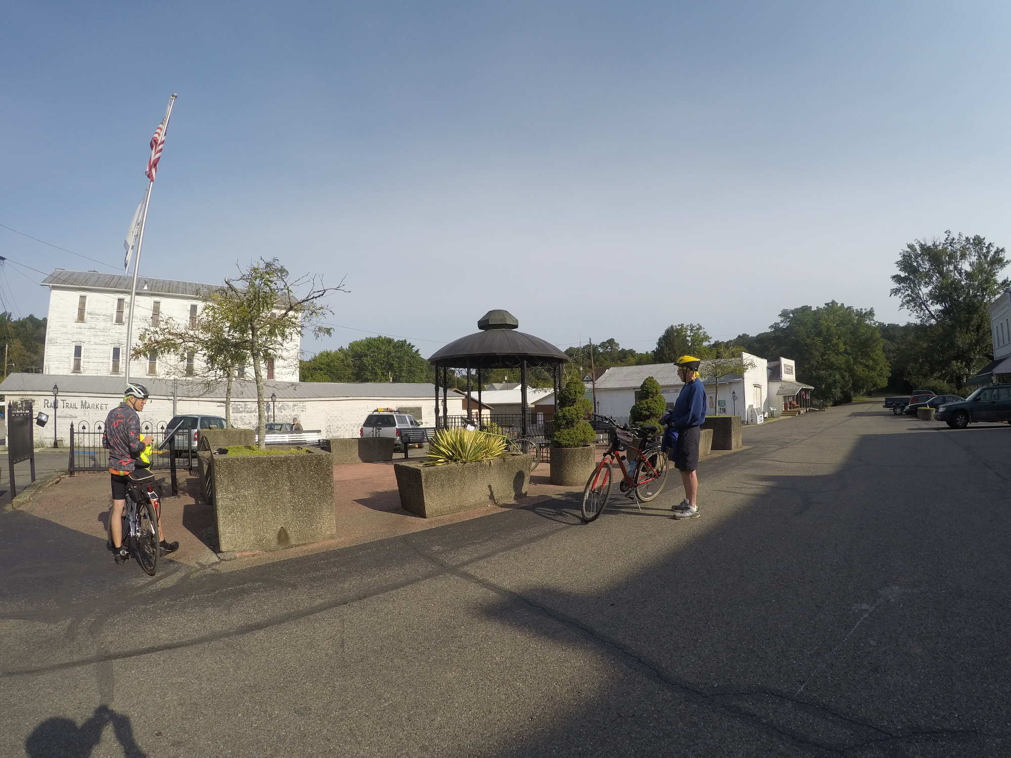
After talking (perhaps too long, but it was unseasonably cool this morning) to innkeepers Ann and Charles, I headed over to the Bankers Corner Cafe for breakfast. It is a neat place that is on the ground floor of a former bank building. Across the street, there is the Sistersville Museum. Both are wedge-shaped stone and brick structures, of the kind they don’t build much of anymore. Classic architecture. Since Sistersville went through an oil boom during its early history, there was some money in the town at one time.

| Heart | 0 | Comment | 0 | Link |

| Heart | 0 | Comment | 0 | Link |
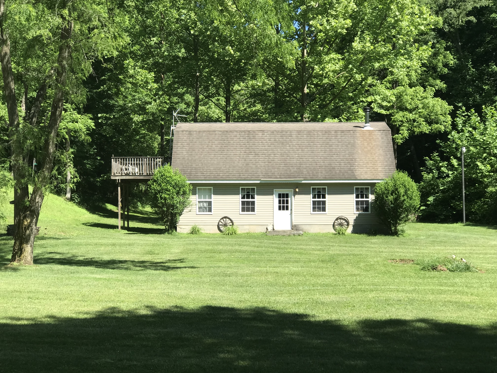
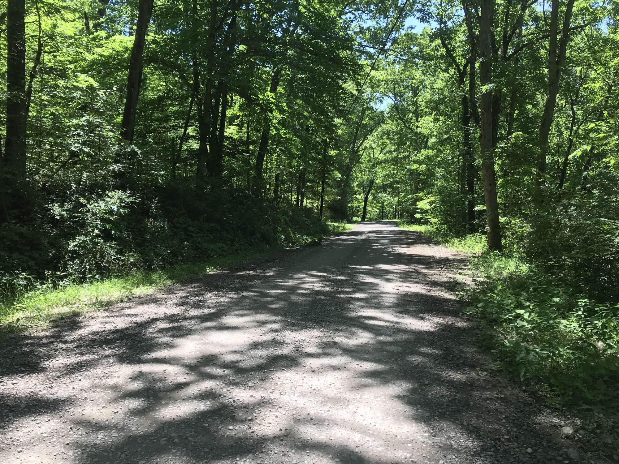
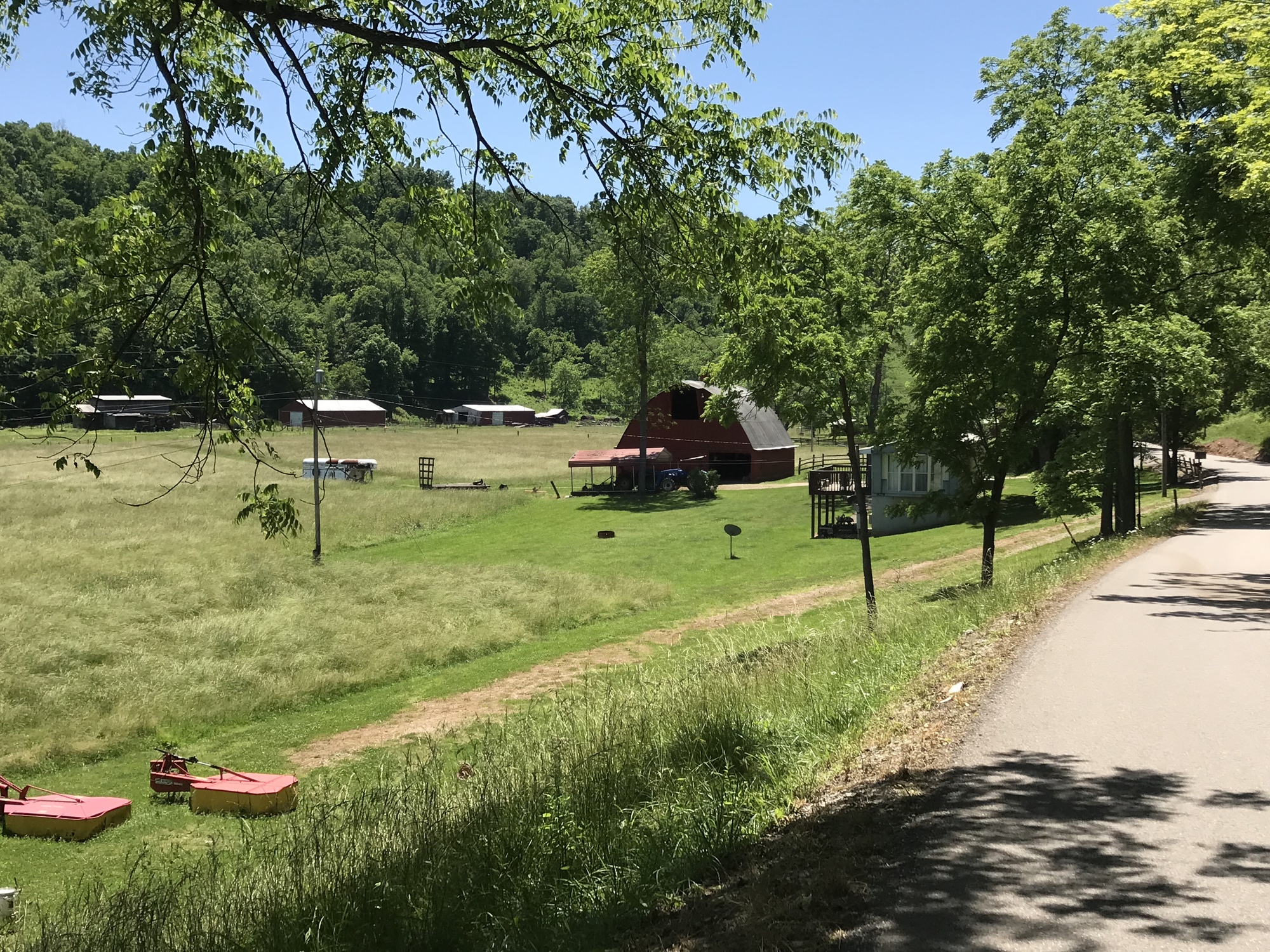
After my brief and unavoidable ride on SR-2, I was able to leave it and enter another world. When I turned onto Cow House Road (CHR), peace and tranquility began immediately. The motor vehicles vanished. The road ascended gradually, following the quietly flowing Cow Hollow Creek. This was a real hollow… a backroad with widely spaced houses along its course, shaded by tree covered hills on either side, and the kind of place most people don’t go unless they live there or know somebody who does. I knew I made the right decision very shortly after having turned.

| Heart | 0 | Comment | 0 | Link |
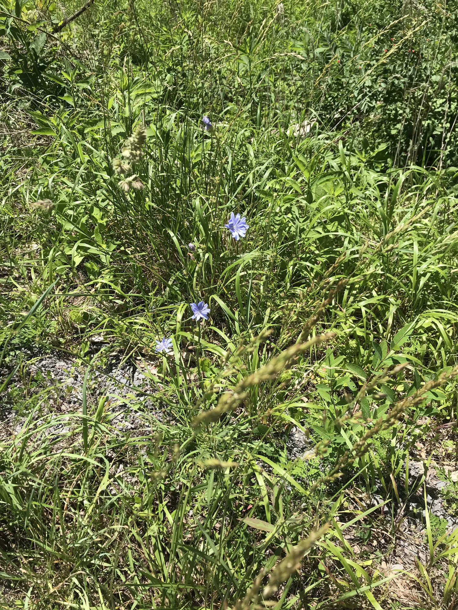
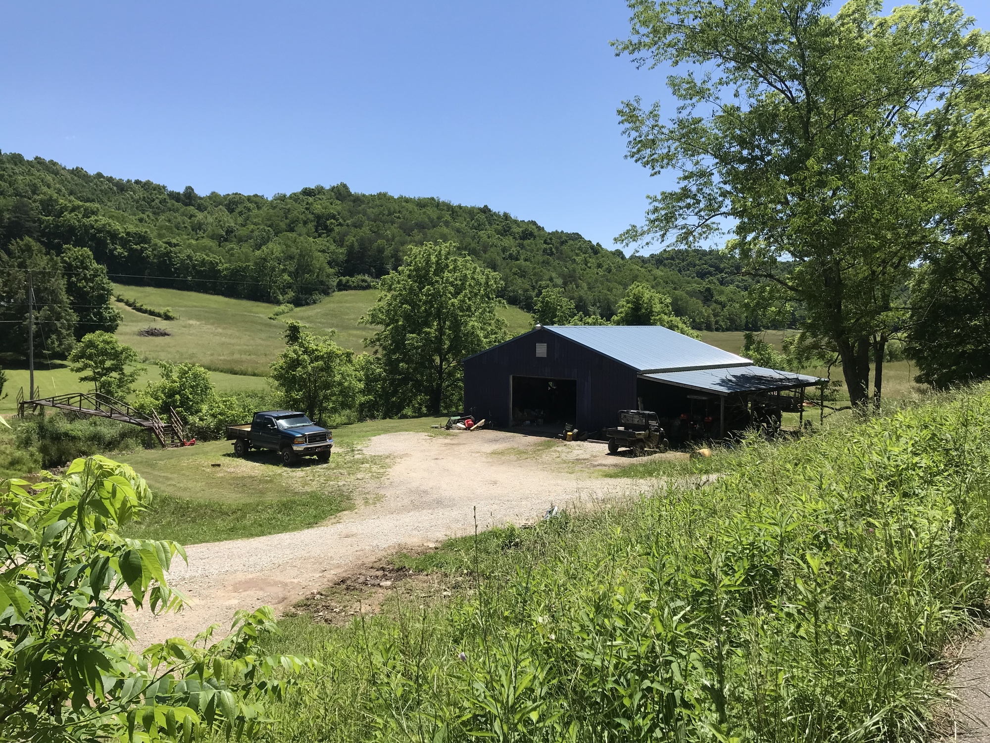
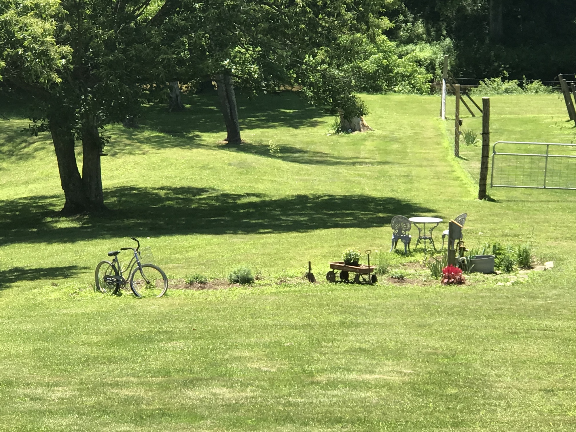
CHR went on for several miles. It climbed gradually and then descended similarly. This became the pattern of my day. The grades were gentler than those of the past few days. The road surfaces were mostly good. The sun was out, the sky was blue, and the temperatures were close to perfect. The few motorists and people working around their properties were friendly. The flora were abundant. The deer were there but not interested in hanging around to be photographed. There were long stretches of riding when absolutely no motor vehicles were around at all. I was taking my time and enjoying myself. The pictorial essay that follows will give the reader an idea of what this part of the ride was like.

| Heart | 0 | Comment | 0 | Link |

| Heart | 0 | Comment | 0 | Link |

| Heart | 0 | Comment | 0 | Link |

| Heart | 0 | Comment | 2 | Link |
1 year ago

| Heart | 0 | Comment | 0 | Link |

| Heart | 0 | Comment | 0 | Link |

| Heart | 0 | Comment | 0 | Link |

| Heart | 0 | Comment | 2 | Link |
https://www.inaturalist.org/taxa/48508-Pieridae/browse_photos?place_id=33
1 year ago
1 year ago

| Heart | 0 | Comment | 0 | Link |

| Heart | 0 | Comment | 0 | Link |

| Heart | 0 | Comment | 0 | Link |

| Heart | 0 | Comment | 0 | Link |
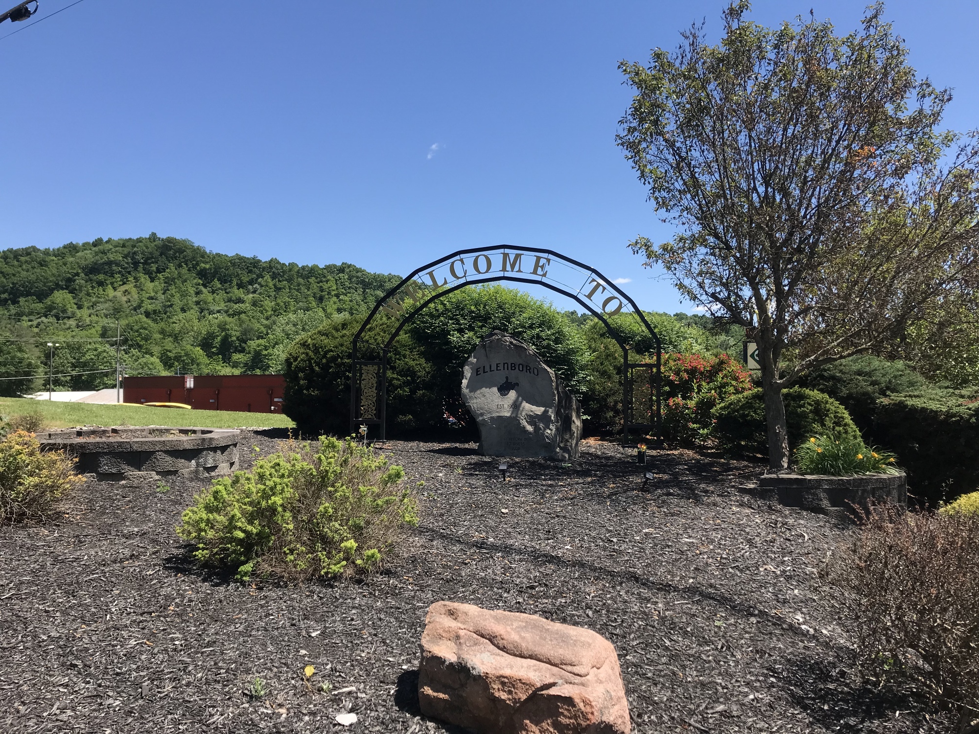
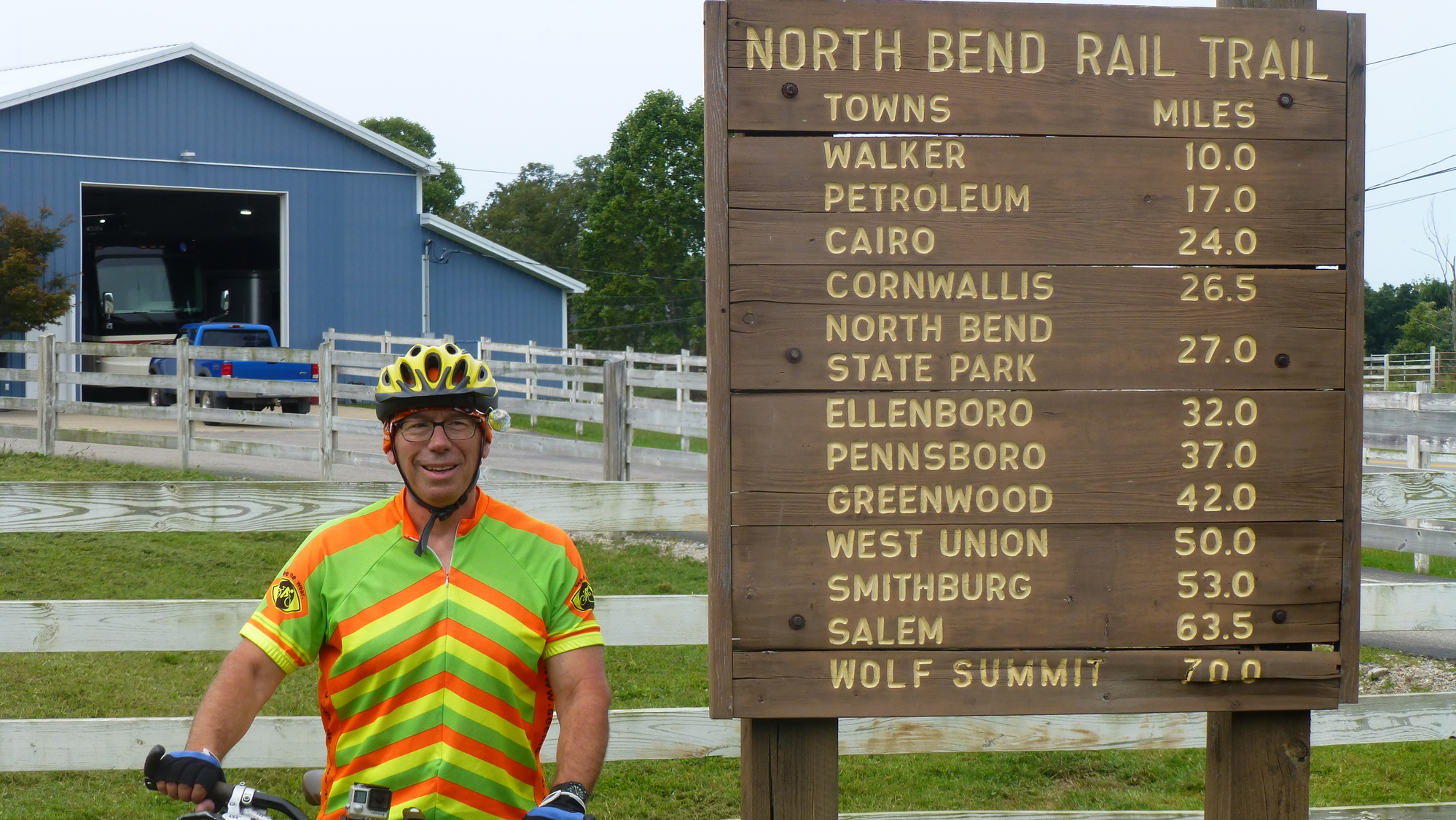
I made it to Ellenboro, which is a North Bend Trail town. After a break, I got onto the North Bend Trail (NBT) and headed West, to the state park with the same name. Actually, the entire 71-mile trail is part of the park but there is also a traditional park area with cabins, camping, a lodge, a pool, and many other amenities. I had a room reserved at the lodge. The park lies between the small towns of Cairo and Harrisville.

| Heart | 0 | Comment | 0 | Link |

| Heart | 0 | Comment | 0 | Link |

| Heart | 0 | Comment | 0 | Link |

| Heart | 0 | Comment | 0 | Link |

| Heart | 0 | Comment | 0 | Link |

| Heart | 0 | Comment | 0 | Link |
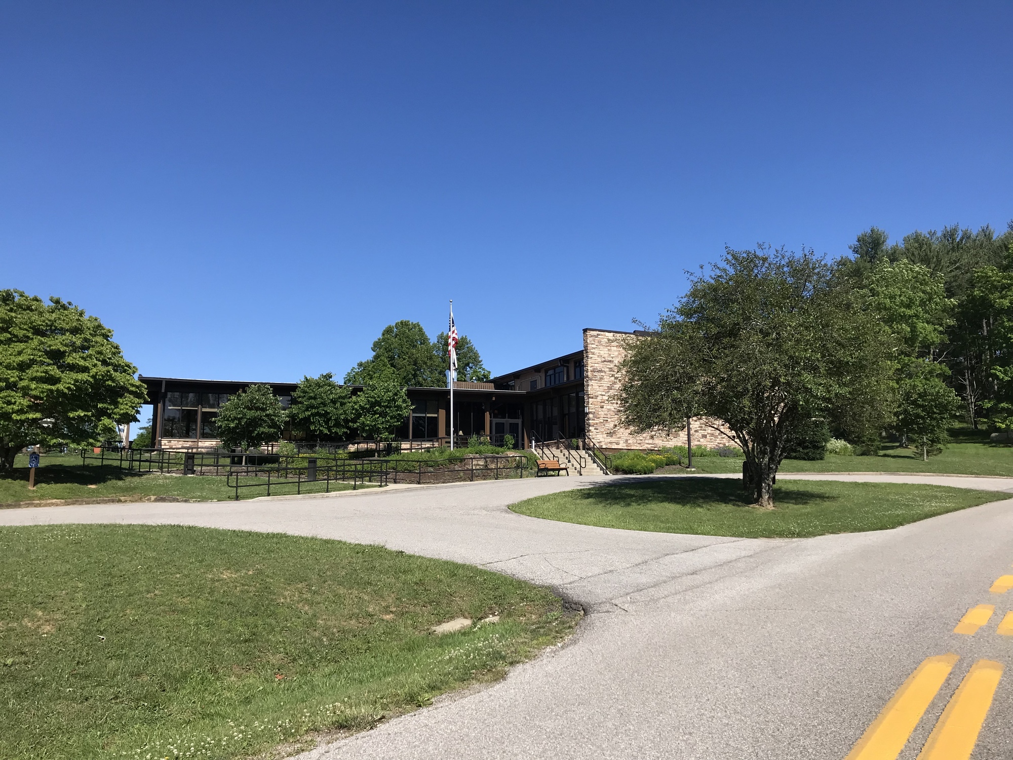
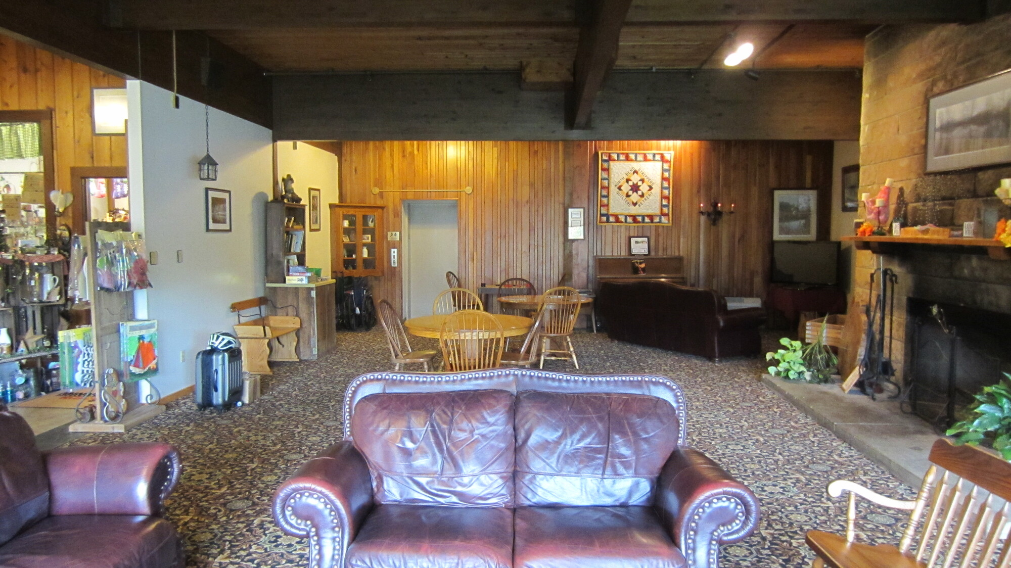
I have been to the lodge and have stayed there on several occasions. While it was always nice, its current condition is a significant upgrade over what I observed in the past. West Virginia has stepped up its tourism game in the past couple of years. The design, decor, food, and service at the lodge make that quite evident. I had a very good dinner at the restaurant at the lodge. The lodge is a classy place with great staff and service. It’s also very reasonably priced. You get 5-star treatment on a 3-star budget. There aren't too many places like that around anymore.

| Heart | 0 | Comment | 0 | Link |

| Heart | 0 | Comment | 0 | Link |
Tomorrow, I’ll be riding the NBT to its Eastern Terminus, in Wolf Summit. The North Bend Trail will be discussed more thoroughly in the next chapter.
Addendum-Riding the Western portion of the NBT, From Milepost 29 to Milepost Zero and then to Parkersburg via Roads.
Back in 2017, I rode the entire North Bend Trail, with a group, as part of a segmented cross country (USA) tour. Here is a paraphrased excerpt from that journal:
Monday, September 11, 2017 - 35 Miles
On this day, we would reach the end of the North Bend Trail and would then have no choice but to ride roads. But, we still had about 29 more miles of trail to enjoy!
I think this morning was actually the coldest and, we had another cold downhill run to start off the ride! Who planned this trip anyway? But first, we had a very good breakfast at the North Bend Lodge before departing.
| Heart | 0 | Comment | 0 | Link |
I have to give credit where due. The North Bend State Park Lodge and Dining Room are excellent. I've stayed and eaten there several times and have always had a quality experience. The hallways in the lodge are huge. You could ride a bike down them.
I led everyone on a cold ride back down to the Cornwallis Bridge (which is the other road that leads from the trail up to the lodge, found approximately at MP 28.5) along the trail. We turned left to go west. The sun was already warming things up a bit. This part of the trail, from the State Park to Parkersburg is in much better condition than the rest of the trail to the East. Thankfully, my rear end was not in as bad of shape as I had feared late yesterday.
| Heart | 0 | Comment | 0 | Link |
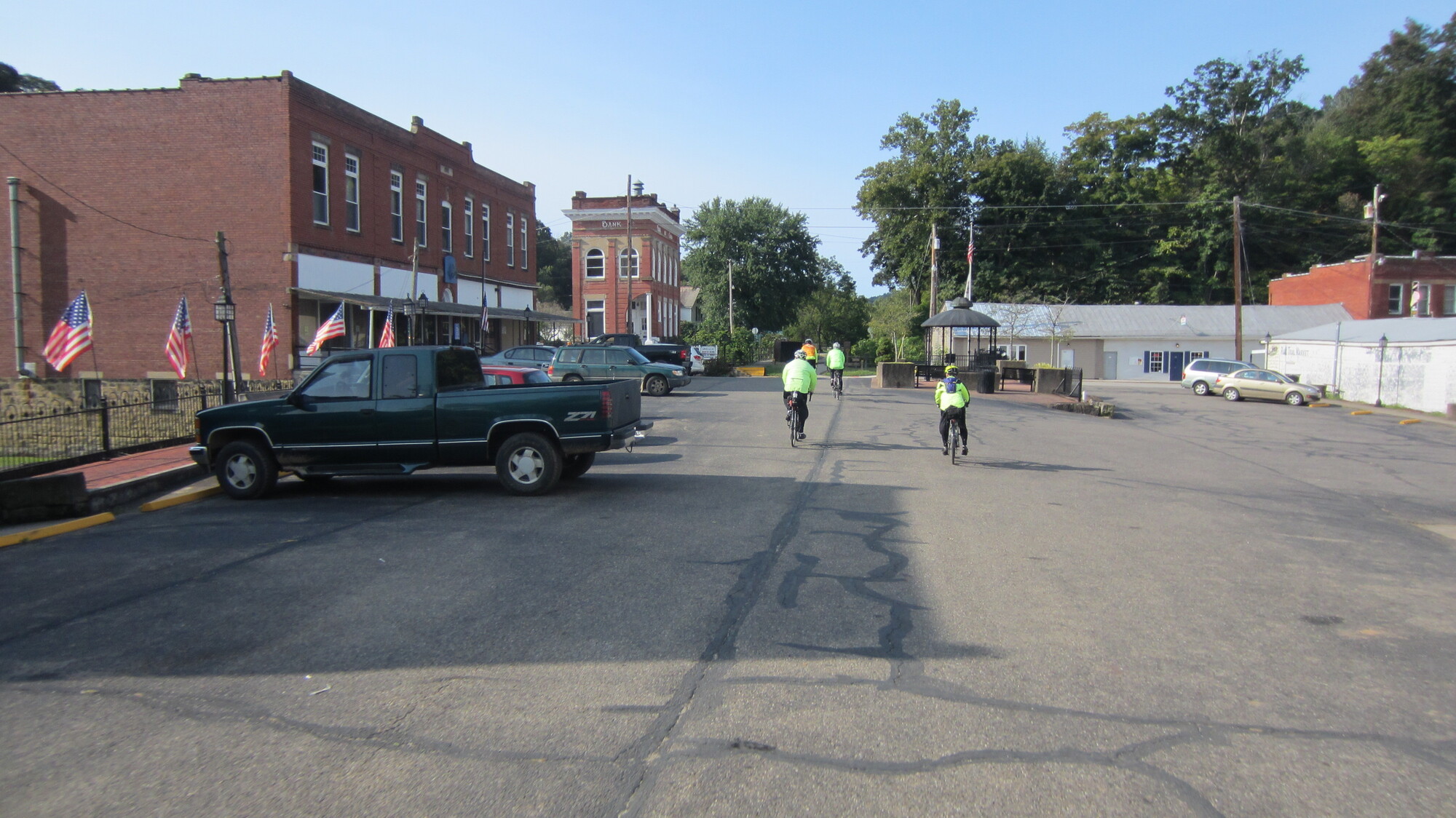
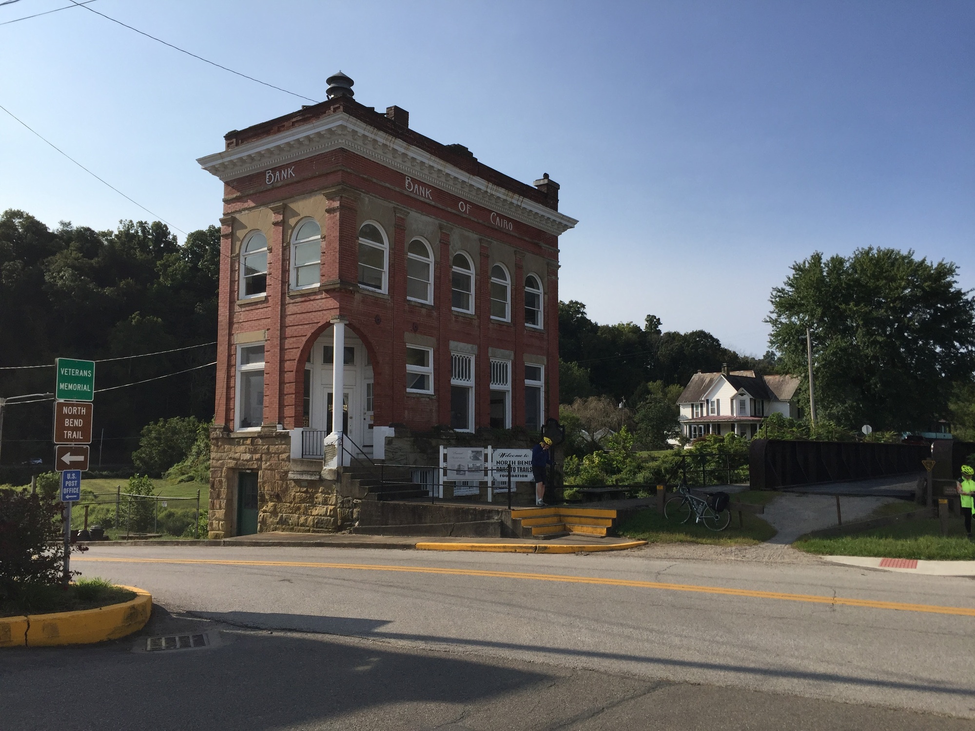
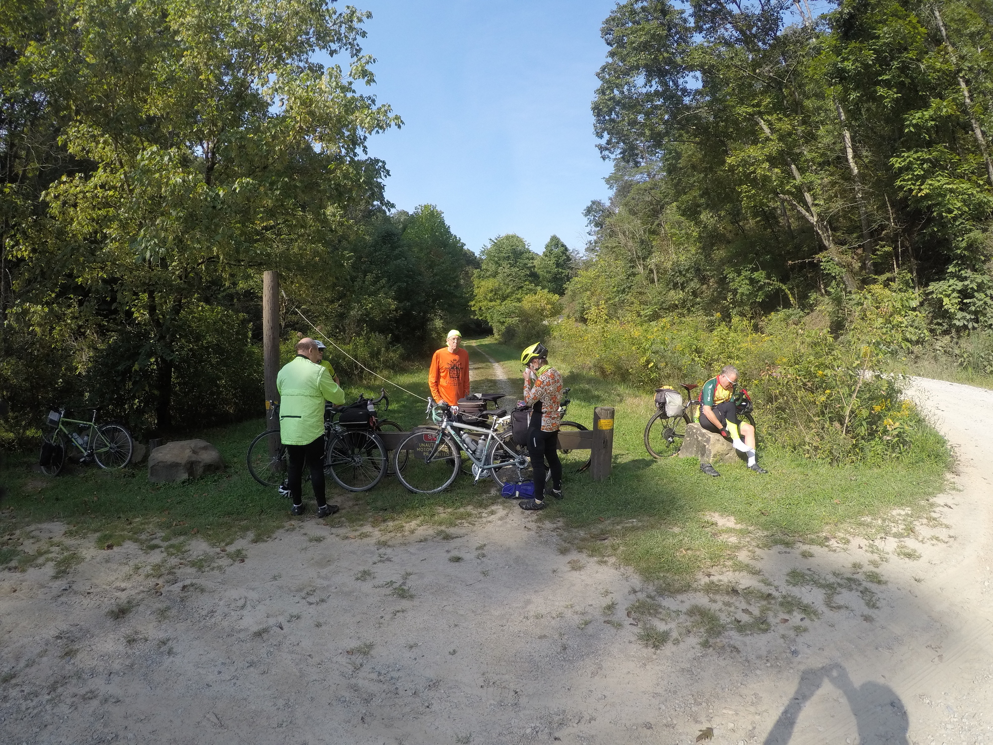
Within 2-3 miles, we reached the town of Cairo. It has a historic bank building (also the trail association headquarters), and some services for townspeople and passersby. A few photos below show our approach and arrival to Cairo, at milepost 25.
| Heart | 0 | Comment | 0 | Link |
| Heart | 0 | Comment | 0 | Link |
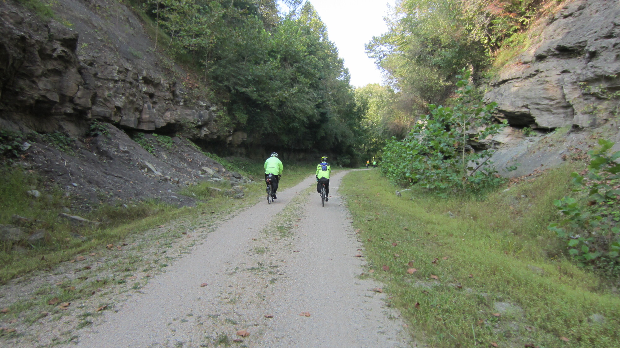
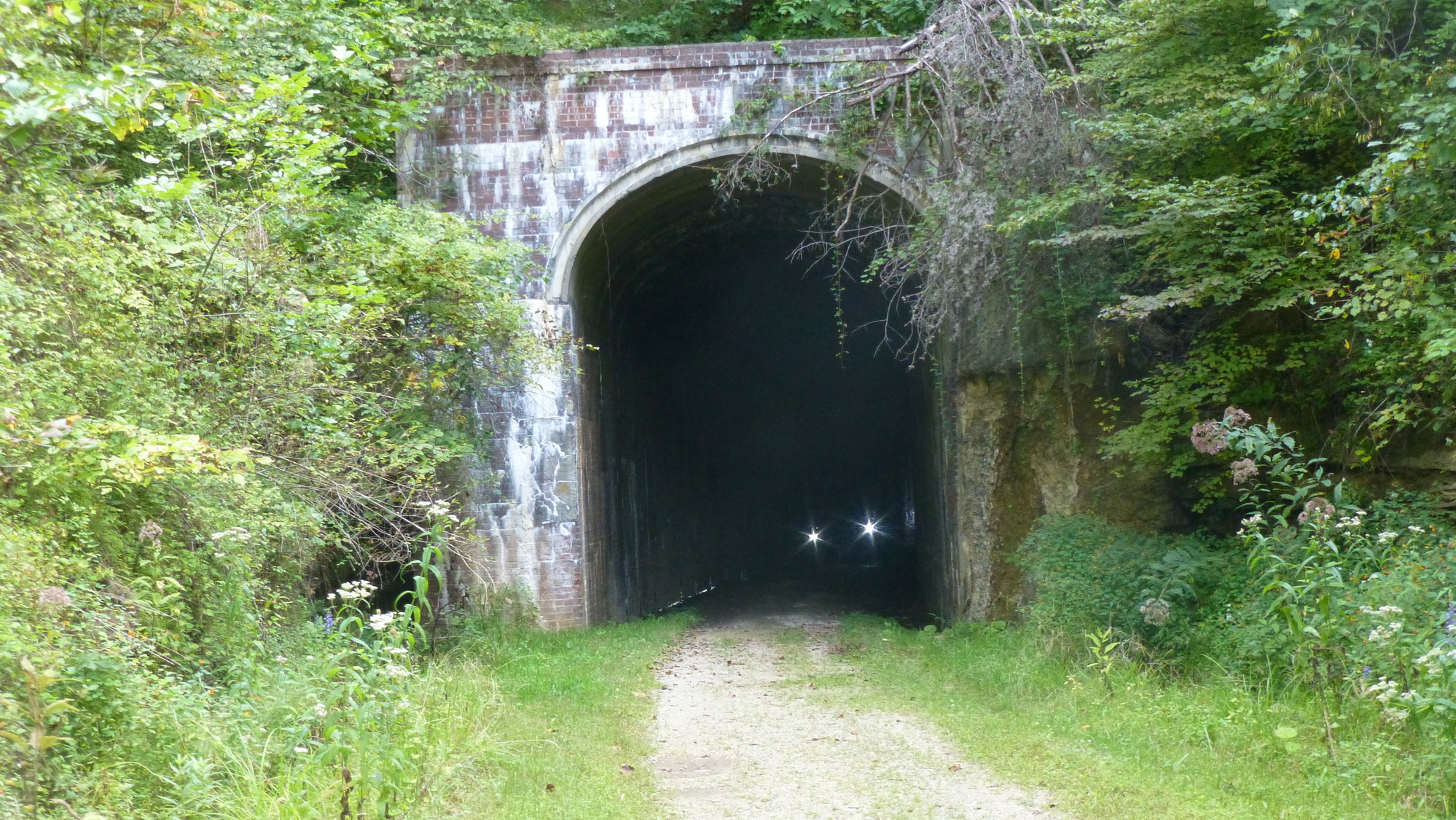
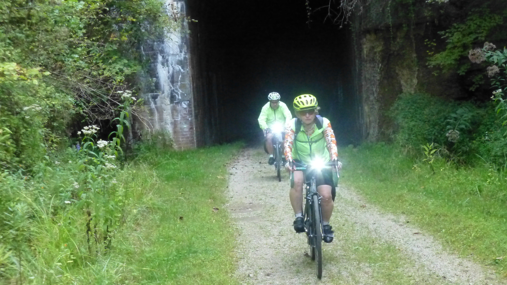
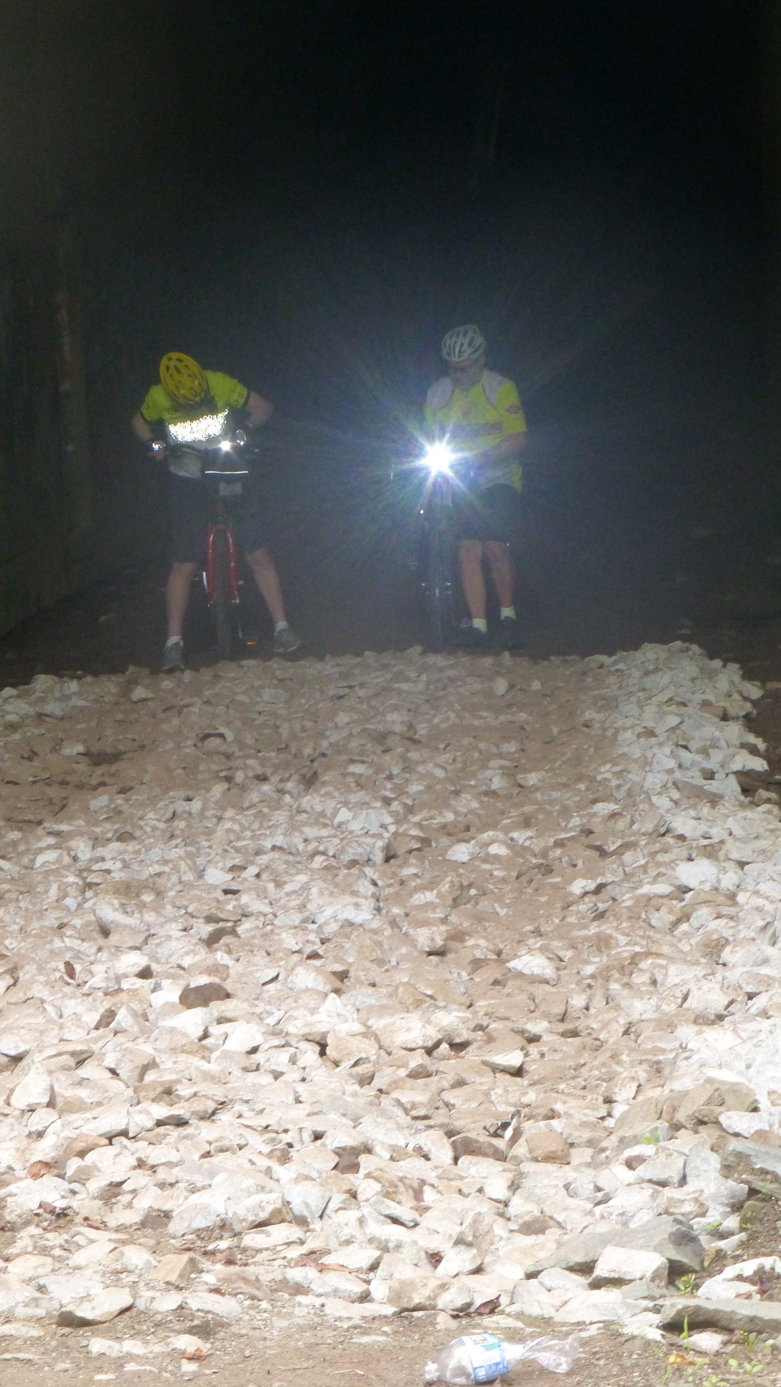
A few miles West of Cairo, it was becoming a lot warmer so we stopped again to shed some layers. The Silver Run Tunnel came along shortly thereafter. The supposedly haunted Silver Run Tunnel is different from all the rest in that its interior is lined with all brick. This is my favorite tunnel, on the NBT, despite the rough surface inside.
| Heart | 0 | Comment | 0 | Link |
| Heart | 0 | Comment | 0 | Link |
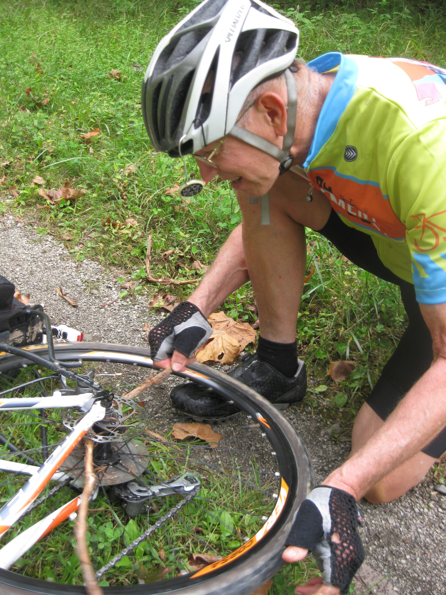
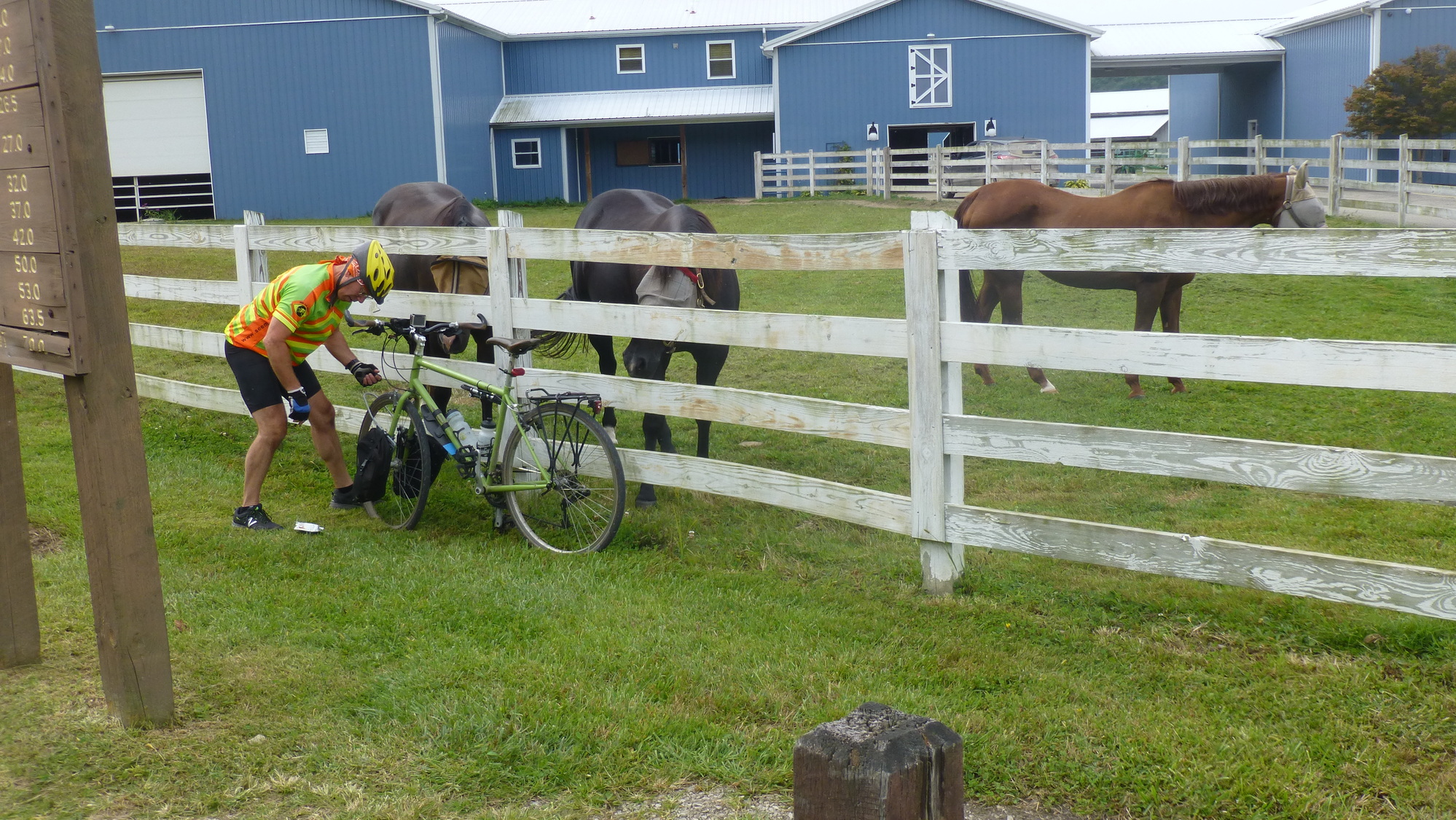
Somewhere along the trail, Fred did a little improvised maintenance to keep his bike running optimally, after a vine wrapped itself in his wheel. Stan captured the moment "on film." Fred is the kind of guy, always helping someone out and coming up with little ingenuities that help the trip along. He is a valuable team member.
| Heart | 0 | Comment | 0 | Link |
We rolled along well on the NBT that morning. Gone were most of the poor trail surface conditions we had experienced yesterday. The last tunnel I remember seeing was #21, called the Eaton Tunnel, at milepost 14. There were other oddities, such as Goose Creek, which we seemed to cross several times, each requiring a bridge to have been built way back when. The work required to build a railroad is incredible, especially for the time period when it was done. The construction of the NBT is remarkable.
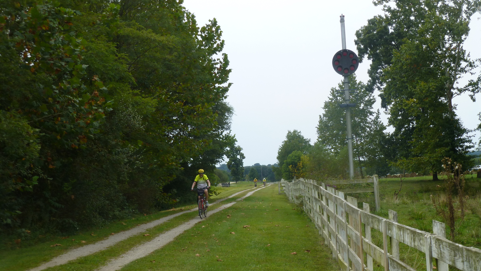
Soon we were approaching the outskirts of Parkersburg and a place known as Happy Valley on the trail signpost. A very distinctive horse farm began, shortly after having passed the 2-mile marker. The property was fenced-off, for at least a mile and a half by a very well-built split rail fence. When we reached Happy Valley, the horse barn was close by and 3 beautiful horses ran up to where we were standing. They know the drill... these bicyclists have food to share. A few photos below show the horse farm passing by as we rode on the trail.
| Heart | 0 | Comment | 0 | Link |
| Heart | 0 | Comment | 0 | Link |
| Heart | 0 | Comment | 0 | Link |
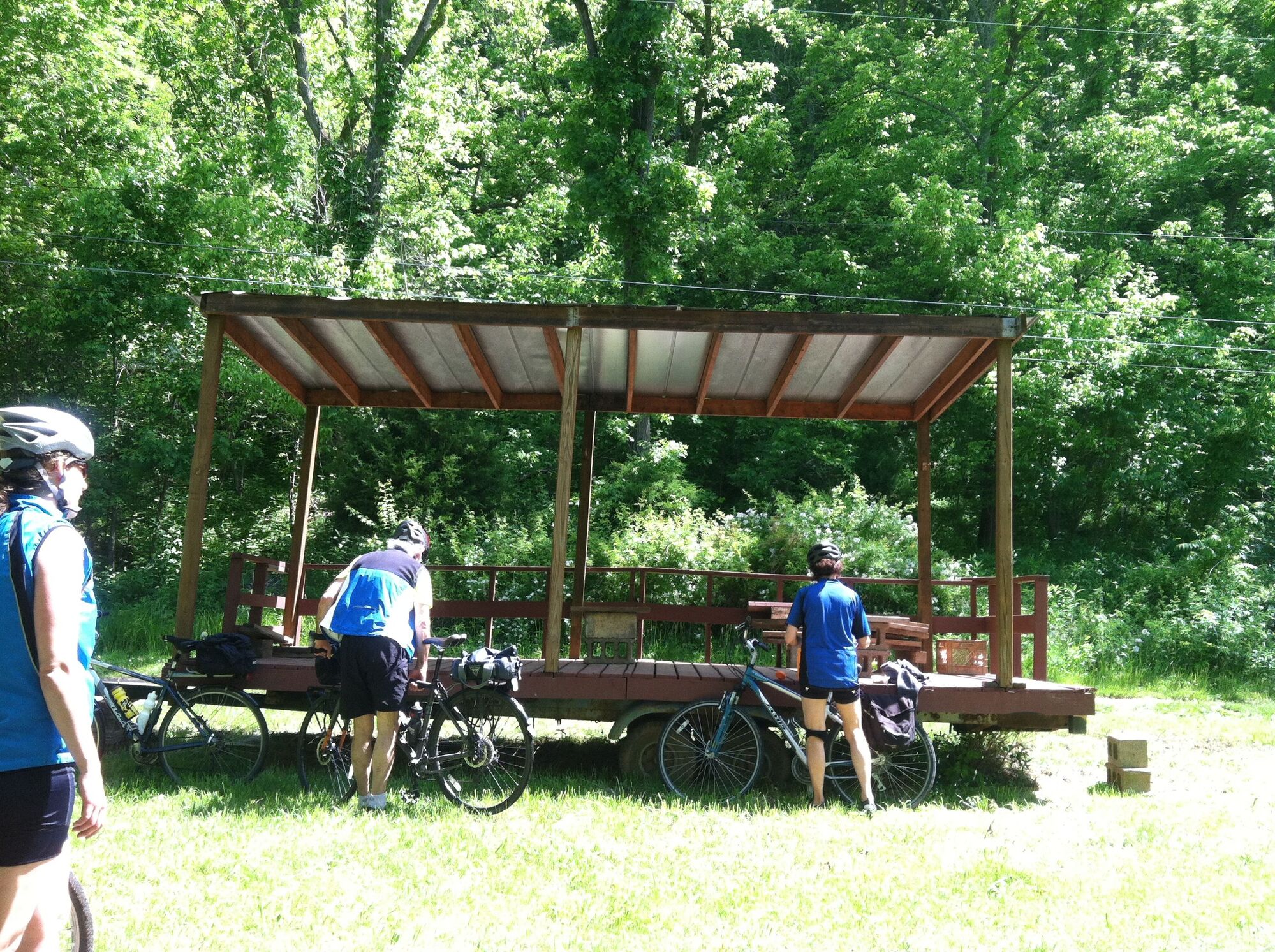
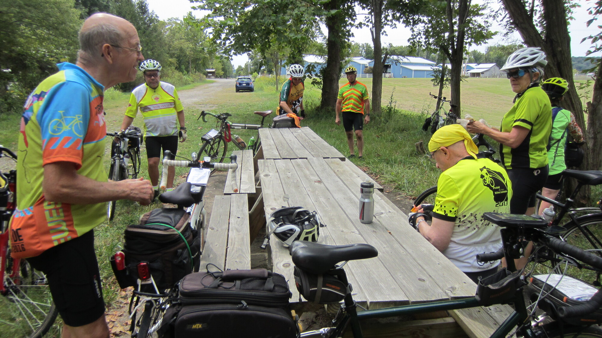
We took a break at some picnic tables adjacent to the trailhead parking lot but moved on in short order. There was another mile and a half of unimproved trail, which could be carefully ridden, back in 2017. It does skirt the edge of an unprotected cliff that drops off sharply. It also comes to an abrupt end at what is likely private property. We had to walk our bikes along the perimeter of the properties of a storage facility and a cluster of townhouses to reach Staunton Avenue (WV-47). The trails had ended for now and our bicycle tour would be transitioning to roads.
Fast forwarding to today (2024), I would offer three pieces of advice:
(1) Avoid the unimproved trail. If nothing has been done since 2017, it has likely become more dangerous. That cliff edge was precarious in 2017. Further erosion could make it deadly.
(2) Since the unimproved section finishes on private property and since people's fuses have become shorter these days, you could have a problem when you exit the woods. It is not recommended that anyone use the unimproved section of the NBT in this area.
(3) Take the roads from Happy Valley to Staunton Avenue (WV-47). Although there is a hill (Happy Valley Road), it beats the possible negative consequences described in (1) and (2). My buddy Stan and I rode the hill on one occasion. It is a typical hill with a bit of a grunt needed to reach the top. But it is not impossible, especially if you ride any roads at all on a typical bicycle tour.
| Heart | 0 | Comment | 0 | Link |
Our ride on WV-47 was about 5 miles long. The traffic was intermittent and the drivers were mostly courteous to us. There is one red pick-up that passed me "kinda" close. But that seems to be standard fare anywhere.
Our meeting point was the Go Mart, across from the Gary's Always Hot establishment at 1416 Staunton Avenue, Parkersburg. The video I shot of a portion of the ride on WV-47, as we passed under US-50 was uploaded to "You Tube" and is presented for your review.

| Heart | 0 | Comment | 0 | Link |
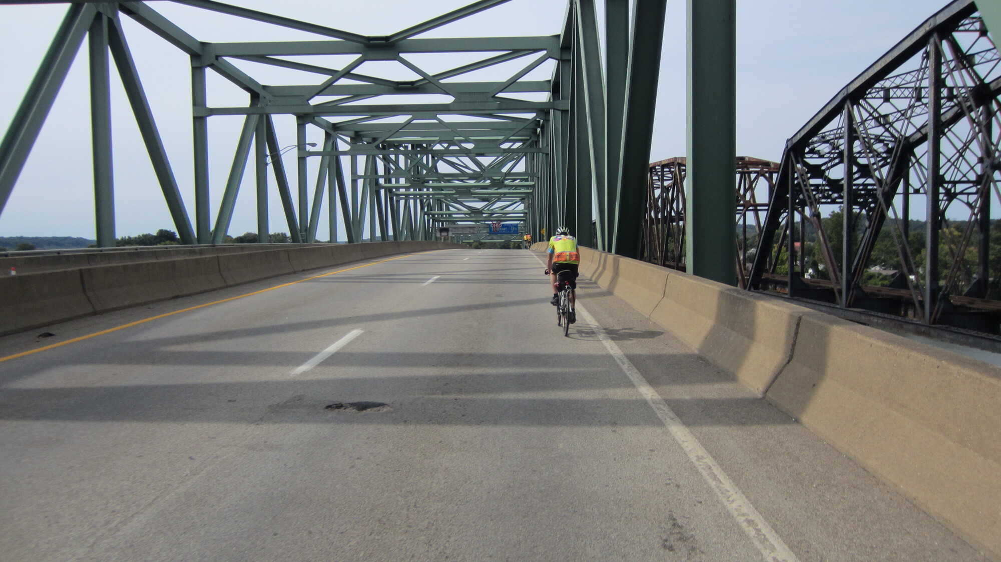
We were shortly off Staunton Avenue and onto some back streets of Parkersburg. They eventually led us onto WV-618 which crossed the Parkersburg (WV) - Belpre (OH) Bridge and we entered Ohio!
In summary, if you decide to ride the whole trail, you will ride from/to Happy Valley ( a "suburb" of Parkersburg) to/from Wolf Summit (as far east as you can go) or vice-versa. The total trail mileage is 71. The section west from the state park (MP 29) to Parkersburg is quite scenic and well worth taking the trouble to see. It covers approximately 35 miles. As the city is approached, the trail surroundings will become less remote with more homesteads but certainly not at all urban or suburban. WVU has a Parkersburg Branch Campus near where the trail crosses I-77. The city itself has most services a traveler could want. Belpre, Ohio is across the river and also has services.
| Heart | 0 | Comment | 0 | Link |
As an aside, when I rode on the Ohio side back in 1983, Belpre was very much down on its luck... looking every bit like a declining rust belt town as the coal and steel industries were in tailspins at the time. When we rode through it in 2017, I barely recognized the place. It has undergone a revitalization, complete with very nice parks, gardens, and several new historical signs. It was good to see a town rebound instead of falling into a status of dystopian decay.

| Heart | 0 | Comment | 0 | Link |
Parkersburg looks to be in pretty good shape, as well. The Parkersburg Patch is an electronic emailed newsletter, to which you can subscribe, if headed there. A fair amount of activity seems to be ongoing in town. The Blennerhassett Hotel is worth checking out. It has music, on some evenings, in the lounge. A ferry ride over to Blennerhassett Island (in the middle of the Ohio River) is also worth doing. Once there, the island can be toured, either on foot or better yet, with your bike!
Today's ride: 73 miles (117 km)
Total: 695 miles (1,118 km)
| Rate this entry's writing | Heart | 0 |
| Comment on this entry | Comment | 0 |