May 28, 2024
Ol’ Hundred
And the Long Drain
With an average of nearly 100 feet of climbing per mile, this was a tough ride. Away from the Ohio River, the Mountaineer State is one ridge after another. For the first 12 miles or so, the ride today followed the route taken out of Wheeling, yesterday. Instead of turning toward the Palace, it went straight ahead onto Pine Hill Road (PHR), aka County Route 14 (CR-14). The climbing began in earnest at that point and didn’t stop until the day concluded.
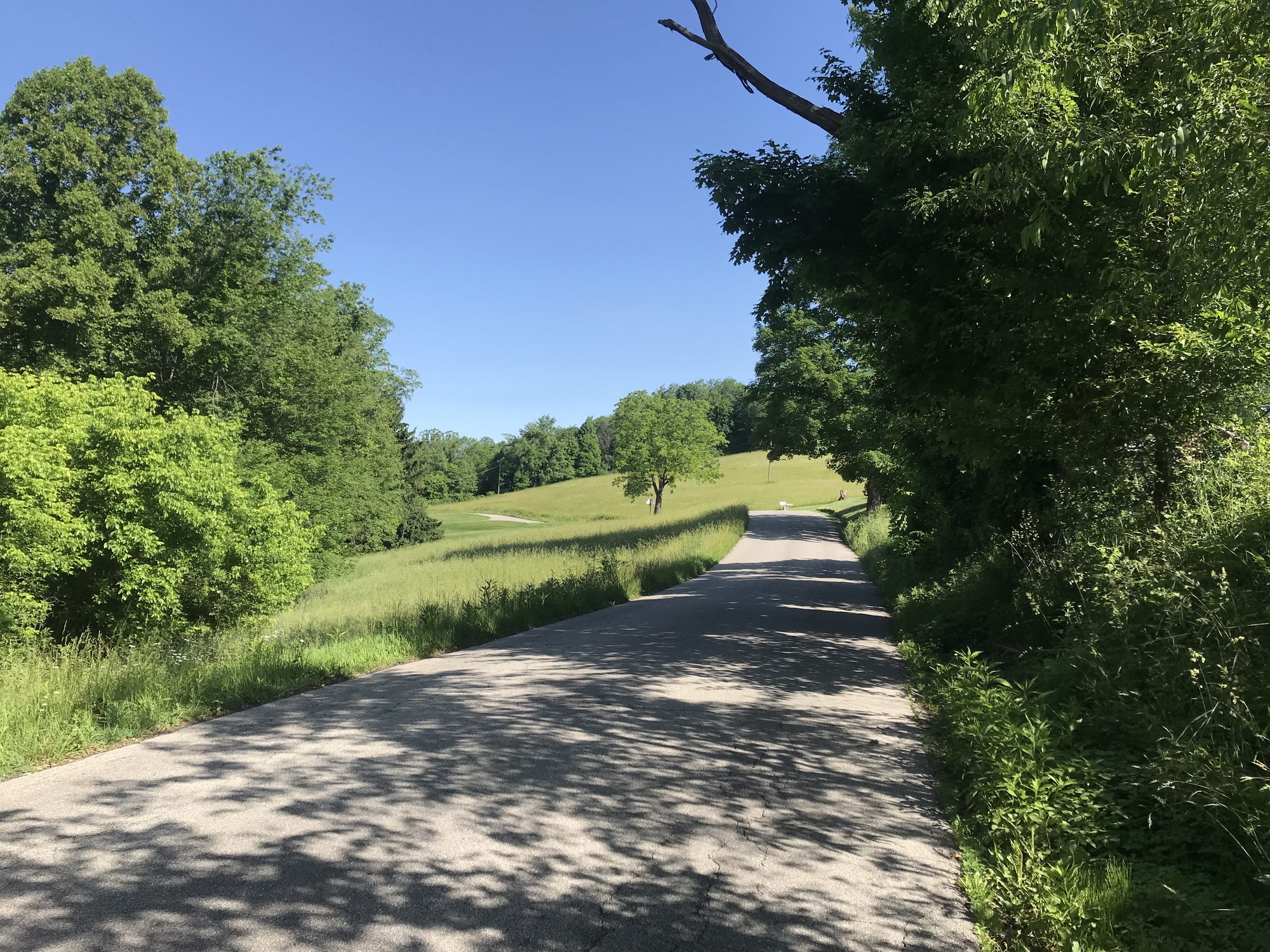
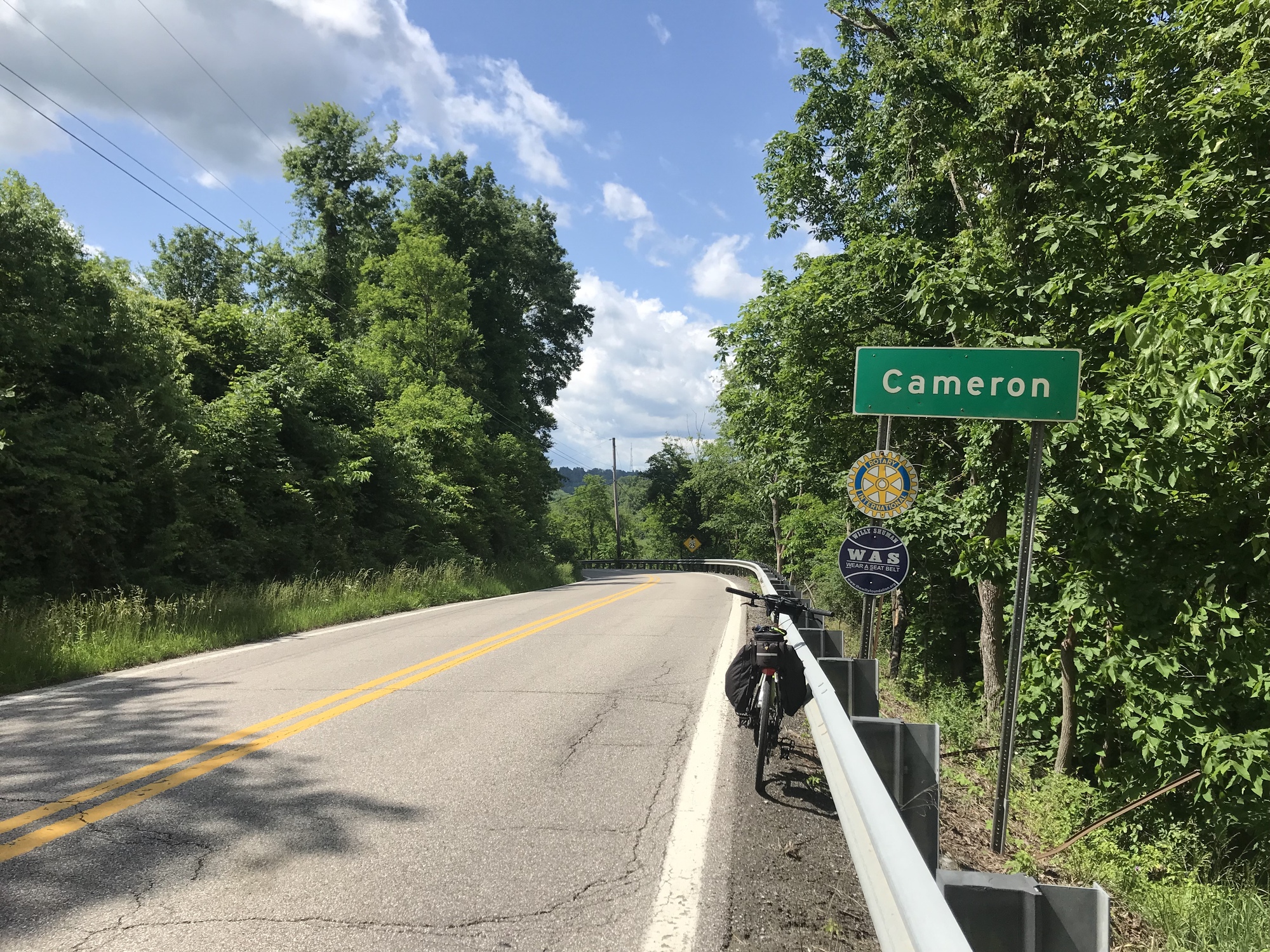
After a long climb that did not have an equivalent drop, PHR met SR-88. I turned left in order to continue Southward. SR-88 met US-250, where I continued heading South. Cameron was my first destination. It lay 13 miles further, according to the sign, which turned out to be correct distance- wise. The sign said absolutely nothing about how many hills were involved in those miles.

| Heart | 0 | Comment | 2 | Link |
http://www.southeasternflora.com/view_flora.php?plantid=1007
and one white daisy.
http://www.southeasternflora.com/view_flora.php?plantid=409
1 year ago
1 year ago
I got into a zone, ascending, descending, and repeating the exercise. None of the signs today said anything about how many road construction projects were occurring. I lost count but can report that all of the flaggers and many of the workers were courteous and nice to me. The drivers were largely courteous as well and many waved as they went by. This was most appreciated because the roads were mostly without shoulders.

| Heart | 0 | Comment | 0 | Link |

| Heart | 0 | Comment | 0 | Link |
Cameron makes you work for it. After quite a bit of up and down, there was a long downhill to a stream bed. The High School was there and I thought I had reached the town also. No way Jose. Another long climb, through wooded terrain followed. Then there was another big drop that led into the town, part of which was on the downslope. Reminded me of Austin, Nevada… with trees!
By the time I reached Cameron, I had 30 tough miles down and my stomach was rumbling. I made a smart choice to stop at Hebrock’s BBQ, which was on the downslope. The food was good and Mr. Hebrock is a real character... in a good sense. Nice guy, knowledgeable about the area, funny, but not someone whose bad side you would want to be on.
I sat outside, to keep an eye on my bike. He said it wasn’t necessary, but I felt better keeping an eye out. I liked Mr. H. His food is good and the prices are very reasonable. He rides motorcycles all over the area and knows the roads well. He told me the ride to Hundred would be tough. He wasn’t kidding.
After leaving Cameron, there were several long climbs, thrilling descents, and interesting wooded valleys along the way. There’s a whole lot of beautiful countryside out in this part of West Virginia. There’s also a lot of gas extraction going on. I was passed by a number of big trucks and company representatives in pick-up trucks. All were courteous and many waved.

| Heart | 0 | Comment | 0 | Link |
Eventually, I left the Northern Panhandle completely when the road took me into Wetzel County. The sliver of land between Pennsylvania and Ohio is bigger than it might seem and I covered quite a bit of it during this quest. It might take me years to cover the rest of West Virginia! I'm up for it.

| Heart | 0 | Comment | 0 | Link |
Difficult undulations continued into Littleton. There are a number of YouTube videos about decimated Appalachian towns. I’m not sure if there is one for Littleton, but it is fodder for such undertakings. Things are pretty rough there. I won’t post very many “ruin-porn” photos but will mention the dilapidated buildings, very rough looking homes, the junk lying about, the threatening signs, and viscous dogs that were thankfully tied up. One person had a sign in the yard that said, “Zombies Ahead.” I didn’t linger in Littleton. However, I did ask a young woman and man what the purpose of the building pictured below had been. The woman told me it had been a bank. Both of these people appeared to be high on something besides life. The woman was coherent but the young man had a vacant look in his eyes and did not speak at all. It was a somewhat disturbing interpersonal encounter. Perhaps the reason for the aforementioned Zombies sign I had seen before reaching this point.

| Heart | 0 | Comment | 0 | Link |
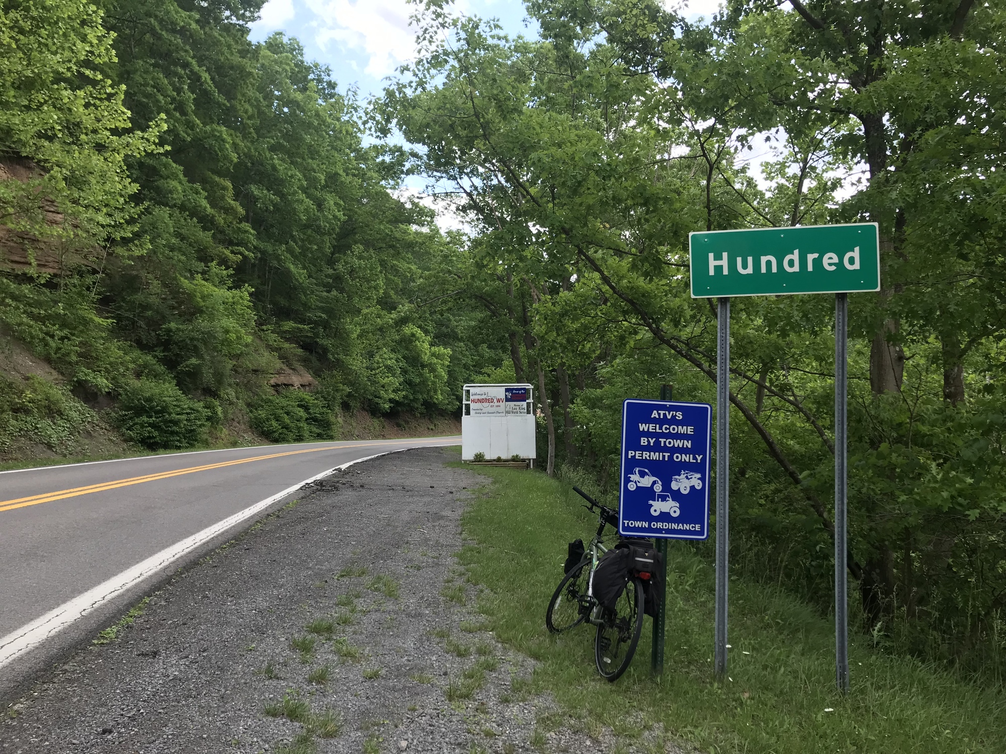
On the approach to Hundred, I caught a break. The Hornet Highway followed a stream and remained mostly flat for a few miles. I finally arrived to the town after so many years.

| Heart | 0 | Comment | 0 | Link |
In the previous chapter, I mentioned a former Wheelmen ride leader named Donald Lemmon. He used to lead intriguing rides that I never went on because I was not a racer. Back then, if you were slow you got dropped by the group. If you got dropped, you were on your own. Since the sophisticated bike computers and cell phone mapping programs didn’t exist then, you could really be screwed. The ride was called, “The Hundred Sixty,” meaning a 60-mile round trip to Hundred and back. The thought of spending 60 miles trying to keep up with very fast riders did not appeal to me. But I always wanted to go to see Hundred. Today, I completed a modified version of the ride… 35 years later. Cheers Donald, wherever you are!

| Heart | 0 | Comment | 0 | Link |
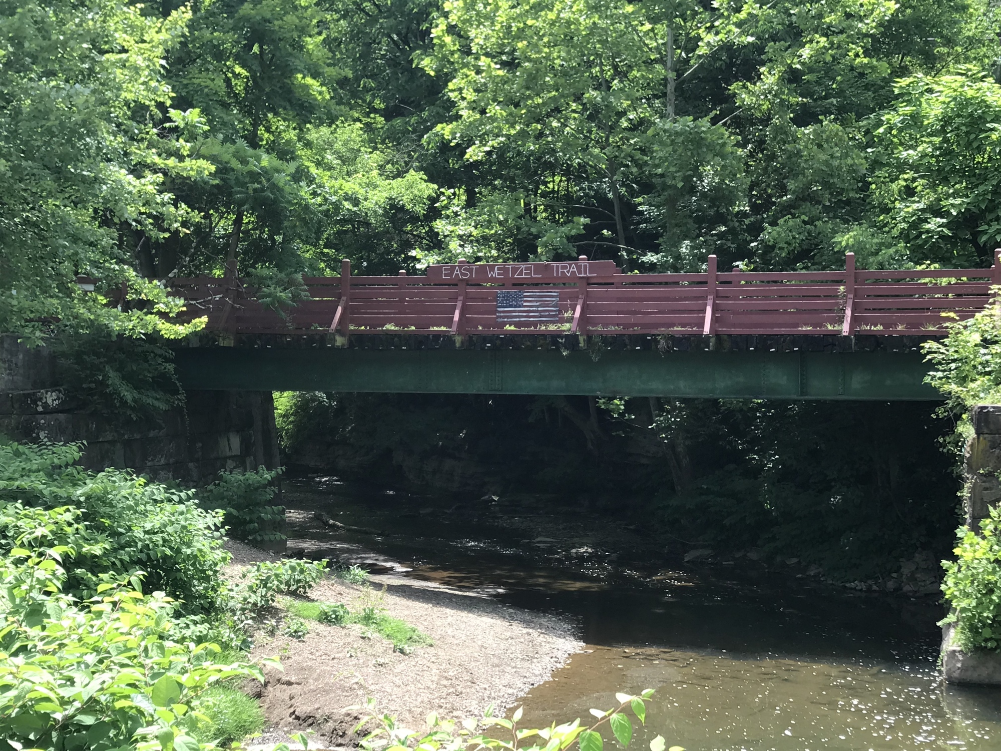
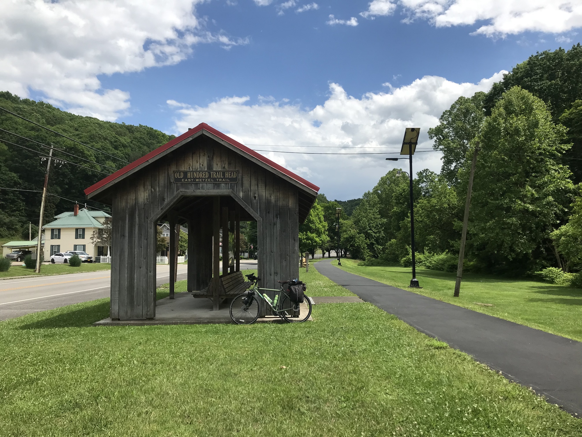
In town, I stopped at the 4 Sisters Market, grabbed some food for later, and continued onward. A brief stop at a local hardware was productive because they let me borrow a 25T star-bit screwdriver to adjust my brakes. Then I headed over to the East Wetzel Trail. Although only 1.5 miles long, it’s in very good shape and right in the center of town. Hundred is the polar opposite of Littleton. Although the economic climate is essentially the same, the citizens have worked to keep the town going and to maintain some level of prosperity. I liked Hundred, very much.

| Heart | 0 | Comment | 0 | Link |
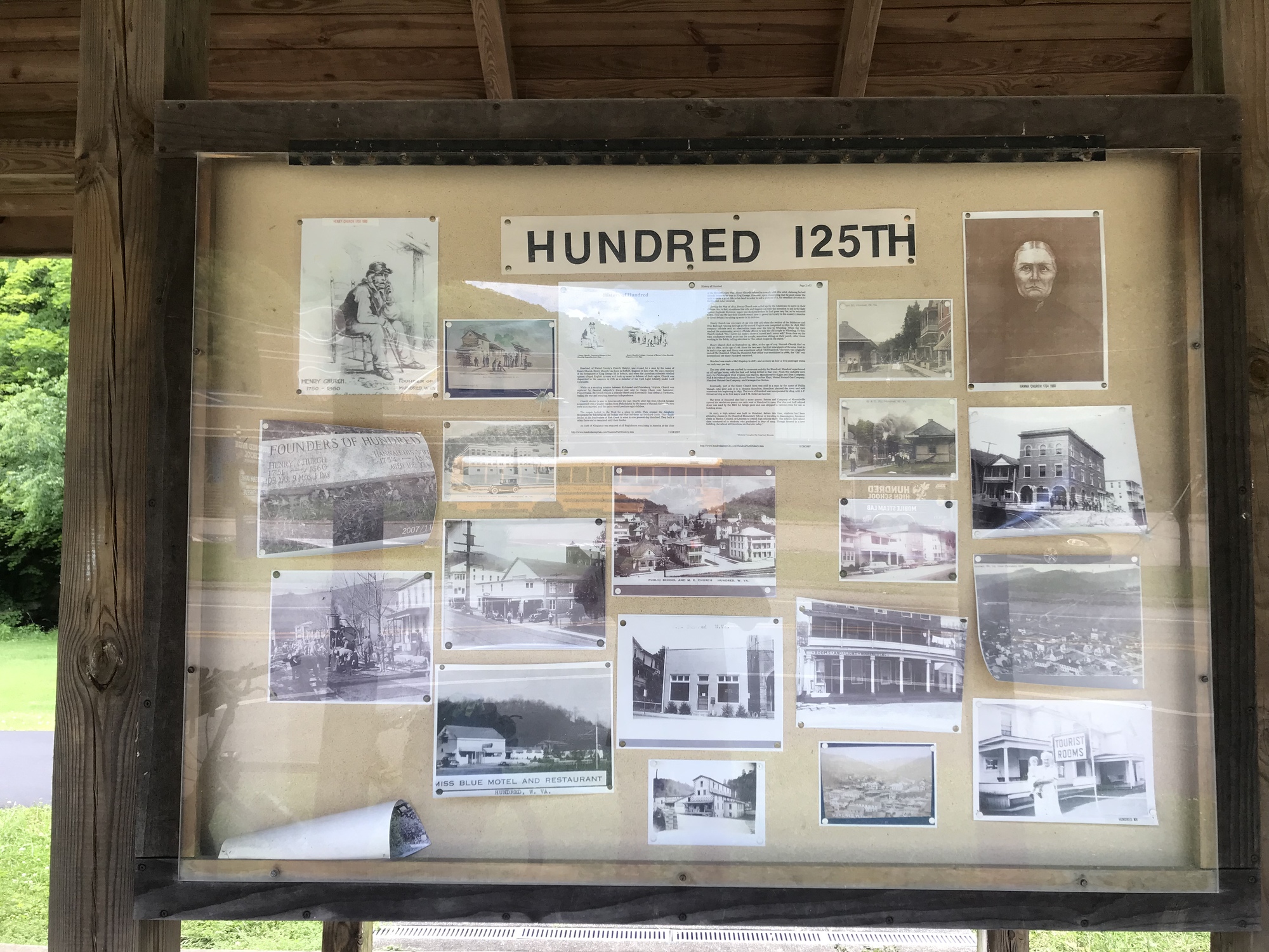
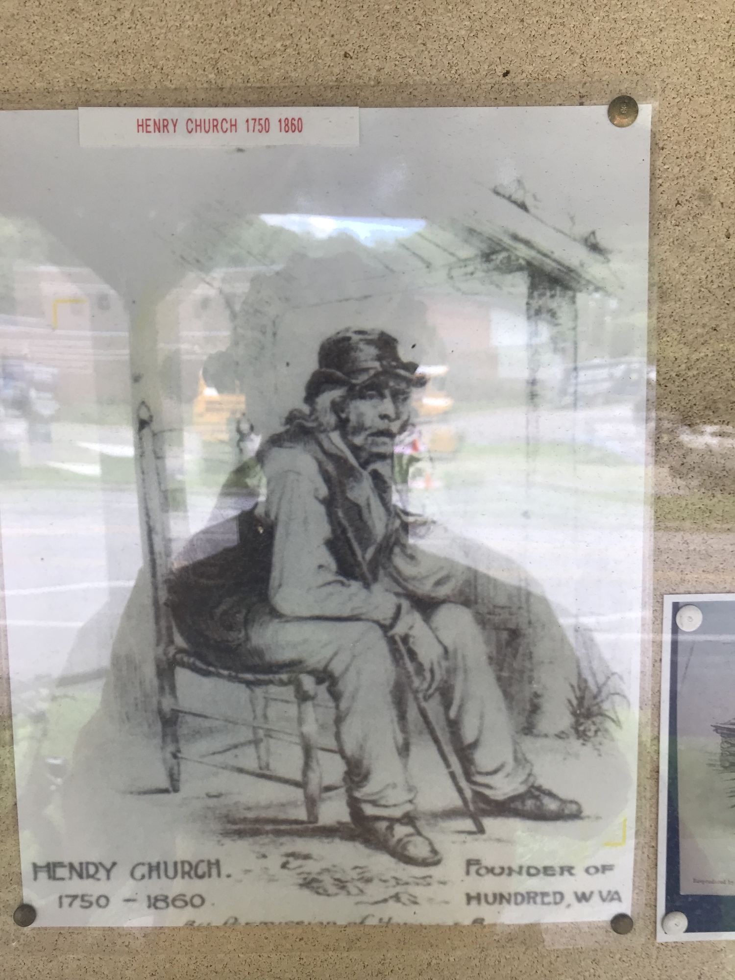
Hundred is the only town in the USA with that name. Why is it named Hundred? I thought you would never ask. As the story goes, the town was founded by Henry and Hannah Church, both of whom lived to be well over 100 years of age. Henry was 109, Hannah, 106. Legend has it that Henry used to go to the train station to meet, wave, and talk with the passengers. Some of them would say, “There goes Ol' Hundred.” Hence the name of the town.

| Heart | 0 | Comment | 0 | Link |
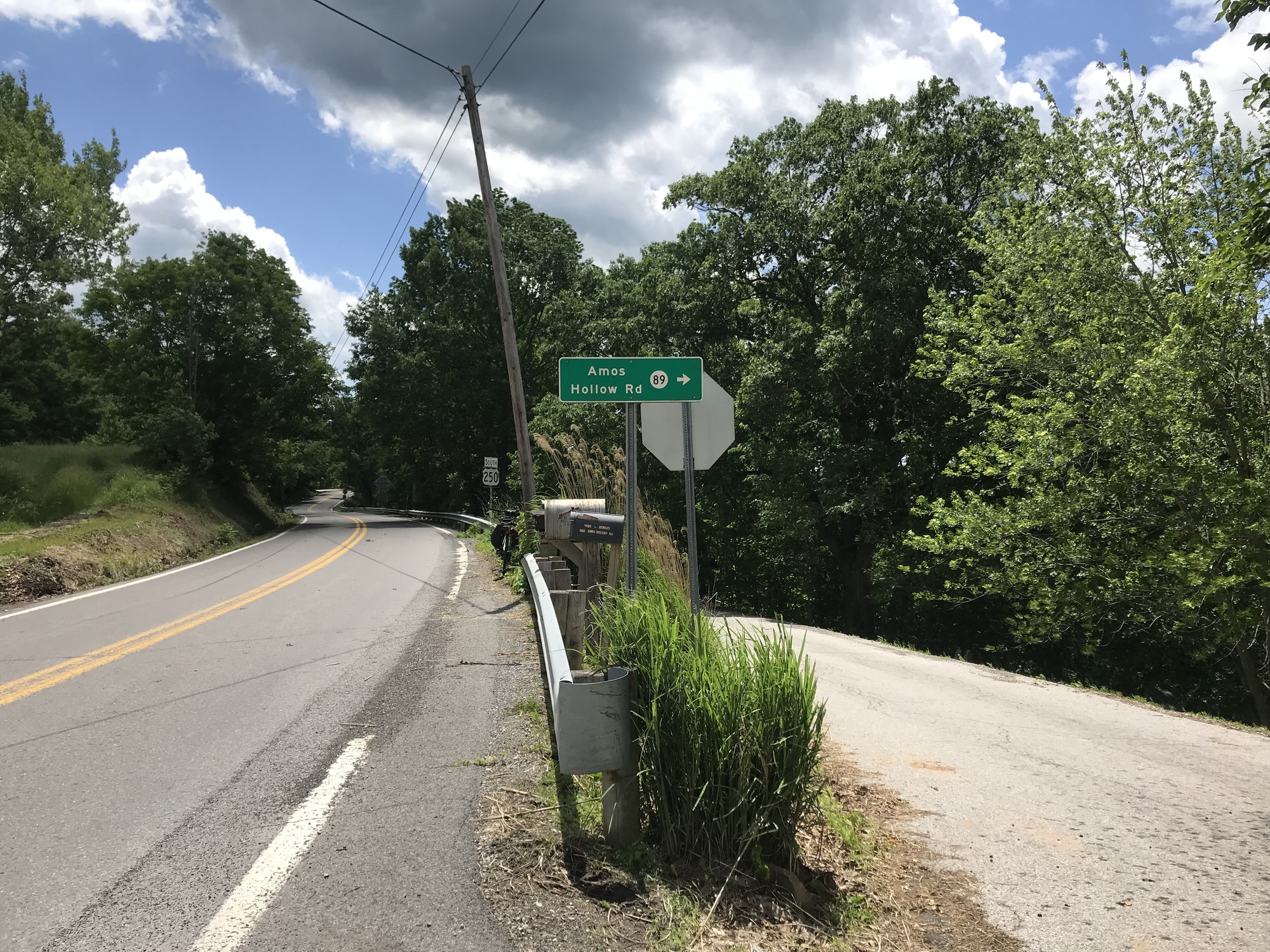
By my reckoning, I had about 10 more miles to cover before ending the day. They turned out to be memorable with a couple of big climbs and a heavy rain storm that happened with a little over a mile to go. The route called for taking SR-7 out of Hundred for about 3 miles. Of course, there was construction on a long hill. The construction guys directed me ride on the freshly resurfaced asphalt lane so I was away from the traffic while climbing. It was very nice and smooth. Eventually, I turned off onto Willey Fork Road.
I followed Willey Fork Road for about 6 more miles. It wound along a creek bed called the Long Drain. Pretty much described my day… a long tough ride that drained a good bit of my energy.

| Heart | 0 | Comment | 0 | Link |
I reached my destination and am enjoying a peaceful evening in some very remote and quiet West Virginia backcountry. I am doing well and it was worth the effort to get here. Tomorrow, I’ll be looking to end up back on the shore of the mighty Ohio River. We'll see what kind of adventure awaits me.
Today's ride: 59 miles (95 km)
Total: 580 miles (933 km)
| Rate this entry's writing | Heart | 1 |
| Comment on this entry | Comment | 0 |