November 6, 2021
In Viterbo: climbing Monte Palanzana
Yesterday
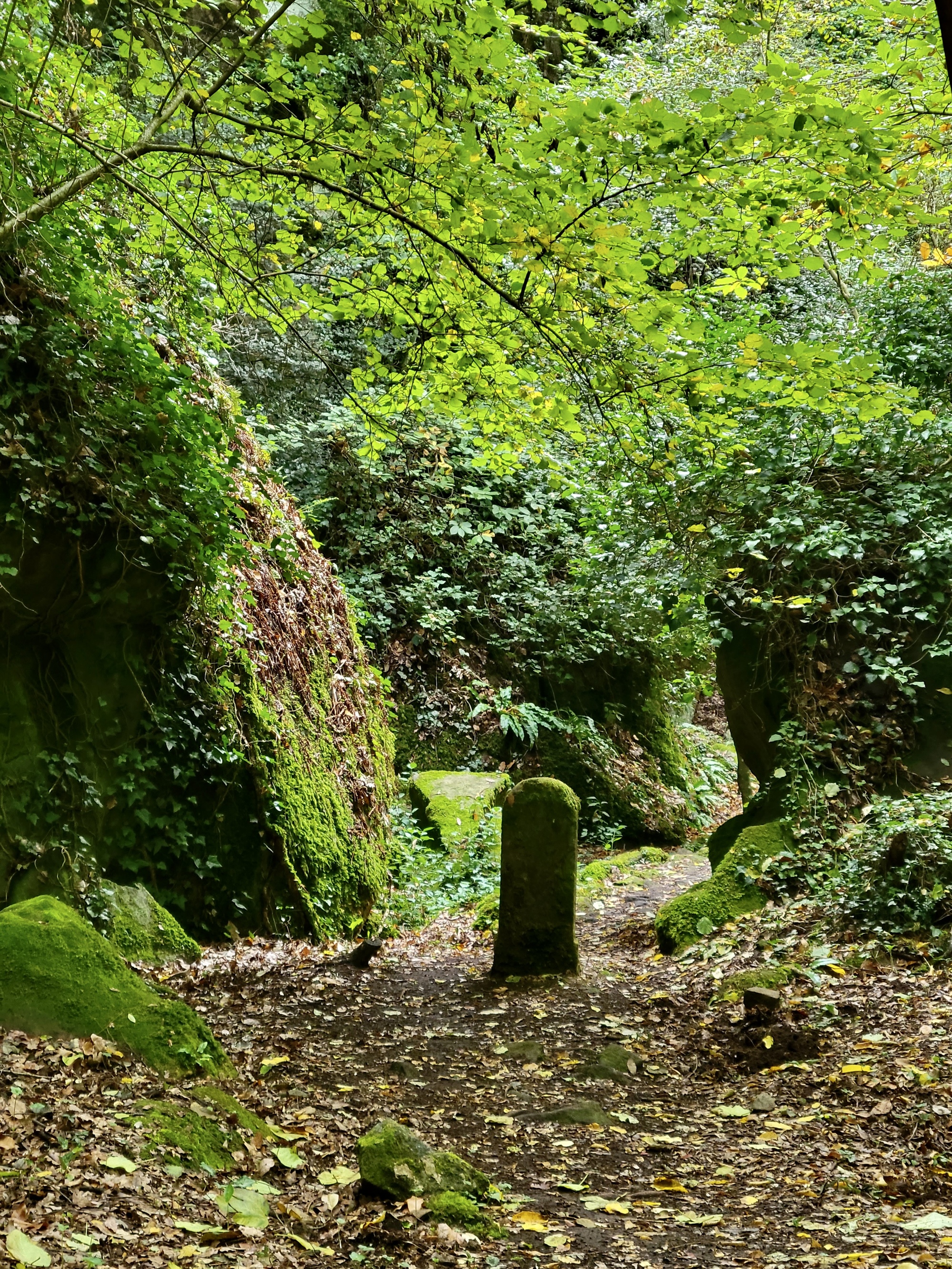
While I was off biking to Tuscania yesterday, Rachael took an 11 mile walk into the hills to the east. She started off with a walking route she found on Kormoot but only followed it part of the way when it started getting too rugged. She came back excited about what a beautiful hike it was once she got away from town, and expressed regrets that I wasn’t along to bring back a better set of photos.
I think she and her phone did just fine though - good enough to make me a little sorry that I hadn’t gone along also.

| Heart | 5 | Comment | 0 | Link |
Today
The weather just keeps breaking our way. We saw heavy rains last night that kept us sheltering under every overhang we could find walking back from dinner. Today though the weather looks beautiful for our last open day of the tour. Rachael decides that she wants to head east into the hills again on a variation of the walk she took yesterday. I want to do so too but also I want to walk through town and see it during the daylight; and if we walk together I’ll just slow her down. We decide to walk the same route but in reverse directions; and at the end I’ll return home through town.
We’re walking basically the same loop, but I’ll describe it from my direction. It begins by walking east across the busy ring road just past the San Marco Gate. In this direction the town and traffic fade away quickly. Within a few blocks you’re on the quiet, dead end Str. della Paranzana that gradually climbs up the shoulder of Monte Palanzana, the closest high ground to town. It dead-ends at a lonely convent in the woods, but after that walkers can continue on to a well marked hiking route through a large natural preserve that extends for miles east and south to the rim of Lake Vico. It looks like there are endless hiking opportunities in this area; and in fact the route we’re on today is just a small part of a long, sprawling trail called the Sentiero del 4 Monti (the four mountain hiking route).

| Heart | 3 | Comment | 0 | Link |

| Heart | 0 | Comment | 0 | Link |
As expected, a few miles into the hike a familiar figure appears ahead, as I knew she would because we’ve been tracking each other on our Garmins. We stop to chat, and she mentions the spur to Monte Palanzana that she just passed a short way back. She started climbing up it but then decided it was the wrong idea to go climbing up a lonely, steep mountain path alone when we hadn’t agreed about it before hand so I would know where she was.
She decides to turn back and walk with me a until we get to this turnoff, one I’d seen on the map and had considered climbing to myself. When we get there we are surprised to see it is only 0.45 kilometers to the top, so we decide to climb up together to see if we can get a view of the town.

| Heart | 3 | Comment | 0 | Link |

| Heart | 3 | Comment | 0 | Link |
Sometimes Team Anderson is quite sharp-witted, sometimes it’s a little dull. This was one of those duller moments. 0.45 of course means 45 minutes, not just under half a k. If we’d interpreted the sign correctly we would probably not have chosen to climb that far, but fortunately in our ignorance we went for it and after a quite steep climb were rewarded by stunning views from a clearing at the top. All of Viterbo is sprawled below us, and views extend far to the north and west. Tuscania is probably visible if I knew what to look for, and Lake Bolsena is visible through gaps in the hills.

| Heart | 0 | Comment | 0 | Link |

| Heart | 2 | Comment | 0 | Link |

| Heart | 5 | Comment | 1 | Link |

| Heart | 2 | Comment | 0 | Link |

| Heart | 2 | Comment | 0 | Link |
The descent is of course technically more challenging than the climb. Rachael had reached the summit and started down sooner than me. I came after, fortunately helped by a good walking stick I found at the summit - otherwise I’m sure I’d have spent a fair amount of the descent skidding on my butt, as Rachael did in spots. The stick definitely helped, but I also relied heavily on grabbing branches to control my descent everywhere I could find them. I woke up the next morning with a sore shoulder which I attribute to reaching back and bearing my weight with it.
The trail back to town is well marked, but I missed the turn I should have taken and ended up adding a mile to the hike by overshooting and finding a longer way back. In doing this I also missed walking what Rachael found to be the most interesting part of the trail yesterday. I think most of her photos above from yesterday’s hike came from this section of the trail.
I made it back to town by early afternoon and stopped in at the first cafe I came to for a slice of pizza bread and a beer before moving on to a walk through town, which we’ll see in the following post.
| Rate this entry's writing | Heart | 9 |
| Comment on this entry | Comment | 0 |


