June 20, 2024
Day 6: Across the Ohio, and I didn't have to swim!
This tour threw a lot at me and it's only about halfway done. The heat wave, pushing me into hotels instead of camping. The hills, which gave me a chance to use a "save the legs" approach of pushing when the grades exceeded 6%. The downed trees letting me explore my arm muscles lifting the bike over the fallen foliage. Broken elevators, road construction. It has it all except for plagues of locusts and hail but I guess I'm not trying to leave Egypt at this point.
Today's route was not my intended route to get to my destination. Originally, I was heading through Steubenville, crossing there, and then hitting the Panhandle trail within a few miles. But in December 2023, the only bridge linking Ohio with East Virginia over the Ohio in that location was indefinitely closed. I even tried an alternate strategy - Measuring the limited access highway bridge that crosses at Steubenville, it was only 4/10 mile from entrance to exit, so not a long crossing. Looking at Google street view it was a full three lanes in each directions. No shoulder at all. I phoned the Steubenville PD and asked about crossing and whether it was (a) illegal or (b) not necessary illegal but certainly not advisable. The sergeant who answered the call said there's road construction on the bridge and the limit is 45 but drivers exceed that and they've had an increase in collisions. So I "noped" myself out of that option. Time for plan C at this point.
| Heart | 0 | Comment | 0 | Link |
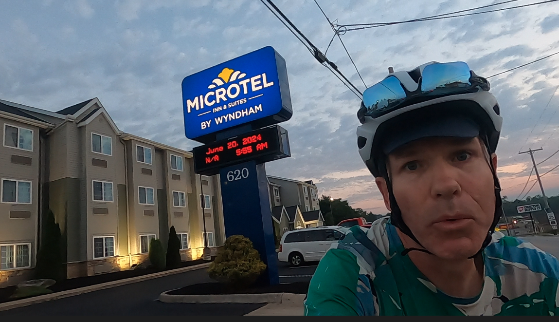
Remember how breakfast started at 4:30am at this location? Well, that was part of the plan. Sunrise was 5:54, so I got out of bed, packed up, had breakfast, and left the hotel right at official sunrise. The sign in the photo changed to 5:55 as I rode from the lobby entrance to the sign. So there!
The first 18 miles or so were up and down heading east towards the river. Then a 3 mile downhill stretch to cross the river, 10 miles north along the river and then a monster of a climb to cross a ridge in order to reach the Panhandle trail.

| Heart | 0 | Comment | 0 | Link |
As was prophesied in the elevation chart, the first part of the journey was indeed up and down. I enacted the strategy when it was over 6% to walk the hill, and this kept my legs fresh as I used different muscles. It was a really peaceful ride that early in the morning. Just me, the birds, and the humidity - very little auto traffic on the back roads.

| Heart | 0 | Comment | 0 | Link |

| Heart | 0 | Comment | 0 | Link |
The early departure plan works like a charm. By 8:30 I've gone through the worst of the hills and I'm bombing down the 3-mile hill towards the river.

| Heart | 0 | Comment | 0 | Link |
The road rolling down to the river emptied me onto an industrial pathway along coal power plants and industrial sites. This is because the other road that goes along the river here is a limited-access highway and yup, "no bikes allowed" So I roll with the coal trucks and large semi-dump trucks for about a mile making it to Brilliant OH, and the Wellsburg bridge. Oh, and only good things to say about the trucks - not one played cowboy with a close pass - they all respected my presence on the road that morning.

| Heart | 0 | Comment | 0 | Link |
The Ohio river crossing is great. A wide, separated path from the automobile traffic. Can't say enough good things about it. The WV side of the bridge connects to the Pioneer path, which runs 15 miles south to Wheeling, or about 2 miles north to Wellsburg. But the Ohio side leads to no cycling infrastructure, and in fact to get anywhere south you have to ride with the coal trucks. So I'm glad it was here for me to cross, but how many cyclists will actually use it since not many are crossing at this point in the river?
I head north along the Pioneer path and am stopped in my track about a mile into the trail with no alternate. Just "TRAIL CLOSED June 10 - August 20" Well, rather than camp here until August 20 when it reopens (I might have considered that but I didn't have enough food), I turn around and look for alternates. Remember what I said about the bridge cycling infrastructure leading to the path? That's it. No alternates once you cross the bridge. So I removed the panniers and lifted my bike up and over the chest/torso height barrier separating the path from the roadway, and then rode north along the limited access highway (didn't see any "no bike" signs so off I went).

| Heart | 0 | Comment | 0 | Link |
After the limited journey on the limited access highway I was able to reconnect onto the Pioneer path just before it enters Wellsburg. As it goes through town it becomes simply painted lines and arrows on side streets going from one block to the next. I thought it may have been a coal town in its heyday, but reading through the Wikipedia entry, I couldn't find anything mentioning that. It did say its main economy includes several telemarketing facilities (so THAT'S where those calls originate from) and a metal fabrication and plastics molding company. I even make a pit stop in Wellsburg at a park to refill water bottle and use the restroom. But the picnic pavilion is a graffiti-canvas, the restrooms are locked, and the water fountain is inoperable. Kind of summed up this town for me.

| Heart | 0 | Comment | 0 | Link |
About 34 miles into the ride I hit the big climb. True, it's only a little more than a mile, but that is a little more than a mile of a 9% grade. I chose to walk the entire thing. 25 minutes later, I'm up and over and can now make my way to the panhandle trail. When I actually do get there, I blow right past the trailhead entrance as I'm cruising downhill. "WAIT A MINUTE!" I say (internally of course, as there would be no-one around for me to verbally exclaim this to) "I think that's the trailhead." and it was. I have made the connection I sought two days ago. Now to ride the Panhandle to the Montour Trail to the GAP/C&O.

| Heart | 0 | Comment | 0 | Link |
Once on the trail, I guess the excitement ends. Nothing more to do but pedal my way to the hotel. This stop in the airport Fairfield Inn in Coraopolis PA was planned as I wanted to stop here, recoup, do laundry (oh, yeah, and guess whose washer was inoperable? That's right - THIS place. The surprises just keep going on and on) and then get ready for my GAP/C&O portion of the tour.

| Heart | 0 | Comment | 0 | Link |
By 1:45 or so my 71 mile day was done as I climbed the last grade up to the hotel and checked in. Thankfully, the room was ready to go and the pool was all mine. And there was A/C. I connected the two great trail systems so it's possible, although I would have liked to see Steubenville.
Today's ride: 70 miles (113 km)
Total: 414 miles (666 km)
| Rate this entry's writing | Heart | 1 |
| Comment on this entry | Comment | 0 |