May 15, 2020
Steptoe Butte
Roughly 20 years ago I went down to the waterfront to browse through Portland’s Saturday Market. I’m not at all a shopper or market browser, and this must have been one of the only times I’ve visited the market. Thinking back now, I think it was winter of 2002, the year we moved to Portland; and I must have been browsing for a gag white elephant exchange gift for the office Christmas party.
I remember this event because I browsed through the booth of a photographer and came across an arresting series of photographs of rolling, velvet green hills. I was so taken by them that I was tempted to buy one for the wall of our new condo. Where is that, I asked the photographer, expecting to hear it was some exotic destination. Steptoe Butte, in SE Washington, I was told. Up in the Palouse.
Ever since, Steptoe Butte has been on my hit list. It’s amazing that it’s taken me almost two decades to finally get up here. I’ve drawn up plans for a short solo tour up through the Palouse a dozen times over the years since then, but somehow never managed to fit it in.
Today’s the day. We’re going up. The weather is overcast this morning, but it’s supposed to break up and turn partly cloudy by midday. just the sort of day we’ve been saving this ride for. I like the idea of a partly cloudy day, with cloud shadows cast across the hills. We hop in the car and drive the roughly thirty miles to Oakesdale, our base for the ride today. As we drive, we see the broad ridge capped by Tekoa Mountain ahead, its crown buried in dense white clouds. Not the most promising outlook, and we wonder whether the forecast was wrong. Maybe this will end up just being a nice ride in the country instead.

| Heart | 6 | Comment | 0 | Link |

| Heart | 5 | Comment | 0 | Link |

| Heart | 4 | Comment | 0 | Link |
The sky lightens up a bit when we near Oakesdale, but it’s still fully overcast and pretty cool. Well layered up, we bike into the face of a chilly headwind as we ride southwest out of town on Oakesdale Road, the first segment of the route. We aren’t really quite committed to the ride yet, actually. We’re going to give it a few miles to see how cold it feels.
Our mission, should we choose to accept, is to make a complete counterclockwise loop of the Butte and then climb it toward the end on our return north to Oakesdale. Hopefully by the time we get there we’ll see some clearing in the skies.

| Heart | 3 | Comment | 0 | Link |

| Heart | 2 | Comment | 0 | Link |

| Heart | 4 | Comment | 0 | Link |

| Heart | 7 | Comment | 2 | Link |
Ten miles into the ride we come to the end of Oakesdale Road, at its junction with US 95. By now we’re committed to the ride. The sun is breaking through here and there, it’s warming up a bit. Just what we hoped for. For the next eight miles we bike straight south on the highway, enjoying a surprisingly fine ride. The shoulder is wide, the traffic is moderate, the views are wonderful. Much better than I imagined when plotting this ride.
At the minimal town of Steptoe we leave the highway and stop for lunch before turning back northeast, toward the Butte and away from the wind.

| Heart | 4 | Comment | 0 | Link |
It’s a joy to bike northeast from Steptoe. We have a nice wind at our backs, there’s a fair amount of sun on the road, the views are gorgeous of the land against the dramatic sky. We really sail the next eight miles to the base of the Butte.
As we bike though, conditions change and the sky darkens significantly. Off to the west it looks like there are bands of rain hitting the hills, and they’re coming our way. By the time I make it to the turnoff to the Butte and the base of the climb, I no longer trust this weather. It’s a four mile climb to the top, and who knows how bad conditions might be when we get up there and on the way back down. And if it’s dark and wet, how much will we enjoy its famous views anyway? I decide to talk this over with Rocky when we get to the turnoff, thinking we should just head for the car post haste, keep dry, and come back again on a drier day.

| Heart | 2 | Comment | 0 | Link |

| Heart | 5 | Comment | 0 | Link |

| Heart | 4 | Comment | 0 | Link |

| Heart | 3 | Comment | 0 | Link |
Unfortunately, as always I’ve fallen behind Rachael when I stop with the camera. When I reach the turnoff she’s not there. She must have just started climbing. We’re out of cell phone range, so there’s no option but to follow after her and hope for the best.
The best doesn’t come, but neither does the worst. I stay dry on the climb up, and the climb goes faster than I expected. The grade is steady and not bad, and the wind is surprisingly modest. I’d expected it to become fairly fierce as I gained elevation, but it never does. Maybe I’m biking in the calm before the storm.
I don’t bother stopping for photographs on the way up, because it’s too dark anyway and I’m focused on getting up as soon as possible and getting us down off the peak before all hell breaks loose. As I bike I watch for an overtaking car can flag down to have them catch Rachael and tell her to turn back, but none come.
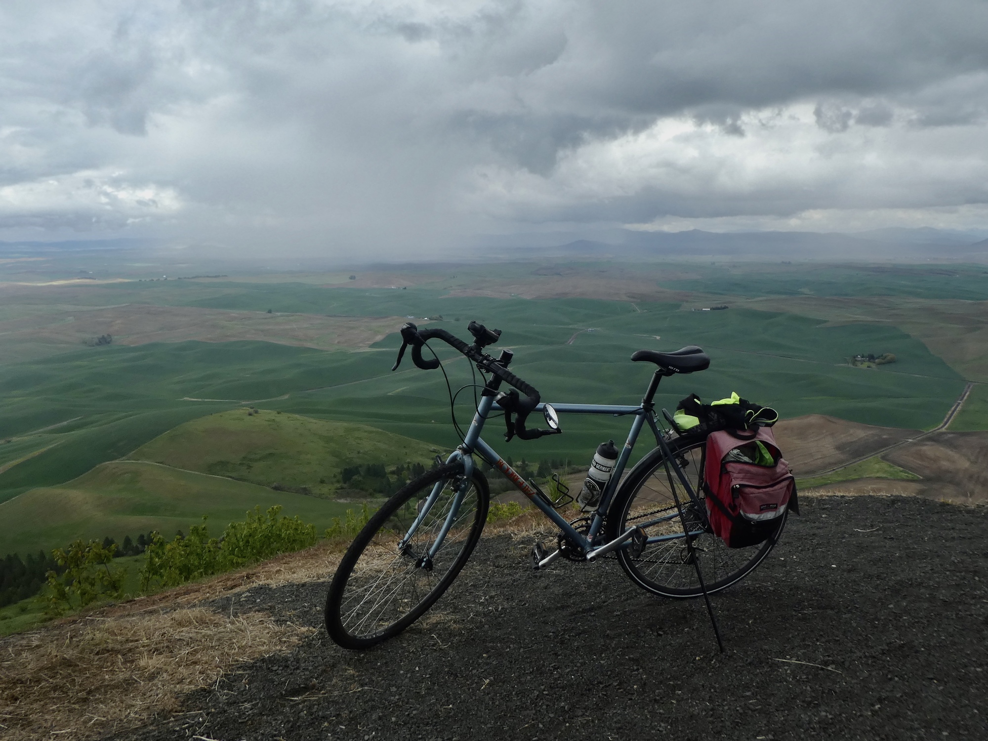
I reach the top just before the rain arrives. Just long enough to gaze around in amazement and take a few photos, before we both hurriedly dash for the shelter of the thankfully open and unoccupied outhouse.

| Heart | 1 | Comment | 0 | Link |

| Heart | 10 | Comment | 0 | Link |

| Heart | 4 | Comment | 0 | Link |

| Heart | 3 | Comment | 1 | Link |
4 years ago
Our situation feels grim as we cower in the shelter of the outhouse. We’re still twelve miles from Oakesdale, with a wet four mile descent in our future. It’s a complex sky though, and I’m hoping that the rain will pass quickly and we’ll get a window to make our dash in. Ten minutes later the rain damps off and we make our move. With the wind and weather going our direction, with luck we might just bike into Oakesdale dry.
It happens. We get our window, complete with just enough clearing to be able to appreciate the phenomenal landscape surrounding us. The next twelve miles are incredible. All the way down-mountain I’m giving thanks for Rachael’s persistence. If it had been up to me we wouldn’t be up here, but thanks to her we’re experiencing a ride we’ll never forget.

| Heart | 7 | Comment | 0 | Link |

| Heart | 4 | Comment | 0 | Link |

| Heart | 7 | Comment | 0 | Link |

| Heart | 6 | Comment | 1 | Link |

| Heart | 8 | Comment | 0 | Link |

| Heart | 4 | Comment | 0 | Link |
Video sound track: Stormy Weather, by Etta James

| Heart | 6 | Comment | 1 | Link |
Ride stats today: 39 miles, 2,000’
| Rate this entry's writing | Heart | 10 |
| Comment on this entry | Comment | 3 |
At least you didn't have to spend the night there!
Wish you could find that photographer from Saturday Market and show him these photos.
4 years ago
4 years ago
4 years ago


