May 20, 2024
Day 5: Quincy to Belden Resort, Feather River
Today is easy and short, but still very interesting. I got up at 7 and ate breakfast again at the Morning Thunder cafe. On the road at 8:30. Today's schedule includes a reserved hot spring soak at 11.
The first 2 or 3 miles backtracking north from Quincy are in unburned forest. But it didn't take long to see the Dixie fire again.

| Heart | 1 | Comment | 0 | Link |
I stopped to look at the famous Keddie Wye where two trestles converge into a tunnel. I didn't see it at all when pedaling the opposite direction. The surrounding trees are so tall that it's hard to see the sides of the trestles. The view was more open 15 years ago during my 2009 California J bike tour.

| Heart | 4 | Comment | 0 | Link |

| Heart | 2 | Comment | 0 | Link |
Soon after the Keddie Wye is another interesting railroad view of a small trestle and tunnel on my side of the canyon and a large trestle on the opposite side of the canyon. A train was stopped on the trestle, one of only two trains I saw today on the Western Pacific railroad.

| Heart | 2 | Comment | 0 | Link |
I took a photo of this scene in 2009, but looking into the setting sun. The distant ridge that is burned now is too washed out to be visible. The most interesting then and now comparison is that Spanish Creek was visible 15 years ago. Now the taller trees obstruct any creek view.

| Heart | 0 | Comment | 0 | Link |
The last two before and after comparisons are different from what I expected. They show how the view changed over time because of growing trees instead of burning trees. Fire isn't the only thing that changes the landscape over the years. The landscape is regularly changed by tree growth, pine beetle infestations, drought, floods, landslides, and human activity. And by rare events such as volcanic eruptions, earthquakes, and tsunamis.
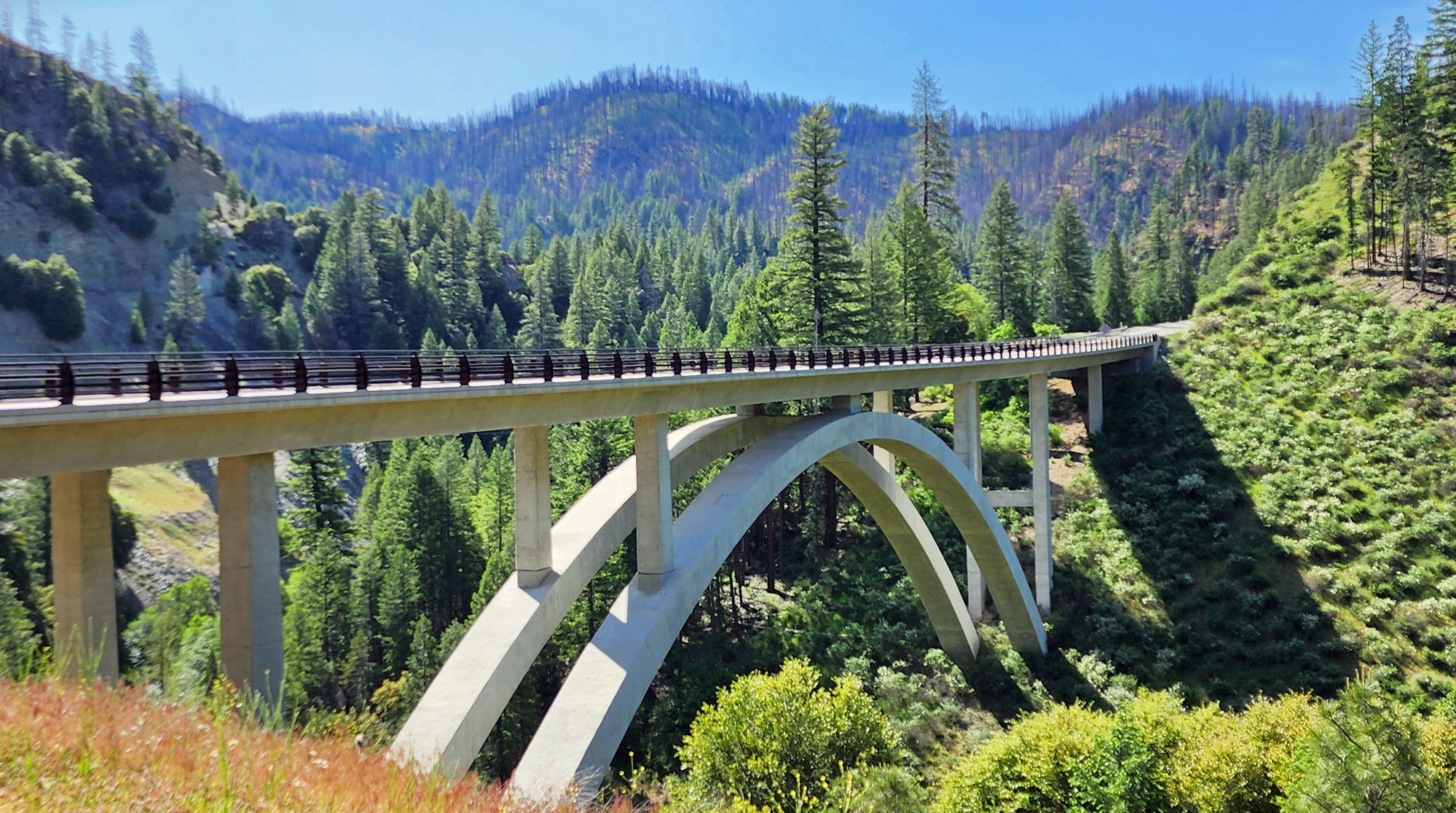
I stopped to take a picture of Spanish Creek from a new concrete arch bridge. The bridge didn't seem familiar. On the far side of the bridge is a huge interpretive display at the entrance to the Spanish Creek USFS campground. One sign describes the 1930's wood bridge that used to be at this site. I pedaled across the wood bridge in 1995 and 2009. This was my first time to see the new concrete arch bridge that was completed in 2012.

| Heart | 1 | Comment | 0 | Link |

| Heart | 2 | Comment | 0 | Link |
I passed through a 4 mile long zone of 1-way traffic. Same as when going up, the flagger allowed me to pedal on my own. During the 4 mile descent I stopped 3 times to take photos. A convoy passed by while I was stopped. When exiting the zone the flagger told me I wasn't allowed to stop in the "construction" zone. I'm not sorry that I made 3 prohibited stops. There was no construction.

| Heart | 0 | Comment | 0 | Link |
The reason for 4 miles of one way traffic is a 500 foot long landslide section. It's a natural landslide slope, but the Dixie fire made it even more unstable. Engineers say the entire roadway could fall down the slope at any time. It doesn't look easy to repair.
I asked why 4 miles of one way traffic for a 500 foot wide landslide. I was told that traffic can only be stopped in places where vehicles have enough space to turn around. There is no place wide enough to turn around on the steep slopes near the landslide.
Cycling was very pleasant in the one way construction zone. Pretty much a private road, except that a pilot car led a low speed convoy past me every 5 minutes. North bound convoys typically included 3 empty log trucks. South bound convoys typically included 3 loaded log trucks headed towards the Sierra Pacific Industries sawmill in Quincy.

| Heart | 0 | Comment | 0 | Link |
The one way traffic zone ends at the junction of highway 89 and 70. This junction is also a major water junction. I followed Spanish creek down from the south. Two days ago I followed Indian creek down from the north. At the confluence, the stream changes name to East Branch North Fork Feather river.

| Heart | 1 | Comment | 0 | Link |
Paxton is the first community I passed along the Feather river. This area is very remote. The communities are small.
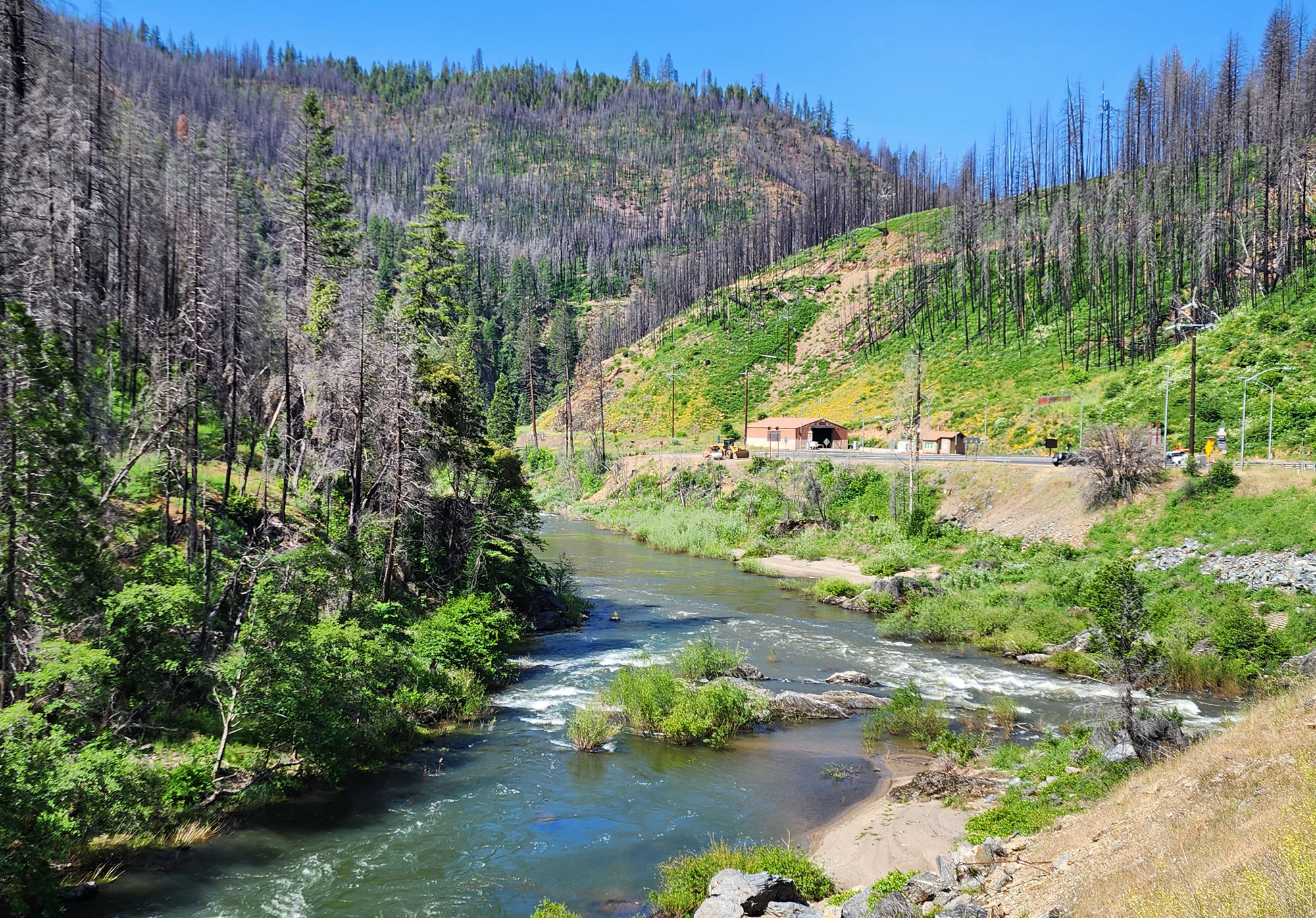
CA 70 stays very close to the Feather river. The river is nearly always visible. It's in a deep canyon that is burned in some places, but not everywhere. The north side of the river is significantly more burned than the south side. The Dixie fire started north of the river and spread mostly east and north.
Along the Feather river I have my final before and after photo comparison. I took a photo here in 2009 while making a detour to Woody's hot spring.

| Heart | 1 | Comment | 0 | Link |
I arrived at Woody's Feather River hot spring 10 minutes before my 11 AM appointment. The hot spring is closed from 9-11 on Mondays for a weekly scrubbing. I was the first person to soak after the scrubbing. Many years ago I soaked here twice when the fee was $2 per person via the honor system. Now the fee is $20 per person for a reserved 2 hour soak with a maximum of 6 people. I reserved the soak a week in advance and was told there would be 2 other guests. But I was the only one who showed up. So I had the hot spring to myself for the first time. There is no shade, so I'm glad the weather is cooler now.

| Heart | 1 | Comment | 0 | Link |
The soaking pools connect to two different hot water sources. Both are about 104F, but the larger pool is more sulfury. I soaked in the smaller tub which is cloudier, but not as sulfury. People also soak in improvised pools where the hot runoff enters the river. But only during summer when the river flow is lower and the river temperature is higher.
A couple miles downstream from the hot spring I stopped at the Twain store for lunch. The BLT sandwich was just what the doctor ordered, with crisp San Francisco style sourdough bread. I like the interior of the remote rustic store. I don't know why this community chose the name Twain. It's quite far north of the area where Mark Twain lived.
After lunch I continued downstream towards Belden Resort. It was an easy, scenic ride. Regularly going in and out of burn zones. Not continuously burned like I saw on CA 89 south of Lake Almanor. The Western Pacific railroad is always across the river, mostly quiet. The Feather river has a robust flow, still in the season called "snowmelt". Too cold for swimming even during a heat wave.

| Heart | 0 | Comment | 0 | Link |
I found it fascinating that the view changes so often and so quickly from burned to forested.
I had to pass through another construction zone with one way traffic led by a pilot car. This one was only 2 miles long, mostly downhill. I fell behind the convoy's pace on one minor rise, but caught up on the final downhill.
The construction work is to dig a very deep trench in the middle of the road to install 4 inch diameter power lines. The buried power line will connect to all the PG&E hydroelectric plants to eliminate the need for overhead power lines that start wildfires. The construction disrupts highway traffic for years, but will be a good investment.
Traffic was extremely light on CA 70 because of the construction delays. Pretty much all long distance traffic used alternate routes to avoid long and unpredictable delays. The only traffic was construction trucks. Construction stopped traffic behind me and ahead of me, so I regularly had 5 minute intervals with NO traffic. For once, I think the road construction is a benefit for me.

| Heart | 1 | Comment | 0 | Link |
Two miles east of Belden resort I crossed the North Fork Feather river which comes down from Lake Almanor in a roadless canyon. This is where the North Fork and the East Branch North Fork combine. Now I follow the North Fork downstream to Oroville reservoir where all the forks meet.

| Heart | 0 | Comment | 0 | Link |
I enjoyed seeing the patchwork of burned and unburned forest. The understory has grown back significantly in 44 months since the Dixie fire. The devastation isn't overwhelming. It's still easy to find shade.
I'm going to steadily lower elevation along the river, but I'm actually slicing through some of the highest parts of the Sierra Nevada. I was surprised to still see snow.
In Belden I stopped to see many interesting sights along the highway, across the river from the old Belden Town. The town was founded in 1905 for construction of the railroad. But a small mining community also sprung up. I stopped to look at the old stamp mill.
The Pacific Crest Trail crosses the North Fork Feather river at Belden. I didn't see any hikers. It's too early. Still too much snow on the trail.

| Heart | 0 | Comment | 0 | Link |
Belden also has a view of the first of many PG&E power plants that I will see along the Feather river. A few minutes later I found out that everything in Belden Town is powered by diesel generators, even though a power plant is visible across the river.

| Heart | 0 | Comment | 0 | Link |
I crossed the one lane 1913 truss bridge to get to Belden Town. It's not really a town now, in fact it's marketed as a ghost town. The town consists of the resort and two small trailer parks. Nothing else. Belden is quite remote, far from any other settlements. Elevation 2221 feet.
Google says the population was 22 in 2010, then zero in 2020 during COVID lockdowns and Dixie fire immediate aftermath. Now the population might be close to to 22 again because of construction workers living in the trailer parks.

| Heart | 0 | Comment | 0 | Link |

| Heart | 0 | Comment | 0 | Link |
I arrived at 4:30 PM and the resort was deserted. Front door was locked. I called the number on the door and the proprietor let me in to my reserved room. She promised that the restaurant would open at 5 PM. I was skeptical because the place was deserted. I see no workers and I seem to be the only guest on this Monday night. Sure enough, the restaurant didn't open until 6:30 PM. It takes 15 minutes to warm up the grill, but the generator conked out before the grill was hot. There will be no dinner from the restaurant, but the bartender said she would serve beer until it's too dark to see. I begged the bartender to let me into their closed grocery store where I got two Ramen noodle bowls, a can of soup, and cookies. There was no AC power in my room, but the trailer park runs on a different generator. One of the trailer guests, a road construction worker, allowed me to heat up water for the ramen bowls. At about 9 PM, after dark, I saw the proprietor and she was shocked that I didn't get dinner. She went to her trailer and started up a charcoal grill and made me a giant cheeseburger. I got it at about 10 PM and ate as much as I could, but I was already full from eating two bowls of ramen noodles.
Fortunately the high temperature was only 76F today. My room was comfortable without A/C or a fan. It might be cold in the morning. My cell phone was the only light in the room. Power was restored at around midnight, probably by connecting to a different generator. So at least I will have a microwave to make tea in the morning. The resort doesn't serve breakfast. And the next store is very far down the road.
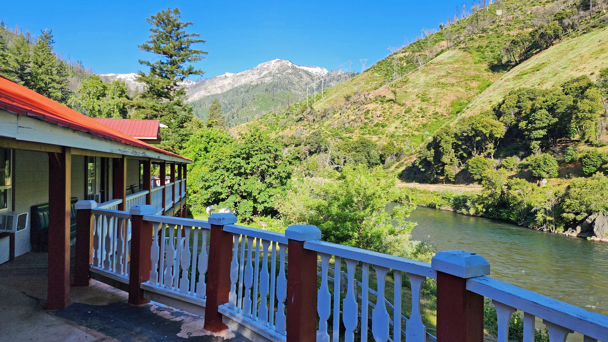
I enjoyed the views from the balcony. The resort is old and funky. Many things in need of repair. The combination of the Dixie fire, COVID lockdowns, and road construction has been devastating to their business. They don't have Wi-Fi, but I got 2 bars of signal from Verizon when out on the deck. No usable signal in my room. I think Belden Resort could be a great place to stay if everything works correctly. But that is never guaranteed when the place is powered by a diesel generator and they struggle to hire workers. Nobody lives nearby.

| Heart | 0 | Comment | 0 | Link |
Today was a schizophrenic day. Long spells of NO traffic. Outstanding scenery. Perfect weather. A hot spring soak. But then everything went wrong at Belden resort. I'm not looking forward to tomorrow, starting the biggest climbing day of the trip without a proper breakfast and probably a very late lunch. I didn't carry a large supply of food because I expected the resort to serve food.
Distance: 30.3 miles
Average Speed: 10.1 mph
Ascent/Descent: +813/-1894 feet
Today's ride: 30 miles (48 km)
Total: 144 miles (232 km)
| Rate this entry's writing | Heart | 5 |
| Comment on this entry | Comment | 1 |
9 months ago


