July 17, 2024
Day 9: Cody to Bridger, Montana
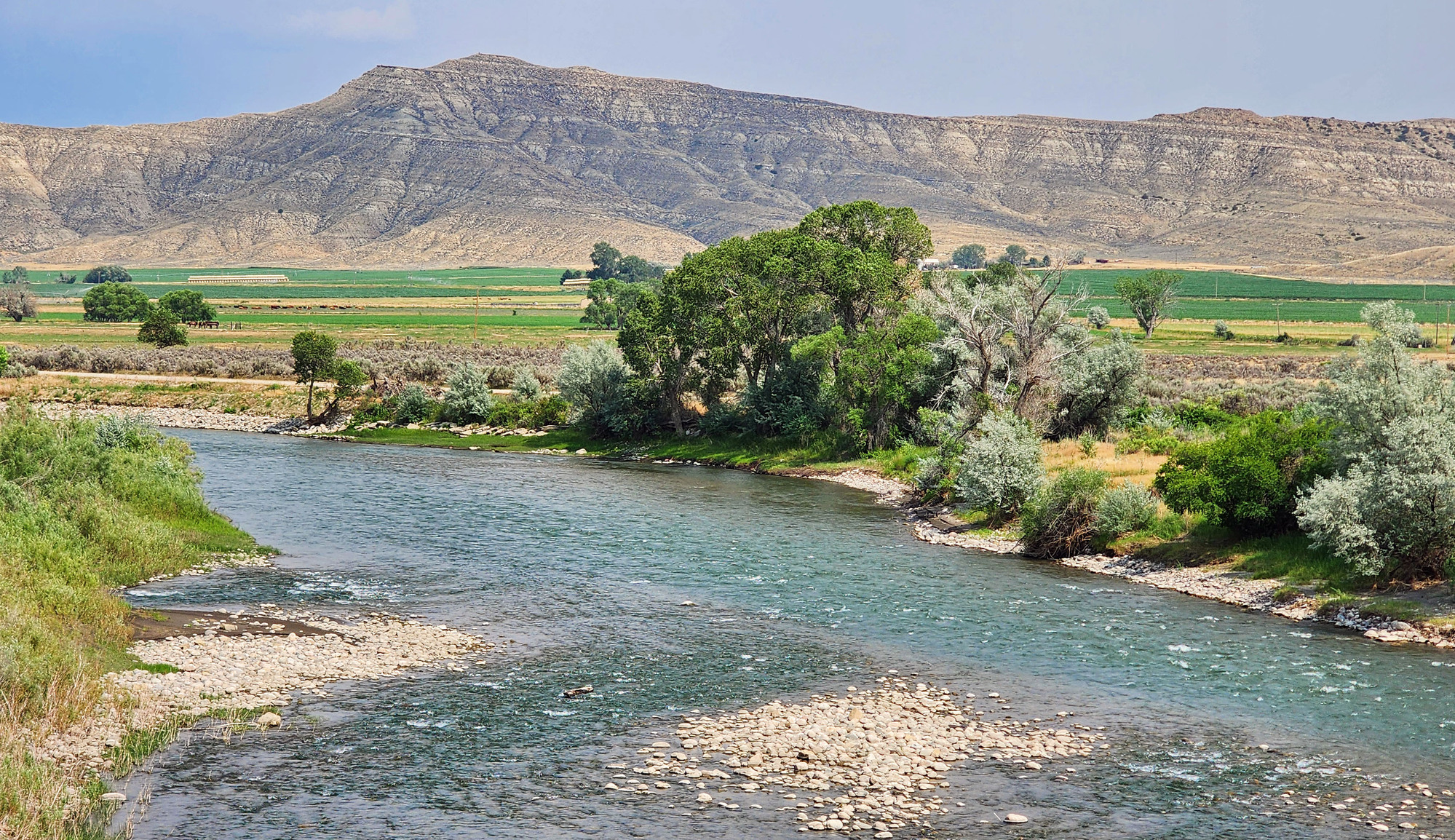
Today is a long day. I went to the breakfast buffet when it opened at 7 and got on the road at 8. Not too bad. Today has a lot of climbing, but the day starts with a 1 mile downhill to cross the Shoshone river. My final views of the Shoshone river.


| Heart | 4 | Comment | 0 | Link |
From Cody I go north on WY 120 all the way to Montana. After crossing the river the highway climbs steeply out of the river bottom, then climbs gently to a 5962 foot summit that separates the Shoshone river from the Clarks Fork Yellowstone river. The long grade was 4% or less, but I still got very hot and sweaty. Partly because the tailwind reduces airflow.

This is the highest summit of the tour, so I was disappointed that there's no summit sign. I pedaled mostly uphill for 1.5 days, gaining 2200 feet since leaving Lovell yesterday morning. So I felt like I truly deserved the 2300 foot descent to Bridger.

| Heart | 3 | Comment | 0 | Link |
During the descent I passed the turnoff for Chief Joseph Scenic Byway which climbs high into the Absaroka mountains. It connects to the Beartooth Scenic Byway which goes even higher, and to the northeast corner of Yellowstone National Park. I pedaled the Beartooth Highway in 2004 but have never driven or pedaled the Chief Joseph Byway.

| Heart | 0 | Comment | 0 | Link |
I was disappointed with the views of the Absaroka mountains to my west. The sun angle was decent, but I wasn't seeing the highest peaks.

I enjoyed the afternoon views of Clarks Fork Yellowstone river. High Desert River #3 on this tour. The first bridge was swarming with swallows.

| Heart | 1 | Comment | 0 | Link |

The morning was mostly sunny but the afternoon became more cloudy. I could see dark clouds in the Absaroka mountains. I could occasionally hear distant thunder but I didn't worry about getting rained on. It didn't appear to be unstable enough to rain in the valley.
I had lunch at a place called Edelweiss Cafe in the middle of nowhere, 31 miles north of Cody. The sole cook/waitress/cashier was overwhelmed and service was slow. I didn't mind the wait, cooling down in the A/C. There is no other store or restaurant, and almost no shade on today's long route.
The cafe obviously caters to local ranch hands, not travelers. I wasn't wearing a cowboy hat, boots, or even jeans. I didn't have a big mustache. I was amused when the waitress straight up asked me where I'm from. Usually waitresses are more nonchalant about travelers.

| Heart | 2 | Comment | 0 | Link |
I stopped to take photos at the state line. I spent 9 days in Wyoming. The final 9 days of the tour will be in Montana.


Today's route is all on highways. In Montana the first 3 miles is brand new pavement with a 4 foot paved shoulder. Then 20 miles of road construction with a constant parade of gravel and asphalt trucks adding to the usual oil tankers and livestock trucks.


| Heart | 1 | Comment | 0 | Link |
A strong tailwind developed late in the afternoon, so the final miles were fast and easy.
| Heart | 0 | Comment | 0 | Link |

| Heart | 2 | Comment | 0 | Link |
I arrived in Bridger, Montana at 4:45 PM. No worries about rush hour traffic coming into a town of 889 people. Temperature was 92F, hot but bearable.

| Heart | 0 | Comment | 0 | Link |
I'm familiar with other famous explorers such as Kit Carson, Jedediah Smith, and John Wesley Powell, but I don't know much about Jim Bridger. Earlier in this tour I saw signs about the Bridger Cutoff of the Oregon Trail which detoured south from the Yellowstone river to the Bighorn river to avoid hostile Crow Indians.

Bridger is not a tourist town at all. I stayed at the only lodging in town, the 8 room Bridger Motel. $85 cash makes it the cheapest lodging of the tour. It has A/C, fridge, microwave. Dinner was at the bar across the street, the only place open for dinner. There is no restaurant open for breakfast. The gas station store opens at 8 AM.

I noticed a store with a peculiar name. It turned out to be a cannabis shop. Cannabis is illegal in Wyoming but legal in Montana.

Bridger is a sleepy, struggling farm town. No tourists, no traffic lights. A refreshing contrast to busy Cody, but not really thriving.

| Heart | 1 | Comment | 2 | Link |
10 months ago
10 months ago
I crossed from Wyoming to Montana at about the halfway point of the tour, leaving behind the consistently wide paved shoulder of Wyoming highways. Montana highways have a narrower shoulder, often with a rumble strip in the middle. And the shoulder in Montana is strewn with fine gravel that was applied for traction during winter.
Today's distance was long and it was one of the hillier days of this tour. But the tailwind and net descent made it easier, and heat was never much of a problem. I'm very tired but the next 3 days will be easier.
Distance: 62.7 miles
Average Speed: 10.1 mph
Ascent/Descent: +1521/-2707 feet
Today's ride: 63 miles (101 km)
Total: 381 miles (613 km)
| Rate this entry's writing | Heart | 4 |
| Comment on this entry | Comment | 2 |
That got my attention. In 2019, on assignment in Germany as a DOD civilian, my wife flew over for a month and we did tourist stuff on the weekends. We stayed at Edelweiss Lodge in southern Germany over the Labor Day weekend. The lodge is owned by the DOD and used for recreational getaways by soldiers and DOD civilians in Europe. Strange to find a cafe with that name in the middle of nowhere - perhaps there is some German/Swiss or Alpine connection with the original owners - or maybe he/she spent time in the DOD in Europe and visited Edelweiss Lodge?
Curiosity took hold and I did a teeny bit of internet digging. The bar was built in 1973. Approx. 2018 the property (bar/lounge, nearby home, 9 acres incl. some RV hookups and a bandstand and riverside picnic area) was for sale for 500k. Some listings note it as being in Clark, WY and other times they say Powell.
10 months ago
When I was a kid our family stayed a week at the DOD run Eibsee Hotel which was next to Eibsee Lake at the foot of Zugspitze. Built in about 1910, torn down soon after we stayed there in 1972. DOD ran many resorts around Garmisch at that time. Surely fewer now.
10 months ago