July 20, 2021
Day 5: Omak to Brewster
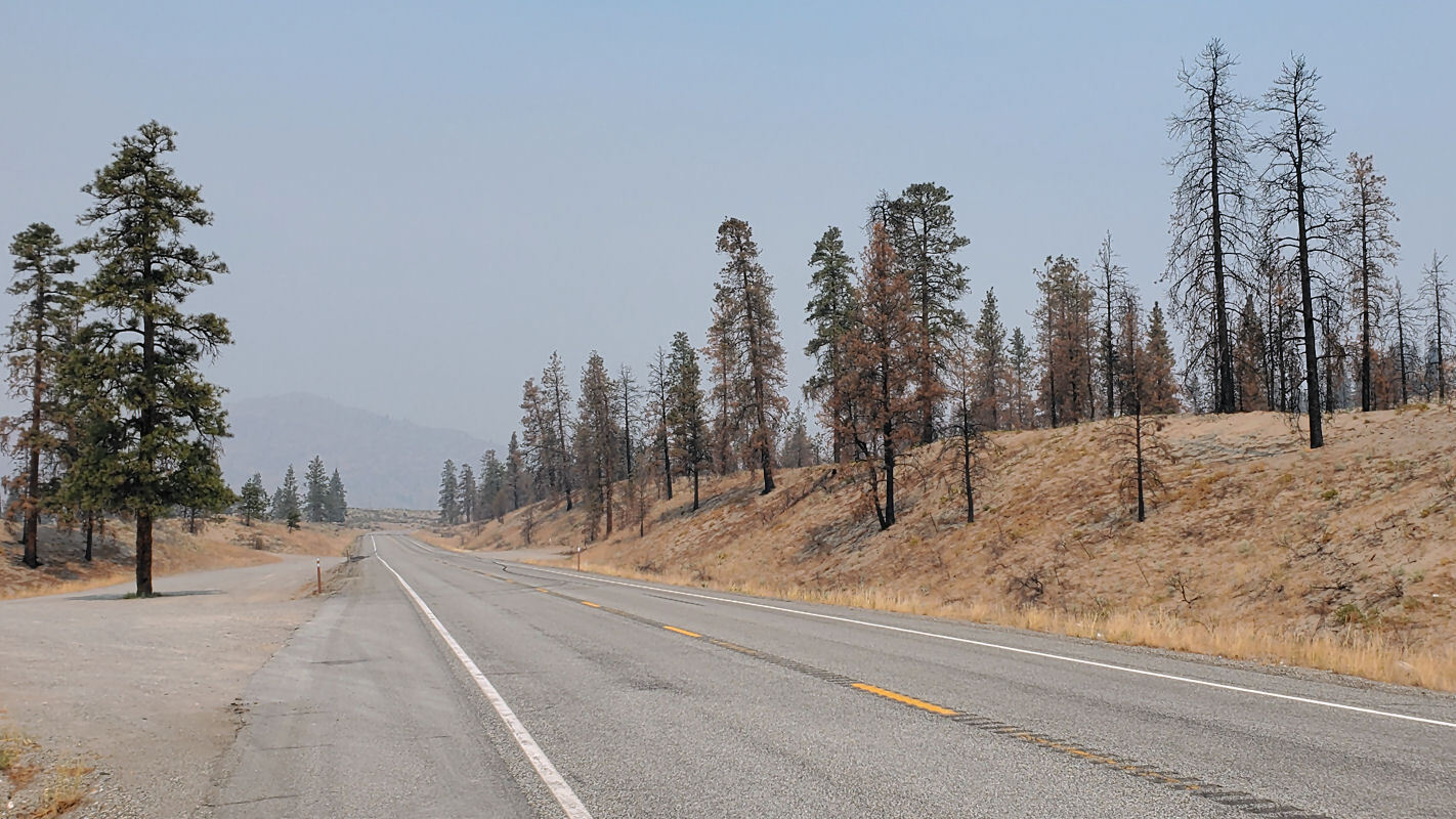
Today's route is relatively flat along the Okanogan and Columbia rivers. I smelled smoke earlier but didn't smell smoke when I got on the road at 8:45. I wanted to start earlier but the restaurant around the corner didn't open until 8. Still smoke high in the atmosphere, making the sky look white instead of blue.
I pedaled south through Omak on WA 20. My route coincides with the east-west highway for 5 miles. It was less busy than usual because the route west over Loup Loup pass is closed because of wildfires. That closure affects cyclists traveling on the ACA Northern Tier route, but it doesn't affect me because I'm going south.
On the edge of the town of Okanogan I stopped for a few minutes to look at the fire museum and the riverside park. I camped at the park in 2007 and was pleased to see that camping is still allowed ($6 for cyclists) and that it still has showers.

| Heart | 1 | Comment | 0 | Link |
I spent about 30 minutes exploring the town of Okanogan. It's an interesting town. It obviously boomed in the early 20th century. It's the county seat and it appears to be more prosperous than Omak. Okanogan is mostly a white town. Omak is more of an Indian town. The difference is very visible.

| Heart | 1 | Comment | 0 | Link |

| Heart | 0 | Comment | 0 | Link |

| Heart | 1 | Comment | 0 | Link |

| Heart | 0 | Comment | 0 | Link |
Traffic was light on US 97A. I could easily follow US 97A all the way to Brewster, but I will detour to Bridgeport to see Chief Joseph dam. The detour doubles today's distance and puts me on busier highways US 97 and WA 17. Fortunately they all have a usable paved shoulder.

| Heart | 0 | Comment | 0 | Link |
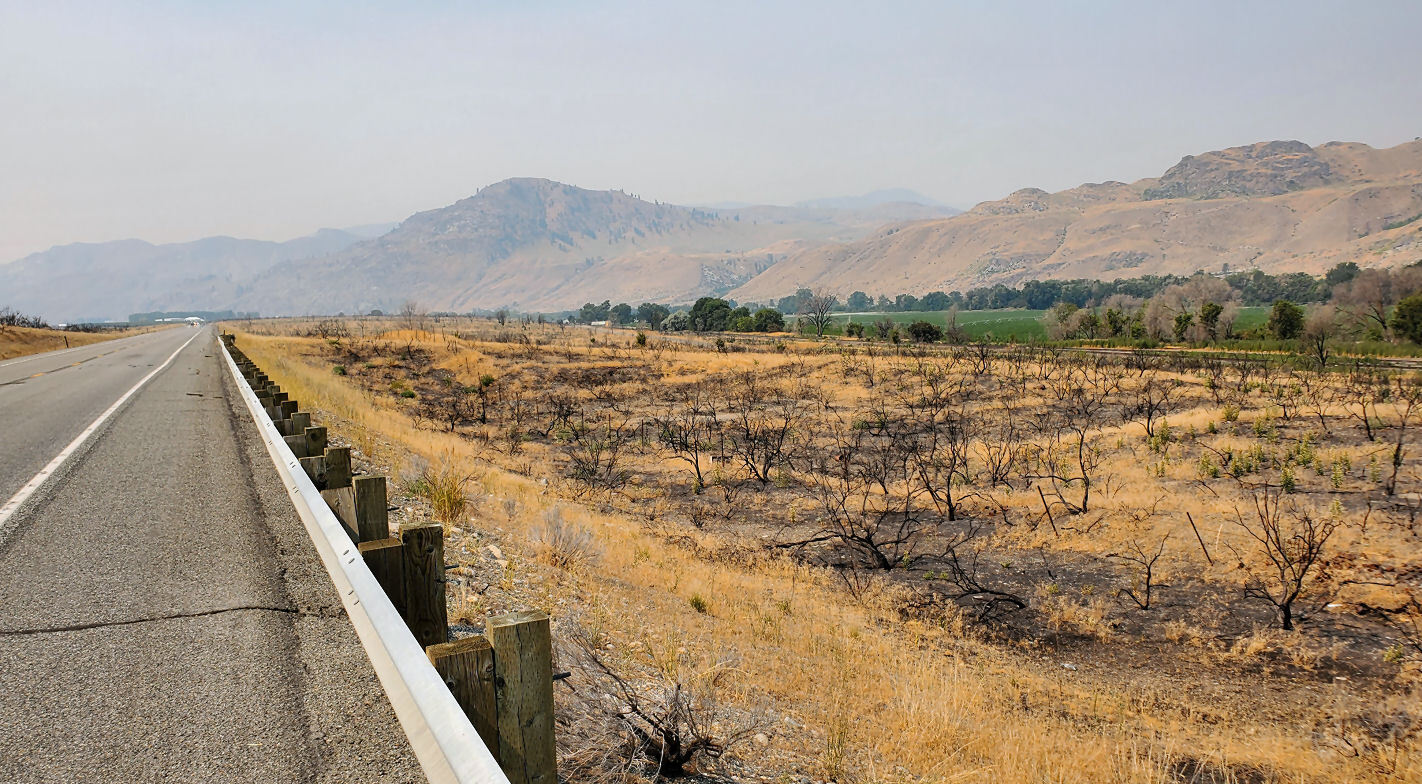
The smoke got gradually more dense as I pedaled south. I literally pedaled into a smoke cloud. I'm on the edge of the smoke cloud, and it wouldn't take much wind to blow the smoke away. Smoke visible to the south and east, but blue sky visible to the north and west.

| Heart | 0 | Comment | 0 | Link |
Today I passed several burned areas along the highway. Sometimes burned bushes, sometimes burned trees. The fires appear to be fairly recent. This year or last year.
I stopped at a roadside fruit stand and bought early season peaches and late season cherries. Good stuff.

| Heart | 0 | Comment | 0 | Link |
The smoke got steadily denser as I pedaled south on US 97 and WA 17 on the east side of the Okanogan river. The river gets steadily wider and deeper as it becomes part of Lake Pateros. It's hard to recognize where the Okanogan river flows into the Columbia river because it's in a reservoir.

| Heart | 1 | Comment | 2 | Link |
1 year ago
1 year ago
I started to see apple orchards a few miles south of Okanogan. I'm entering the largest apple growing region of the US.

| Heart | 1 | Comment | 0 | Link |
The main purpose of my detour is to see Chief Joseph dam. I pedaled a mile down a dead end road to the visitor center which is closed for the pandemic. I had the patio area to myself while waiting an hour for the smoke to blow away. The wind was calm until about 1 PM, but the smoke rapidly blew away to the east after the wind started blowing.

| Heart | 0 | Comment | 0 | Link |
Chief Joseph dam is the largest dam ever built by the US Army Corps of Engineers. It's not very tall but it has the second largest generating capacity in the US. This little-known dam generates more power than Hoover dam because the Columbia river has a far larger flow than the Colorado river. The dam uses 27 comparatively small turbines instead of a smaller number of giant turbines.
Chief Joseph is well known in the Pacific Northwest. He was the chief of the Nez Perce tribe during its final days of independence. 7 years after a treaty guaranteed them land forever, they were expelled during winter and chased more than 1000 miles by the US Army. The tribe was captured in Montana just a few miles before they could have reached sanctuary in Canada. The survivors were forced to live on a reservation, and much later were forced to join a confederation of tribes that speak a different language. The Nez Perce tribe was one of the most prosperous and civilized societies on the continent. The behavior of the US government was absolutely barbaric.

| Heart | 0 | Comment | 0 | Link |
The best view of the dam isn't at the visitor center, but at the bridge where WA 17 crosses the Columbia river. It's easy for a cyclist to stop on the bridge, but motorists can't stop there.
From the bridge the sky looked fairly blue to the east and north, but still smoky to the south and west. But it was steadily improving. 30 minutes later I had beautiful blue sky.
I pedaled through the town on Bridgeport on WA 173. It has more traffic than I expected, and Bridgeport is a bigger town than I expected. Bridgeport is very much a farm town, surrounded by apple orchards. Interestingly, it has two downtowns. First I passed through the Mexican downtown which has brightly colored cinder block buildings and all signs in Spanish. A mile later I passed through the white downtown with more conventional buildings. The white downtown is well on its way to becoming a second Mexican downtown. Most of Bridgeport's population is Mexican farm workers.
I don't think orchards are especially beautiful but I enjoyed the contrast between the green irrigated orchards and the barren hills. I was surprised to see how many orchards are high in the hills, where it costs far more to pump water from the river.
South of the town of Okanogan I didn't see any churches. Only iglesias. Few people know that northern Washington has communities that are almost 100% Mexican.
The route from Bridgeport to Brewster is on WA 173. It has more traffic than I expected, but does have a usable shoulder. I'm impressed that most rural state highways in Washington have a rideable shoulder. Much better than state highways in my home state of Oregon.
I stopped for a few minutes to look around downtown Brewster. I first saw it during a tour in 2013. The town seems to be doing better now. Brewster is a mostly Mexican town. Every sign downtown is in Spanish.
The east end of Main street ends at a small riverside park, with some of the few shade trees in town.

| Heart | 0 | Comment | 0 | Link |

| Heart | 0 | Comment | 2 | Link |
https://www.waymarking.com/waymarks/wm1019K_T33A_Shooting_Star_Brewster_WA
3 years ago
3 years ago
Brewster is a planned town built along the shore of Lake Pateros after Wells Dam was completed in 1967 . The original riverside town site is now under water. New planned towns typically have a bland character, but have amenities that are impossible in an un-planned town. Brewster has a very long walking path along the lake shore.

| Heart | 0 | Comment | 0 | Link |
From downtown Brewster I pedaled uphill to US 97A to get to the Apple Avenue motel. I have never seen that term before but it's obvious that Apple Avenue refers to US 97. There is no city street called Apple Avenue.
I had two options for dinner. McDonalds on US 97A or Camperos Mexican restaurant down the hill in town. I went down the hill.
Today had the most cultural contrast of the tour. I started in the Indian town of Omak. Then pedaled through the white town of Okanogan. Then I entered the central Washington apple growing region and pedaled through the Mexican towns of Bridgeport and Brewster. I will see many more orchards the next two days.
Today's high temperature was only 95F. The mid-day sun was weakened by a thick cloud of smoke. It surely would have been hotter if not for the smoke. This is my 3rd consecutive day of obnoxious smoke, but so far the smoky periods have been only a few hours at a time, not continuous. I still see blue sky sometimes.
Distance: 51.9 miles (83 km)
Average Speed: 9.0 mph (14.4 km/h)
Ascent/Descent: +1200/-1092 feet (+366/-333 m)
Today's ride: 52 miles (84 km)
Total: 198 miles (319 km)
| Rate this entry's writing | Heart | 1 |
| Comment on this entry | Comment | 0 |


